Malolos

Log in to your account

AroundUs is a community-driven map of interesting places, built by curious explorers like you. It grows with every review, story, and photo you share.
Connect to save your favorite spots, contribute locations, and create personalized routes.
Continue with Google
Continue with Apple
Continue with X
Continue with Facebook
Continue with email
By continuing, you accept our Terms and Conditions and our Privacy Policy
Create an account
Add to collection
Map
Suggest a change
Share

Malolos, Component city in Bulacan, Philippines.

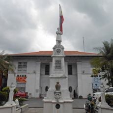
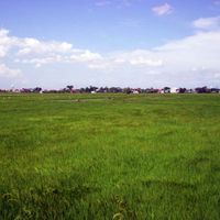
Malolos is a large city in Bulacan province north of Manila, spreading across several districts that include both urban neighborhoods and farming areas. Streets lead from the historic center with its colonial buildings to modern residential zones and industrial areas on the outskirts.

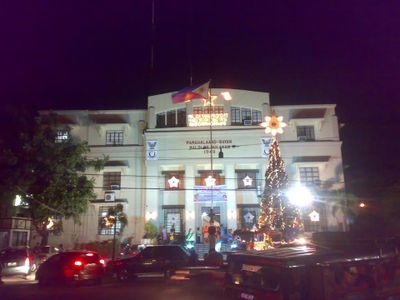
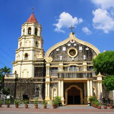
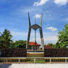
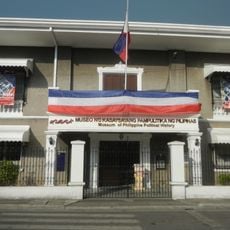
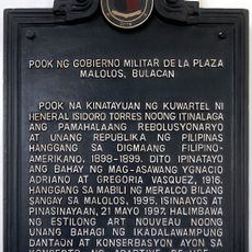
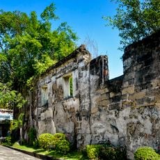
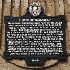
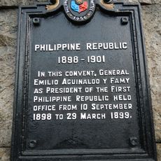
The city was founded in the 16th century during Spanish colonial rule and grew into an important administrative center for the province. In the late 19th century it became the site of decisive events during the Philippine Revolution and the founding of the first republic.

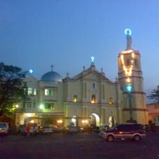
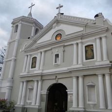
The city takes its name from the Tagalog word "paluspalus," referring to the way farmers harvested rice by hand in the fields. Visitors walking through the old center notice how local families still gather near the cathedral plaza on weekends, continuing a tradition that dates back generations.

Buses and jeepneys run frequently between the city center and surrounding districts, with main roads experiencing heavy traffic during morning and evening hours. Visitors exploring the historic district can walk between most sites, as they are located close to each other.

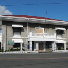
Near the old town center stand several colonial wooden houses with windows made from capiz shells that let light filter through softly. These traditional materials were sourced from coastal areas and were a sign of wealth in earlier centuries.

Location: Bulacan

Elevation above the sea: 9 m

Shares border with: Calumpit

Website: http://maloloscity.gov.ph

GPS coordinates: 14.84361,120.81139

Latest update: December 13, 2025 18:13

Photos
Around this place
Barasoain Church
Philippines

Barasoain Church

323 m
Malolos Cathedral
Philippines

Malolos Cathedral

144 m
Santiago Apostol Church
Philippines

Santiago Apostol Church

7 km
Marcelo H. del Pilar Shrine
Philippines

Marcelo H. del Pilar Shrine

8.1 km
Museum of Philippine Political History
Philippines

Museum of Philippine Political History

77 m
Guiguinto Church
Philippines

Guiguinto Church

7.3 km
Casa Real
Philippines

Casa Real

77 m
Birthplace of General Gregorio H. del Pilar historical marker
Philippines

Birthplace of General Gregorio H. del Pilar historical marker

8.7 km
Birthplace of Marcelo H. del Pilar historical marker
Philippines

Birthplace of Marcelo H. del Pilar historical marker

8 km
Site of the Military Government Place historical marker
Philippines

Site of the Military Government Place historical marker

118 m
Battle of Quingua historical marker
Philippines

Battle of Quingua historical marker

6.4 km
Casa Real
Philippines

Casa Real

74 m
General Isidoro D. Torres historical marker
Philippines

General Isidoro D. Torres historical marker

3.9 km
Enactment of the Malolos Constitution historical marker
Philippines

Enactment of the Malolos Constitution historical marker

362 m
Emilio Aguinaldo y Famy historical marker
Philippines

Emilio Aguinaldo y Famy historical marker

346 m
Bahay ni kuya resort
Philippines

Bahay ni kuya resort

4.9 km
Church of Quingua historical marker
Philippines

Church of Quingua historical marker

7 km
Church of Barasoain historical marker
Philippines

Church of Barasoain historical marker

323 m
Jose C. Cojuangco historical marker
Philippines

Jose C. Cojuangco historical marker

207 m
Casa Real historical marker
Philippines

Casa Real historical marker

70 m
Hagonoy Municipal Hall
Philippines

Hagonoy Municipal Hall

8.4 km
Church of Hagonoy historical marker
Philippines

Church of Hagonoy historical marker

8.4 km
Guillermo E. Tolentino historical marker
Philippines

Guillermo E. Tolentino historical marker

377 m
Oath-taking of Emilio Aguinaldo as president of the Republic of the Philippines historical marker
Philippines

Oath-taking of Emilio Aguinaldo as president of the Republic of the Philippines historical marker

315 m
Church of Barasoain historical marker
Philippines

Church of Barasoain historical marker

317 m
Philippine Republic historical marker
Philippines

Philippine Republic historical marker

89 m
Site of the School of the Women of Malolos historical marker
Philippines

Site of the School of the Women of Malolos historical marker

216 m
Cathedral of Malolos historical marker
Philippines

Cathedral of Malolos historical marker

93 m
Show the full map
Reviews

Visited this place? Tap the stars to rate it and share your experience / photos with the community! Try now! You can cancel it anytime.

Administrative divisions
« Malolos - Component city in Bulacan, Philippines » is provided by Around Us (aroundus.com). Images and texts are derived from Wikimedia project under a Creative Commons license. You are allowed to copy, distribute, and modify copies of this page, under the conditions set by the license, as long as this note is clearly visible.

Discover hidden gems everywhere you go!

From secret cafés to breathtaking viewpoints, skip the crowded tourist spots and find places that match your style. Our app makes it easy with voice search, smart filtering, route optimization, and insider tips from travelers worldwide. Download now for the complete mobile experience.

Around Us App Screenshot

A unique approach to discovering new places

Le Figaro

All the places worth exploring

France Info

A tailor-made excursion in just a few clicks

20 Minutes