Santa Maria, Municipality in Bulacan, Philippines
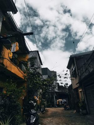
Santa Maria is a first-class urban municipality in the eastern section of Bulacan province, bordering Angat, Norzagaray, Marilao, and San Jose del Monte. The 24 barangays spread across a compact area with established residential neighborhoods, market zones, and open fields along the edges.
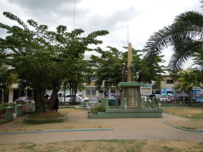
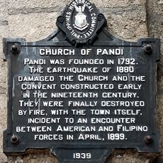
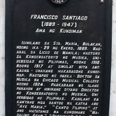
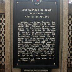
The area began as a barrio of Bocaue during the early seventeenth century and gained independence on November 26, 1793, under Spanish friar Francisco Dominguez Javier. Poet José Corazón de Jesús and composer Francisco Santiago, who wrote the piece Nasaan Ka Irog, came from this town.
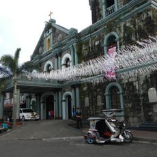
The name honors the Virgin Mary and appears in several chapels across the neighborhoods, where communities gather regularly for prayer and local events. Small roadside altars and religious images decorate house walls near the parish church, showing how faith shapes everyday routines.
The area works best for short walking explorations in the central neighborhoods, while outlying sections are easier to reach by public transport or taxi. Early morning on weekdays means less traffic and open markets with fresh produce.
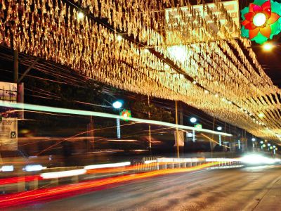
The town ranks among the most populated in Central Luzon and hosts more than a quarter of a million residents on relatively little land. This high density creates busy streets and markets where you quickly sense the local rhythm.
Location: Bulacan
Inception: 1792
Elevation above the sea: 20 m
Shares border with: Pandi, סן חוסה דל מונטה, Bocaue
Address: Santa Maria, Bulacan, Philippines
Website: http://santamariabulacan.gov.ph
GPS coordinates: 14.81833,120.95633
Latest update: December 5, 2025 16:34
Philippine Stadium
2.7 km
Bulakan Church
8.6 km
San Juan de Dios Church
15.6 km
Marcelo H. del Pilar Shrine
9.7 km
Meycauayan Church
9.3 km
Marilao Church
6.8 km
St. Martin of Tours Parish
4.1 km
Guiguinto Church
8.6 km
San Lorenzo de Roma Church
5.2 km
Grotto Vista Resort
11.7 km
Meycauayan Tree
9.3 km
Francisco “Soc” Rodrigo historical marker
8.9 km
Birthplace of General Gregorio H. del Pilar historical marker
9 km
Battle of Kakarong historical marker
11.7 km
Villa Concepcion
7.3 km
Dream Wave Resort
3.4 km
Birthplace of Marcelo H. del Pilar historical marker
9.7 km
Battle of San Rafael historical marker
15.6 km
Birthplace of Balagtas historical marker
6.5 km
Birthplace of General Gregorio del Pilar Historical Landmark
9 km
The Church of Bulacan historical marker
8.7 km
San Rafael Elementary School historical marker
15.6 km
Church of Marilao historical marker
6.8 km
Francisco Soc Rodrigo House
8.9 km
Church of Pandi historical marker
741 m
Jose Corazon de Jesus historical marker
664 m
Francisco Santiago historical marker
717 m
Church of Meycauayan historical marker
9.3 kmReviews
Visited this place? Tap the stars to rate it and share your experience / photos with the community! Try now! You can cancel it anytime.
Discover hidden gems everywhere you go!
From secret cafés to breathtaking viewpoints, skip the crowded tourist spots and find places that match your style. Our app makes it easy with voice search, smart filtering, route optimization, and insider tips from travelers worldwide. Download now for the complete mobile experience.
A unique approach to discovering new places❞
— Le Figaro
All the places worth exploring❞
— France Info
A tailor-made excursion in just a few clicks❞
— 20 Minutes