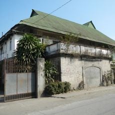
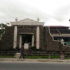
Quezon, Municipality in Nueva Ecija, Philippines.
Quezon is a municipality in Nueva Ecija characterized by flat terrain at approximately 28 meters elevation, with the Ilog Baliwag river running through its boundaries. The administrative division consists of agricultural land and rural communities spread across the province's central landscape.
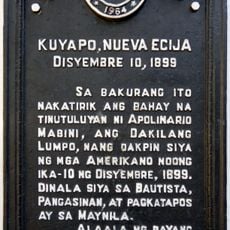
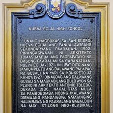
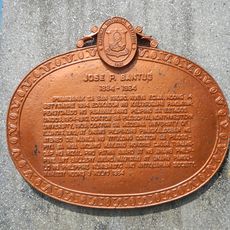
The area was initially inhabited by Bugkalot and Ilongot indigenous peoples before being established as an administrative division of Nueva Ecija province. This transformation from indigenous settlement to municipal jurisdiction marks a key shift in the region's development.
The community maintains strong ties to rice farming, which shapes both the visual landscape and the daily rhythm of local life. These agricultural roots connect residents to the broader identity of Nueva Ecija as the nation's primary rice-growing region.
The municipality is accessible by bus and provincial roads that connect it to neighboring areas and regional centers throughout Nueva Ecija. The best time to visit is during the drier months when roads are more passable and agricultural activities are most visible.
The municipality quietly serves as a rice production hub where crops grown in surrounding fields feed into the nation's food supply system. This role makes it a vital part of the country's agricultural backbone, even though individual communities often remain overshadowed by larger provincial centers.
Location: Nueva Ecija
Elevation above the sea: 28 m
Shares border with: Guimba, Aliaga
Address: Quezon, Nueva Ecija, Philippines
GPS coordinates: 15.55417,120.81111
Latest update: December 10, 2025 16:02
Cabanatuan American Memorial
25.5 km
Cabanatuan Cathedral
17.9 km
Tarlac Cathedral
25 km
Sideco House
28.8 km
Cuyapo, Nueva Ecija historical marker
29.8 km
Death Place of General Antonio Luna historical marker
17.9 km
Francisco Makabulos historical marker
25.3 km
Diwa ng Tarlac
25.2 km
Villa Luisa Resort
24 km
Nueva Ecija High School historical marker
18.5 km
Jose P. Bantug historical marker
28.8 km
House of Makabulos historical marker
15.4 km
Cathedral of Saint Joseph the Worker
32.7 km
Jose Rizal historical marker
24.8 km
Makabulos House
15.4 km
Central Luzon State University historical marker
23.4 km
Memorare historical marker (Raid at Cabanatuan)
25.4 km
Rancho Caridad historical marker
27.6 km
Francisco Makabulos historical marker
15.3 km
Penyaranda historical marker
30.3 km
Lazaro Francisco historical marker
17.6 km
Gerona Plaza
23.5 km
Corazon C. Aquino historical marker
25 km
Capital of the Republic of the Philippines historical marker
25.3 km
General Manuel Tinio historical marker
18 km
Cathedral of Tarlac historical marker
25 km
San Isidro historical marker
29.1 km
Tarlac historical marker
25.2 kmVisited this place? Tap the stars to rate it and share your experience / photos with the community! Try now! You can cancel it anytime.
Discover hidden gems everywhere you go!
From secret cafés to breathtaking viewpoints, skip the crowded tourist spots and find places that match your style. Our app makes it easy with voice search, smart filtering, route optimization, and insider tips from travelers worldwide. Download now for the complete mobile experience.
A unique approach to discovering new places❞
— Le Figaro
All the places worth exploring❞
— France Info
A tailor-made excursion in just a few clicks❞
— 20 Minutes