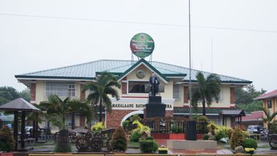
Talavera, First-class municipality in Nueva Ecija, Philippines.
Talavera is a municipality in Nueva Ecija situated on flat terrain spanning 53 administrative barangay divisions. The landscape is shaped by agricultural land and dairy farms that define the area's character.
The area was originally known as Catuguian before receiving its current name Talavera in 1853 following a successful petition by local residents. This name change marked a significant moment for local independence and identity.
The town celebrates its farming roots through local fiestas that showcase dairy and agricultural work throughout the year. Visitors can observe how these traditions remain woven into everyday community life.
National highways connect this municipality to larger cities with regular jeepney and bus services operating throughout the region. Visitors should prepare for warm tropical weather and explore during the drier months when travel conditions are easiest.
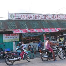
This area serves as a primary milk production hub for inland Luzon with numerous dairy operations that supply the broader region. This agricultural specialization makes it a key supply point for surrounding areas.
Location: Nueva Ecija
Inception: 1872
Elevation above the sea: 42 m
Shares border with: Muñoz, Cabanatuan
Website: http://talavera.gov.ph
GPS coordinates: 15.58389,120.91889
Latest update: December 7, 2025 10:04
Cabanatuan American Memorial
15.8 km
Cabanatuan Cathedral
11.6 km
Pantabangan–Carranglan Watershed Forest Reserve
39.2 km
Sideco House
30.4 km
Saint Francis of Assisi Parish Church
27.2 km
Cuyapo, Nueva Ecija historical marker
35 km
Death Place of General Antonio Luna historical marker
11.6 km
Villa Luisa Resort
35 km
Nueva Ecija High School historical marker
11.8 km
Jose P. Bantug historical marker
30.4 km
House of Makabulos historical marker
25.8 km
Cathedral of Saint Joseph the Worker
24.4 km
Central Luzon State University historical marker
16.4 km
Makabulos House
25.8 km
Memorare historical marker (Raid at Cabanatuan)
15.6 km
Rancho Caridad historical marker
34.6 km
Church of Peñaranda historical marker
27.2 km
Francisco Makabulos historical marker
25.7 km
Penyaranda historical marker
26.4 km
Lazaro Francisco historical marker
11.7 km
Gerona Plaza
34.4 km
General Manuel Tinio historical marker
12.8 km
Epifanio de los Santos historical marker
30.7 km
Dreamwater Resort
26.5 km
MGL Hotel & Resort
11.9 km
San Isidro historical marker
30.6 km
Battle of San Isidro historical marker
30.6 km
Llanera Public Market
13.8 kmVisited this place? Tap the stars to rate it and share your experience / photos with the community! Try now! You can cancel it anytime.
Discover hidden gems everywhere you go!
From secret cafés to breathtaking viewpoints, skip the crowded tourist spots and find places that match your style. Our app makes it easy with voice search, smart filtering, route optimization, and insider tips from travelers worldwide. Download now for the complete mobile experience.
A unique approach to discovering new places❞
— Le Figaro
All the places worth exploring❞
— France Info
A tailor-made excursion in just a few clicks❞
— 20 Minutes