Floridablanca, Municipality in Pampanga, Philippines
Floridablanca is a municipality in Pampanga stretching along the Zambales mountain ranges with terrain ranging from flat plains to hilly areas in the northwest. The territory is divided into 33 barangays connected by a network of roads covering 261 kilometers and 16 bridges that link different sections.
The settlement originated in 1823 as Hacienda de San Jose de Calampaui and received its current name in 1867 in honor of José María de Castillejo y Moñino. This renaming marked a turning point in how the place was recognized and governed locally.
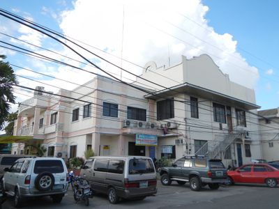
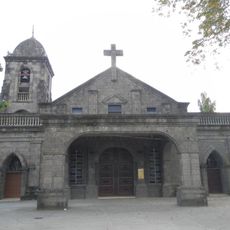
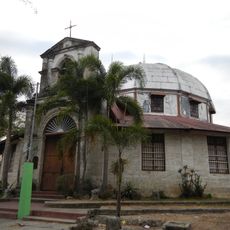
The San Jose Obrero Parish Church and Bahay na Puti ancestral house display traditional Philippine building styles that reflect local craftsmanship. Walking through these structures, you notice details in construction and design that residents have valued for generations.
The area is best explored by car or on foot following the established road network that connects the different barangays. Keep in mind that mountainous sections in the northwest may be more challenging to reach compared to the flatter central areas.
This region is one of the major rice-growing areas in the province and plays an important role in the local economy. The rice fields shape the landscape and represent an agricultural tradition that has long defined the area.
Location: Pampanga
Inception: April 30, 1867
Elevation above the sea: 28 m
Shares border with: Porac, Hermosa
GPS coordinates: 14.97460,120.52772
Latest update: December 7, 2025 10:00
Betis Church
12.4 km
Minalin Church
16.8 km
Lubao Church
8.9 km
Santa Catalina de Alejandria Church
11 km
Guagua Church
11.5 km
San Jose Obrero Church
127 m
Pio Chapel
8.2 km
Juan Crisostomo Soto (Crissot) historical marker
13.7 km
Tiburcio Hilario historical marker
17.1 km
Felix Galura historical marker
13.6 km
President Diosdado P. Macapagal Library and Museum
8.8 km
Jose Abad Santos historical marker
17.1 km
The House Where President Diosdado Macapagal was Born historical marker
8.7 km
Jose B. Lingad historical marker
8.9 km
Paciano Dizon y Santos historical marker
11.1 km
Aurelio Tolentino historical marker
11.4 km
Rufino J. Cardinal Santos historical marker
11.5 km
Don Honorio Ventura Technological State University historical marker
13.7 km
Guagua National Colleges historical marker
11.5 km
Church of Orani historical marker
19.3 km
Pampanga Provincial Jail historical marker
17.9 km
Pedro Abad Santos historical marker
17.1 km
Church of Samal historical marker
22.8 km
Church of Guagua historical marker
11.5 km
Church of Lubao historical marker
8.9 km
Diosdado P. Macapagal historical marker
8.7 km
Bataan and Democracy historical marker
12 km
Diosdado P. Macapagal historical marker
8.8 kmVisited this place? Tap the stars to rate it and share your experience / photos with the community! Try now! You can cancel it anytime.
Discover hidden gems everywhere you go!
From secret cafés to breathtaking viewpoints, skip the crowded tourist spots and find places that match your style. Our app makes it easy with voice search, smart filtering, route optimization, and insider tips from travelers worldwide. Download now for the complete mobile experience.
A unique approach to discovering new places❞
— Le Figaro
All the places worth exploring❞
— France Info
A tailor-made excursion in just a few clicks❞
— 20 Minutes