Enable Location

We need your location to show you interesting places around you

Discover nearby places

Find interesting locations and hidden gems around you

Precise directions

Get accurate directions and distances to places

Your location is never shared with other users. It's only used when you tap the location button.

Siargao

Log in to your account

Start exploring — it's free

Trusted by 62,069 travelers worldwide

Continue with Google
Continue with Apple
or

We will send you a code to connect

By continuing, you accept our Terms and Conditions and our Privacy Policy

Check your inbox

We've sent a pincode in your inbox. Please enter the code below.

Siargao

Siargao, Tropical island in Surigao del Norte, Philippines

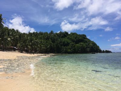
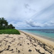
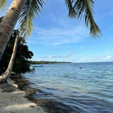
Siargao is an island in Surigao del Norte, Philippines, lying in the Philippine Sea and surrounded by coral reefs, lagoons, and mangrove forests. The coast shows narrow strips of sand, rocky coves, and shallow reef platforms that become partly visible at low tide.

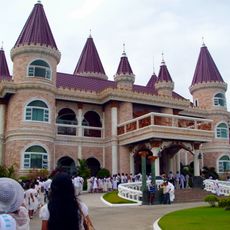
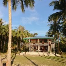
Spanish seafarers reached the island in the mid-16th century and initially called it Isla de las Palmas because of the thick palm groves along its shores. For centuries it remained thinly populated until surfers from Australia and the United States discovered the wave formations in the 1980s and the first simple accommodations appeared.

The local name comes from

Sayak Airport sits on the east coast and receives planes from Manila and other Philippine cities, with the main travel season running from October to April. Boats and ferries connect the island to nearby coastal towns, and the crossing takes several hours depending on weather conditions.

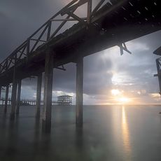
A narrow wooden walkway leads over the shallow reef to the spot where the waves break, allowing onlookers to reach close to the surfing zone without getting their feet wet. The reef top lies so close beneath the surface that at certain tides only a few centimeters of water stand above the coral rock.

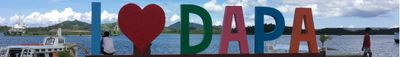
The community of curious travelers

AroundUs brings together thousands of curated places, local tips, and hidden gems, enriched daily by 60,000 contributors worldwide.

Start exploring
Part of
Siargao Islands
GPS coordinates
9.86667,126.05000
Latest update
December 15, 2025 08:34
Natural landmarks of the Philippines for photography

The Philippines display rice terraces in Ifugao mountains, coral reefs in Tubbataha National Park, and cave systems in Samar. Mayon Volcano shows its geometric shape, while Chocolate Hills of Bohol extend across the landscape. White sand beaches line the coasts of Boracay and Palawan.

The most beautiful sites of the Philippines

The Philippines is an archipelago where nature shows off in every direction. Each island has its own character. You can find white sandy beaches that stretch for kilometers, coral reefs teeming with colorful fish, and lagoons where the water is so transparent you can see straight to the bottom. The...

« Siargao - Tropical island in Surigao del Norte, Philippines » is provided by Around Us (aroundus.com). Images and texts are derived from Wikimedia project under a Creative Commons license. You are allowed to copy, distribute, and modify copies of this page, under the conditions set by the license, as long as this note is clearly visible.

Discover hidden gems everywhere you go!

From secret cafés to breathtaking viewpoints, skip the crowded tourist spots and find places that match your style. Our app makes it easy with voice search, smart filtering, route optimization, and insider tips from travelers worldwide. Download now for the complete mobile experience.

Around Us App Screenshot

A unique approach to discovering new places

Le Figaro

All the places worth exploring

France Info

A tailor-made excursion in just a few clicks

20 Minutes

Around Us
Travel Guide & Maps
Download

Send to your phone

QR Code
1

Open the camera app on your mobile.

2

Point at the QR code with your camera. A notification will appear.

3

Tap the notification to open the link.