
Tambak-kinimi Beach, Strand auf den Philippinen
Location: Maguindanao
Elevation above the sea: 23 m
GPS coordinates: 6.93667,123.96917
Latest update: April 5, 2025 22:04

Bangsamoro Parliament
42.1 km
Mount Ragang
105 km
Mount Makaturing
88 km
Fort Pikit
79.5 km
Bangsamoro Government Center
42.1 km
Marawi Cathedral
123.4 km
Cotabato Regional and Medical Center
41.6 km
Tantawan Park
44 km
Fort of the Conception and Triumph
134.7 km
Tamontaka Church
39.2 km
Fuerte de Reina Regente
60.7 km
Burial Site of the Seventeen Filipino Martyrs of Koronadal historical marker
108 km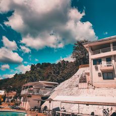
Alindahaw Lakeview Resort
134.1 km
Sultan Dipatuan Kudarat historical marker
44 km
Mount Parker
136.9 km
Pagadian Cathedral
114.9 km
Donel's Beach Resort
111.8 km
Immaculate Conception Church of Tamontaka historical marker
39.2 km
Notre Dame Archdiocesan Seminary historical marker
49.5 km
Museyo Kutawato
111.5 km
KCC Cinema
109 km
Koronadal Cathedral
108.2 km
Wasag Beach
76.7 km
Fort of the Conception and Triumph historical marker
134.7 km
Datu Paglas Municipal Hall
101.8 km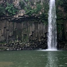
Cathedral Falls Waterworld
106.4 km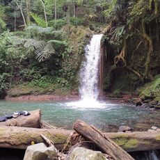
Balnunto Falls
129.9 km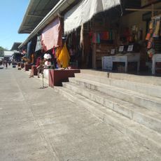
Carmen Public Market
96.2 kmReviews
Visited this place? Tap the stars to rate it and share your experience / photos with the community! Try now! You can cancel it anytime.
Discover hidden gems everywhere you go!
From secret cafés to breathtaking viewpoints, skip the crowded tourist spots and find places that match your style. Our app makes it easy with voice search, smart filtering, route optimization, and insider tips from travelers worldwide. Download now for the complete mobile experience.

A unique approach to discovering new places❞
— Le Figaro
All the places worth exploring❞
— France Info
A tailor-made excursion in just a few clicks❞
— 20 Minutes