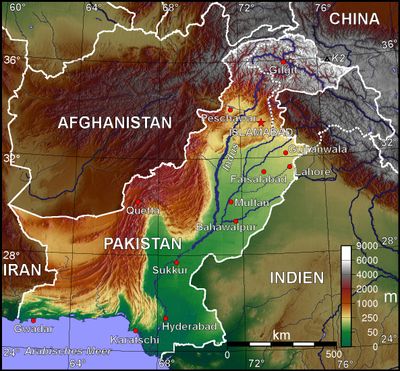
Geography of Pakistan, Geographical territory in South Asia, Pakistan
The geography of Pakistan describes a territory in South Asia that connects the Arabian Sea shores to the heights of the Karakorum range. This area combines coastal strips with river plains and rises to some of the tallest peaks on Earth.
The current territory emerged in 1947 when British India was divided through new border lines. This reorganization triggered large migration movements and shaped the spatial structure of the independent nation.
The country's geography influences its four major linguistic regions: Punjabi in Punjab, Sindhi in Sindh, Pashto in Khyber Pakhtunkhwa, and Balochi in Balochistan.
The Indus river system runs through the entire area and supplies water to farmland via irrigation canals. These canals enable the cultivation of wheat, cotton, rice and sugarcane across large sections of the plains.
The territory holds K2, which rises to 8611 meters and ranks as the second highest mountain in the world. It also sits on the boundary between the Indian and Eurasian plates, which causes frequent seismic activity.
The community of curious travelers
AroundUs brings together thousands of curated places, local tips, and hidden gems, enriched daily by 60,000 contributors worldwide.