Enable Location

We need your location to show you interesting places around you

Discover nearby places

Find interesting locations and hidden gems around you

Precise directions

Get accurate directions and distances to places

Your location is never shared with other users. It's only used when you tap the location button.

Log in to your account

Start exploring — it's free

Trusted by 63,295 travelers worldwide

Continue with Google
Continue with Apple
or

We will send you a code to connect

By continuing, you accept our Terms and Conditions and our Privacy Policy

Check your inbox

We've sent a pincode in your inbox. Please enter the code below.

Discussion Reviews Photo
3.9k Popularity

Gmina Głogów Małopolski, Administrative district in Rzeszów County, Poland.

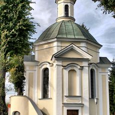
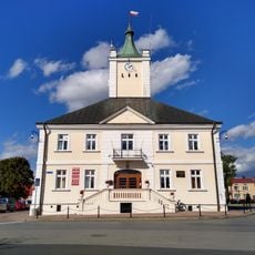
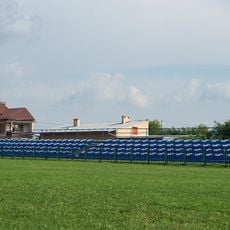
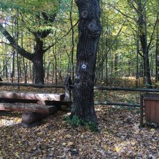
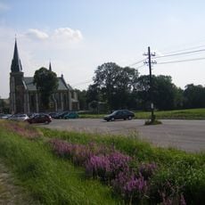
Gmina Głogów Małopolski is an administrative district in Podkarpackie Voivodeship that encompasses the main town and seven surrounding villages. The area shows a mix of built-up zones and agricultural land, with varying terrain and different settlement types.

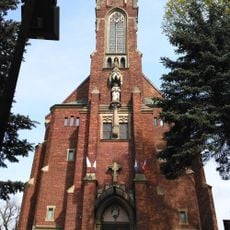
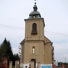
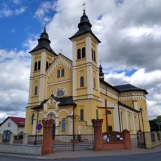
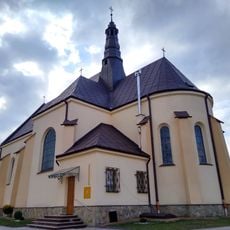
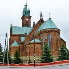
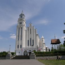
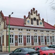
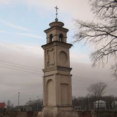
The town of Głogów Małopolski was founded in 1570 as a Renaissance trading center positioned on a merchant route toward nearby Sandomierz. The administrative structure developed over centuries to form the district as it exists today.

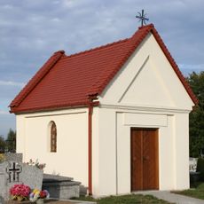
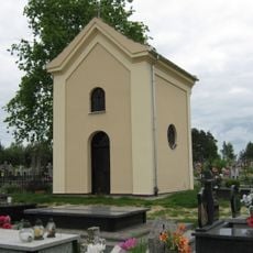
Local traditions in craftsmanship and regional cooking remain visible through community gatherings throughout the year. Residents keep these practices alive by sharing skills and recipes at public events in their towns and villages.

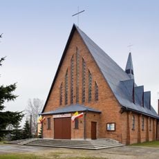
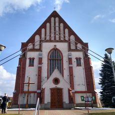
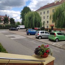
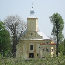
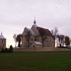
The district serves roughly 18,000 residents and is best explored by starting at the main town before visiting surrounding villages like Budy Głogowskie and Wysoka Głogowska. Basic services are available throughout the area, and moving between settlements is straightforward.

The area takes its name from its main settlement and sits north of the county seat Rzeszów. This location on a historic trade corridor has shaped how the place developed for centuries.

The community of curious travelers

AroundUs brings together thousands of curated places, local tips, and hidden gems, enriched daily by 60,000 contributors worldwide.

Start exploring
Location
GPS coordinates
50.16667,21.96667
Latest update
December 11, 2025 18:03
Around this place
Most im. Tadeusza Mazowieckiego w Rzeszowie
Poland

Most im. Tadeusza Mazowieckiego w Rzeszowie

12.3 km
Church of St. Joseph in Rzeszów
Poland

Church of St. Joseph in Rzeszów

13 km
Saint Hubertus chapel in Rzeszów
Poland

Saint Hubertus chapel in Rzeszów

10.5 km
Pomnik Sybiraków w Rzeszowie
Poland

Pomnik Sybiraków w Rzeszowie

13.1 km
Saint Michael Archangel church in Głogów Małopolski (Styków)
Poland

Saint Michael Archangel church in Głogów Małopolski (Styków)

2.6 km
Church of the Assumption in Raniżów
Poland

Church of the Assumption in Raniżów

10.3 km
Kościół Świętej Trójcy w Głogowie Małopolskim
Poland

Kościół Świętej Trójcy w Głogowie Małopolskim

1.6 km
Our Lady Queen of Poland church in Widełka
Poland

Our Lady Queen of Poland church in Widełka

7.3 km
Głogów Małopolski town hall
Poland

Głogów Małopolski town hall

1.7 km
Czarna
Poland

Czarna

4 km
Church of St. John in Sokołów Małopolski
Poland

Church of St. John in Sokołów Małopolski

12.7 km
Kościół św. Jadwigi Królowej w Wólce Podleśnej
Poland

Kościół św. Jadwigi Królowej w Wólce Podleśnej

11.7 km
Stadion TG Sokół w Sokołowie Małopolskim
Poland

Stadion TG Sokół w Sokołowie Małopolskim

12.6 km
Church of Saint John the Baptist in Kupno
Poland

Church of Saint John the Baptist in Kupno

10.4 km
Dairy museum
Poland

Dairy museum

13.1 km
Saint Luke church in Mrowla
Poland

Saint Luke church in Mrowla

8.7 km
Kaplica grobowa Politalskich w Przewrotnem
Poland

Kaplica grobowa Politalskich w Przewrotnem

5.1 km
Manor in Przewrotne
Poland

Manor in Przewrotne

5.7 km
Church of the Visitation in Medynia Głogowska
Poland

Church of the Visitation in Medynia Głogowska

12.3 km
Rezerwat przyrody Bór
Poland

Rezerwat przyrody Bór

4.5 km
Zespół kościoła św. Antoniego Padewskiego w Przewrotnem
Poland

Zespół kościoła św. Antoniego Padewskiego w Przewrotnem

5.1 km
Saint Onuphrius church in Łąka
Poland

Saint Onuphrius church in Łąka

12.9 km
Kaplica grobowa rodz. Krupnickich i Kirchnerów
Poland

Kaplica grobowa rodz. Krupnickich i Kirchnerów

11.6 km
Town hall in Sokołów Małopolski
Poland

Town hall in Sokołów Małopolski

12.9 km
Saint Bartholomew church in Nienadówka
Poland

Saint Bartholomew church in Nienadówka

10.3 km
Kaplica grobowa rodziny Politalskich (na cmentarzu górnym) w Przewrotnem
Poland

Kaplica grobowa rodziny Politalskich (na cmentarzu górnym) w Przewrotnem

5 km
Kapliczka Latarnia Zmarłych, poł. XVII
Poland

Kapliczka Latarnia Zmarłych, poł. XVII

5.2 km
Kościół św. Antoniego Padewskiego w Przewrotnem
Poland

Kościół św. Antoniego Padewskiego w Przewrotnem

5.1 km
Show the full map
Reviews
Share your experience

No review yet

Discussions
Start a discussion...

No discussion yet

« Gmina Głogów Małopolski - Administrative district in Rzeszów County, Poland » is provided by Around Us (aroundus.com). Images and texts are derived from Wikimedia project under a Creative Commons license. You are allowed to copy, distribute, and modify copies of this page, under the conditions set by the license, as long as this note is clearly visible.

Discover hidden gems everywhere you go!

From secret cafés to breathtaking viewpoints, skip the crowded tourist spots and find places that match your style. Our app makes it easy with voice search, smart filtering, route optimization, and insider tips from travelers worldwide. Download now for the complete mobile experience.

Around Us App Screenshot

A unique approach to discovering new places

Le Figaro

All the places worth exploring

France Info

A tailor-made excursion in just a few clicks

20 Minutes

Around Us
Travel Guide & Maps
Download

Send to your phone

QR Code
1

Open the camera app on your mobile.

2

Point at the QR code with your camera. A notification will appear.

3

Tap the notification to open the link.