Kraśnik, Urban municipality in Lublin Voivodeship, Poland.
Kraśnik is an urban municipality in Lublin Voivodeship situated among the hills of the Lublin Upland. The town comprises two districts, Kraśnik Lubelski and Kraśnik Fabryczny, linked by transportation connections.
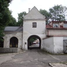
The town received city rights in 1377 from King Louis I of Hungary and grew along a major trade route between Silesia and Kyiv. This advantageous location supported its development and economic importance through the centuries.
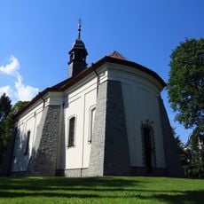
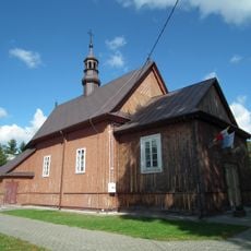
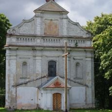
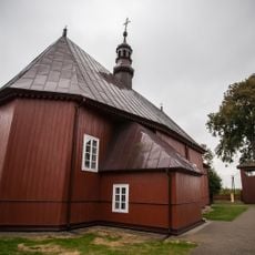
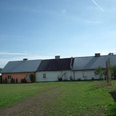
The Church of the Assumption reflects the Gothic-Renaissance architectural heritage found throughout southeastern Poland. Visitors can observe the local building styles and religious traditions that shaped the town's identity.
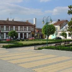
The town offers several sports facilities, public transportation hubs, and administrative centers accessible to visitors. The two districts are easy to explore and connected by local transportation options.
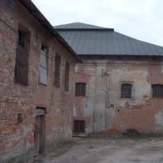
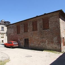
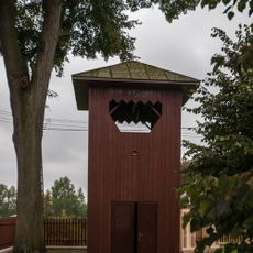
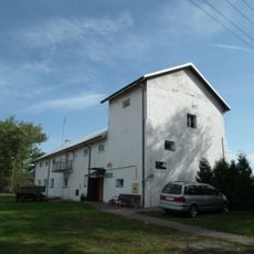
The Kraśnik Fabryczny district originated in the 1930s as a planned workers' settlement for an ammunition factory. This modern neighborhood offers insight into Poland's industrial development in the 20th century.
Location: Kraśnik County
Website: http://krasnik.pl
GPS coordinates: 50.91667,22.21667
Latest update: December 14, 2025 18:25
Church of the Assumption in Kraśnik
614 m
Great Synagogue in Kraśnik
570 m
Holy Spirit church in Kraśnik
699 m
Small Synagogue in Kraśnik
611 m
Saint Nicholas church in Urzędów
8.8 km
Jewish cemetery in Kraśnik
501 m
Kościół Św. Krzyża w Rzeczyca Księży
5.3 km
Kościół Św. Trójcy w Popkowicach
8.7 km
Muzeum 24. Pułku Ułanów. Oddział Muzeum Narodowego w Lublinie
347 m
Kościół Przemienienia Pańskiego
8.2 km
Churchyard of Holy Spirit church in Kraśnik
731 m
Bell tower of Church of the Assumption in Kraśnik
607 m
Kaplica Św. Trójcy, Brzozowa 6 w Stróża-Koloni
5.2 km
Parish cemetery in Rzeczyca Ziemiańska
8.1 km
Dzwonnica
8.2 km
Zabudowania gospodarcze (wzdłuż ogrodzenia dziedzińca klasztornego od wewnątrz)
665 m
Zespół kościoła Św. Krzyża w Rzeczycy Księżej
5.3 km
Rządcówka
7.3 km
Dzwonnica w Rzeczyca Księży
5.3 km
Zespół kościoła Przemienienia Pańskiego
8.1 km
Spichlerz
7.1 km
Czworak
7.1 km
Ogrodzenie z kapliczkami
8.1 km
Oficyna, tzw. arka
7.1 km
Zespół kościoła Św. Trójcy w Popkowicach
8.7 km
Zespół kaplicy Św. Trójcy
5.2 km
Układ urbanistyczny obejmujący rynek, ulice i wały obronne
10 km
D. szpital przykościelny (przytułek), tzw. dworek modrzewiowy
706 mVisited this place? Tap the stars to rate it and share your experience / photos with the community! Try now! You can cancel it anytime.
Discover hidden gems everywhere you go!
From secret cafés to breathtaking viewpoints, skip the crowded tourist spots and find places that match your style. Our app makes it easy with voice search, smart filtering, route optimization, and insider tips from travelers worldwide. Download now for the complete mobile experience.
A unique approach to discovering new places❞
— Le Figaro
All the places worth exploring❞
— France Info
A tailor-made excursion in just a few clicks❞
— 20 Minutes