Enable Location

We need your location to show you interesting places around you

Discover nearby places

Find interesting locations and hidden gems around you

Precise directions

Get accurate directions and distances to places

Your location is never shared with other users. It's only used when you tap the location button.

Różanystok

Log in to your account

Start exploring — it's free

Trusted by 61,998 travelers worldwide

Continue with Google
Continue with Apple
or

We will send you a code to connect

By continuing, you accept our Terms and Conditions and our Privacy Policy

Check your inbox

We've sent a pincode in your inbox. Please enter the code below.

Różanystok

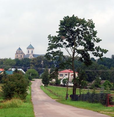
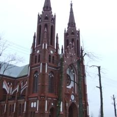
Różanystok, Religious village in Podlaskie Voivodeship, Poland

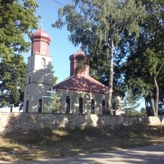
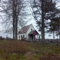
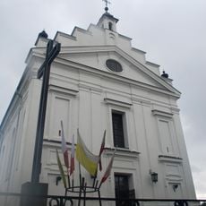
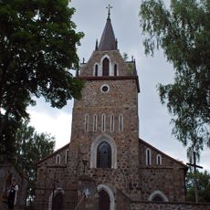
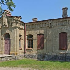
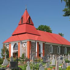
Różanystok is a village in northeastern Poland centered on an 18th-century basilica complex built with substantial stone walls. The site includes the church, a former monastery, and supporting structures arranged across the grounds.

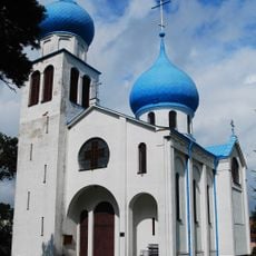
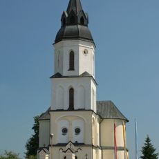
The settlement was originally called Krzywy Stok before being transformed by the establishment of a Marian shrine housing a 17th-century religious image. This development made the location a destination for the faithful.

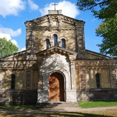
The village draws pilgrims throughout the year who come to venerate Mary at the basilica. Visitors can observe active religious practices that shape daily life and the character of the settlement.

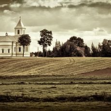
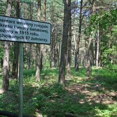
The village sits in rural countryside and is accessible by rail via the northeastern Poland train network. It is best visited during daylight hours when the basilica and grounds are open to the public.

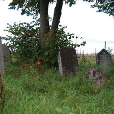
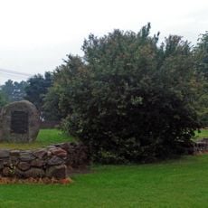
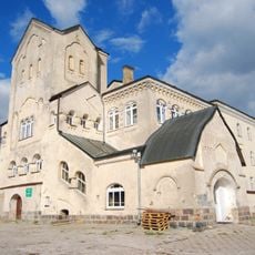
The village retains a substantial stone boundary wall that dates to its monastic period and survives to the present day. This wall once enclosed the entire monastery grounds and shows visitors how the site was once separated from the surrounding landscape.

The community of curious travelers

AroundUs brings together thousands of curated places, local tips, and hidden gems, enriched daily by 60,000 contributors worldwide.

Start exploring
GPS coordinates
53.63583,23.40444
Latest update
December 10, 2025 15:50
Around this place
Sanktuarium Maryjne w Różanymstoku
Poland

Sanktuarium Maryjne w Różanymstoku

166 m
Our Lady of the Angels church in Lipsk
Poland

Our Lady of the Angels church in Lipsk

11 km
Храм Александра Невского в Куркине
Russian Federation

Храм Александра Невского в Куркине

7.9 km
Providence of God church in Siderka
Poland

Providence of God church in Siderka

6.7 km
Saint Anne church in Stara Kamienna
Poland

Saint Anne church in Stara Kamienna

9 km
Saint John the Baptist church in Nowy Dwór (powiat sokólski)
Poland

Saint John the Baptist church in Nowy Dwór (powiat sokólski)

9.2 km
Orthodox church of Saint John the Evangelist in Dąbrowa Białostocka
Poland

Orthodox church of Saint John the Evangelist in Dąbrowa Białostocka

3.6 km
Saint Stanislaus church in Dąbrowa Białostocka
Poland

Saint Stanislaus church in Dąbrowa Białostocka

4.2 km
Saint Nicholas Orthodox church in Nowy Dwór
Poland

Saint Nicholas Orthodox church in Nowy Dwór

9.5 km
Church of the Resurrection in Jaczno
Poland

Church of the Resurrection in Jaczno

2.3 km
Kamienna Nowa
Poland

Kamienna Nowa

10.9 km
Smock mill in Dąbrowa Białostocka
Poland

Smock mill in Dąbrowa Białostocka

3.6 km
Orthodox chapel of the Nativity of Saint John the Baptist in Siderka
Poland

Orthodox chapel of the Nativity of Saint John the Baptist in Siderka

7.2 km
Muzeum Regionalne w Lipsku
Poland

Muzeum Regionalne w Lipsku

10.9 km
Holy Trinity church in Sidra
Poland

Holy Trinity church in Sidra

9.7 km
Jewish cemetery in Lipsk
Poland

Jewish cemetery in Lipsk

11.3 km
Our Lady of Częstochowa and Saint Casimir church in Majewo Kościelne
Poland

Our Lady of Częstochowa and Saint Casimir church in Majewo Kościelne

15.7 km
Kościół, ob. Ofiarowania NMP
Poland

Kościół, ob. Ofiarowania NMP

251 m
Cerkiew prawosławna, ob. kościół rzym.-kat. Przemienienia Pańskiego
Poland

Cerkiew prawosławna, ob. kościół rzym.-kat. Przemienienia Pańskiego

13.8 km
Former Saint Sergius of Radonezh Orthodox Church in Różanystok
Poland

Former Saint Sergius of Radonezh Orthodox Church in Różanystok

88 m
Zielona Dacza in Różanystok
Poland

Zielona Dacza in Różanystok

284 m
Dworzec PKP
Poland

Dworzec PKP

11.2 km
Fundamenty kościoła kalwińskiego
Poland

Fundamenty kościoła kalwińskiego

9.7 km
Układ przestrzenny
Poland

Układ przestrzenny

4.4 km
Church in Krasnybór
Poland

Church in Krasnybór

17.1 km
Cemetery chapel in Krasnybór
Poland

Cemetery chapel in Krasnybór

17.1 km
World War I cemetery
Poland

World War I cemetery

11.1 km
Former female Orthodox monastery in Różanystok
Poland

Former female Orthodox monastery in Różanystok

278 m
Show the full map
« Różanystok - Religious village in Podlaskie Voivodeship, Poland » is provided by Around Us (aroundus.com). Images and texts are derived from Wikimedia project under a Creative Commons license. You are allowed to copy, distribute, and modify copies of this page, under the conditions set by the license, as long as this note is clearly visible.

Discover hidden gems everywhere you go!

From secret cafés to breathtaking viewpoints, skip the crowded tourist spots and find places that match your style. Our app makes it easy with voice search, smart filtering, route optimization, and insider tips from travelers worldwide. Download now for the complete mobile experience.

Around Us App Screenshot

A unique approach to discovering new places

Le Figaro

All the places worth exploring

France Info

A tailor-made excursion in just a few clicks

20 Minutes

Around Us
Travel Guide & Maps
Download

Send to your phone

QR Code
1

Open the camera app on your mobile.

2

Point at the QR code with your camera. A notification will appear.

3

Tap the notification to open the link.