Chest opened
+${chestReward.xp} XP
Explorer
NOUVEAU ×${chestReward.collectible.quantity}
tapez pour fermer
Chest locked

Open chests in the app

Around Us is built for your phone — chests unlock when you walk, explore and capture nearby places.

Enable Location

We need your location to show you interesting places around you

Discover nearby places

Find interesting locations and hidden gems around you

Precise directions

Get accurate directions and distances to places

Your location is never shared with other users. It's only used when you tap the location button.

Komarów-Osada

Log in to your account

Start exploring — it's free

Trusted by 72,904 travelers worldwide

Continue with Google
Continue with Apple
or

We will send you a code to connect

By continuing, you accept our Terms and Conditions and our Privacy Policy

Check your inbox

We've sent a pincode in your inbox. Please enter the code below.

Komarów-Osada
Discussion Reviews 1 Photos
5.9k Popularity

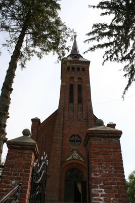
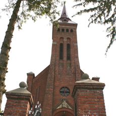
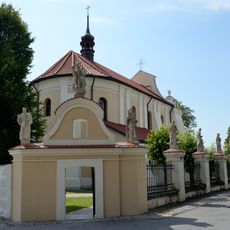
Komarów-Osada, Administrative village in Zamość County, eastern Poland

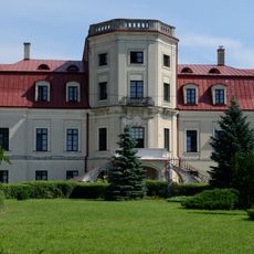
Komarów-Osada is a village in eastern Poland located in Zamość County. It serves as the administrative center for the surrounding gmina and provides basic services to its residents.

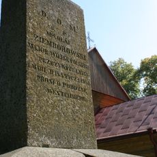
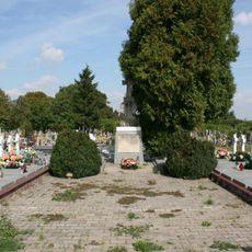
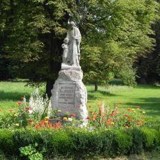
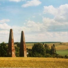
The village witnessed a major cavalry engagement during the Polish-Soviet War in August 1920, which resulted in a Polish victory. This battle holds significance among the largest cavalry actions of that conflict.

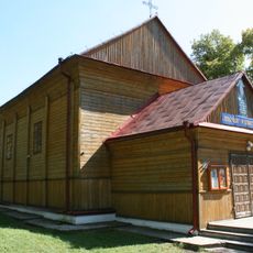
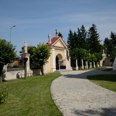
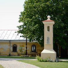
The village maintains traditional Polish rural customs while serving as an administrative center for the surrounding communities within Gmina Komarów-Osada district.

The village is located in a rural area and is best reached by car. Nearby towns like Zamość and Lublin offer more facilities and serve as good reference points for orientation.

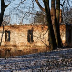
Before World War II, the village had a diverse population with a significant Jewish community that ran local businesses. This community shaped the village's economic and social life until displacement.

The community of curious travelers

AroundUs brings together thousands of curated places, local tips, and hidden gems, enriched daily by 60,000 contributors worldwide.

Start exploring
GPS coordinates
50.63333,23.48333
Latest update
December 10, 2025 16:22
Around this place
Holy Trinity church in Komarów-Osada
Poland

Holy Trinity church in Komarów-Osada

819 m
Kościół Matki Bożej Szkaplerznej i św. Dominika w Łabuniach
Poland

Kościół Matki Bożej Szkaplerznej i św. Dominika w Łabuniach

9.1 km
Church in Śniatycze
Poland

Church in Śniatycze

3.2 km
Saint Michael Archangel church in Zubowice
Poland

Saint Michael Archangel church in Zubowice

6.5 km
Church in Niewirków
Poland

Church in Niewirków

7.7 km
Church in Cześniki
Poland

Church in Cześniki

9.1 km
Church of the Visitation in Wożuczyn
Poland

Church of the Visitation in Wożuczyn

10.4 km
Cmentarz kościelny
Poland

Cmentarz kościelny

7.3 km
Kościół Niepokalanego Poczęcia NMP i św. Marii Magdaleny
Poland

Kościół Niepokalanego Poczęcia NMP i św. Marii Magdaleny

7.3 km
Cmentarz kościelny w Łabuniach
Poland

Cmentarz kościelny w Łabuniach

9.1 km
Cmentarz rzym.-kat.
Poland

Cmentarz rzym.-kat.

8.2 km
Ogrodzenie z bramką
Poland

Ogrodzenie z bramką

7.2 km
Zespół dworski w Krynicach
Poland

Zespół dworski w Krynicach

8.8 km
Kościół Matki Boskiej Szkaplerznej i św. Dominika, Kościelna 44 w Łabuniu
Poland

Kościół Matki Boskiej Szkaplerznej i św. Dominika, Kościelna 44 w Łabuniu

9.1 km
Kaplica, ob. galeria, tzw. „korytarz”
Poland

Kaplica, ob. galeria, tzw. „korytarz”

9.1 km
Zamoyski Palace in Łabunie
Poland

Zamoyski Palace in Łabunie

7.7 km
Palace in Niewirków
Poland

Palace in Niewirków

7.8 km
Ruina dworu w Krynicach
Poland

Ruina dworu w Krynicach

8.8 km
Kaplica grobowa Rulikowskich
Poland

Kaplica grobowa Rulikowskich

8.1 km
Park – regularne założenie ogrodowe za pałacem, wraz z zachowanym drzewostanem, układem zieleni, alejami, drzewami i osiami widokowymi
Poland

Park – regularne założenie ogrodowe za pałacem, wraz z zachowanym drzewostanem, układem zieleni, alejami, drzewami i osiami widokowymi

7.4 km
Zespół cmentarza rzym.-kat.
Poland

Zespół cmentarza rzym.-kat.

8.2 km
Zespół kościoła Niepokalanego Poczęcia NMP i św. Marii Magdaleny
Poland

Zespół kościoła Niepokalanego Poczęcia NMP i św. Marii Magdaleny

7.2 km
Pałac, Parkowa 33 w Łabuniach
Poland

Pałac, Parkowa 33 w Łabuniach

7.6 km
Oficyna I
Poland

Oficyna I

7.6 km
Mury obronne (relikty)
Poland

Mury obronne (relikty)

9.4 km
Ogrodzenie z 2 bramami, 2 kapliczkami i 18 figurami świętych
Poland

Ogrodzenie z 2 bramami, 2 kapliczkami i 18 figurami świętych

9.1 km
Zespół kościoła Matki Boskiej Szkaplerznej i św. Dominika w Łabuniach
Poland

Zespół kościoła Matki Boskiej Szkaplerznej i św. Dominika w Łabuniach

9.1 km
Brama (obeliski)
Poland

Brama (obeliski)

9.7 km
Show the full map
Reviews
Share your experience

No review yet

Discussions
Start a discussion...

No discussion yet

« Komarów-Osada - Administrative village in Zamość County, eastern Poland » is provided by Around Us (aroundus.com). Images and texts are derived from Wikimedia project under a Creative Commons license. You are allowed to copy, distribute, and modify copies of this page, under the conditions set by the license, as long as this note is clearly visible.

Discover hidden gems everywhere you go!

From secret cafés to breathtaking viewpoints, skip the crowded tourist spots and find places that match your style. Our app makes it easy with voice search, smart filtering, route optimization, and insider tips from travelers worldwide. Download now for the complete mobile experience.

Around Us App Screenshot

A unique approach to discovering new places

Le Figaro

All the places worth exploring

France Info

A tailor-made excursion in just a few clicks

20 Minutes

Around Us
Travel Guide & Maps
Download

Send to your phone

QR Code
1

Open the camera app on your mobile.

2

Point at the QR code with your camera. A notification will appear.

3

Tap the notification to open the link.