Old City of Zamość
Old City of Zamość, Renaissance old town in Zamość, Poland
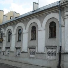
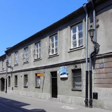
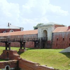
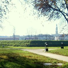
The Old City of Zamość is a Renaissance settlement in Poland with a systematic hexagonal layout featuring three main squares that blend Italian Renaissance architecture with Eastern European building elements. Fortification walls encircle roughly 75 hectares containing around 200 historical structures connected by pedestrian-friendly streets and passages.
The settlement was founded in 1580 by Chancellor Jan Zamoyski, who commissioned Italian architect Bernardo Morando to design it following Renaissance urban planning principles. This early establishment made it a significant trade hub between different cultural regions.
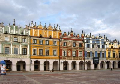
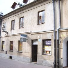
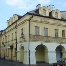
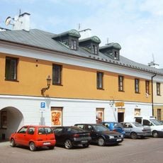
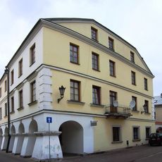
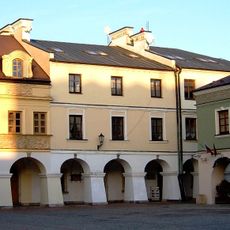
The central market square is lined with colorful merchant houses featuring detailed decorative elements that reflect the craftsmanship of both Italian and local builders. This blend of influences shapes every corner of the plaza and remains visible in the buildings today.
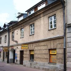
Visitors can easily explore the paved streets on foot since the terrain is flat and the paths are clearly marked. It helps to start near the central square and then venture through the side streets and lanes to discover all areas.
The town hall features a 52 meter tall tower with a double staircase that combines Mannerist architecture with mathematical precision. This architectural detail showcases the care and skill invested in designing this city.
Location: Zamość
Inception: 1580
Address: Bastion VII, Waleriana Łukasińskiego 4, 22-400 Zamość, Poland
Website: http://twierdza.zamosc.pl/pl/places/127/.html
GPS coordinates: 50.72056,23.25861
Latest update: January 7, 2026 10:21
Zamość Synagogue
424 m
Mikvah in Zamość
401 m
Jews in Zamość
434 m
Synagoga w Zamościu (ul. Daniłowskiego)
368 m
Roman catholic cemetery at Peowiaków st. in Zamość
237 m
12 Pereca Street in Zamość
425 m
8 Pereca Street in Zamość
410 m
4 Pereca Street in Zamość
399 m
New Lublin Gate in Zamość
355 m
Nadszaniec przy dawnym bastionie VI (1827-35 r.)
319 m
Kamienica (XVII-XVIII w.
432 m
Dom grabarza (2 poł. XIX w.)
237 m
Kamienica (poł. XIX w.)
396 m
Rawelin kurtyny V-VI (1809-13 r.
312 m
14 Zamenhofa Street in Zamość
447 m
Luneta kurtyny VI-VII (1809-13 r.
259 m
10 Pereca Street in Zamość
418 m
Koszarka drogowa, tzw. Belwederek (1901 r.)
275 m
Cemetery chapel in Zamość
237 m
Dom (łącznik) (XVII/XVIII w.
432 m
Kamienica (1 poł. XVII w.
434 m
2 Pereca Street in Zamość
388 m
Kamienica (pocz. XX w.)
393 m
Kamienica (1 poł. XVII w.
440 m
6 Pereca Street in Zamość
404 m
Dom tylny (1829 r.)
417 m
Kamienica (1868 r.)
426 m
Zespół cmentarza rzymskokatolickiego
237 mVisited this place? Tap the stars to rate it and share your experience / photos with the community! Try now! You can cancel it anytime.
Discover hidden gems everywhere you go!
From secret cafés to breathtaking viewpoints, skip the crowded tourist spots and find places that match your style. Our app makes it easy with voice search, smart filtering, route optimization, and insider tips from travelers worldwide. Download now for the complete mobile experience.
A unique approach to discovering new places❞
— Le Figaro
All the places worth exploring❞
— France Info
A tailor-made excursion in just a few clicks❞
— 20 Minutes