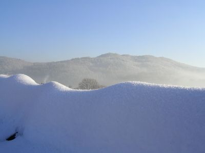
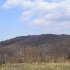
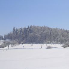
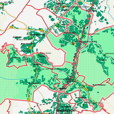
Ptasia Kopa, Mountain summit in Góry Wałbrzyskie, Poland
Vogelskoppe, also known as Ptasia Kopa, rises to 590 meters between the peaks Lisi Kamień and Czarnota and forms a ridge in the Walbrzych Mountains of Lower Silesia. The slopes are covered with spruce and deciduous forests that represent the typical mid-mountain vegetation of the region.
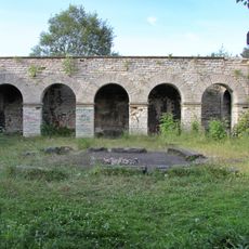
The mountain slopes contain remnants of lead and silver ore mining operations that were active during the 14th and 15th centuries. This period of activity significantly shaped the economic development of the Walbrzych region.
The European long-distance trail E3 passes through this summit and connects several villages with marked routes that visitors regularly use. This path serves as a main reference point for hikers exploring the broader landscape.
Multiple marked trails lead to the summit, including a blue-marked route for hikers and dedicated paths for mountain biking enthusiasts. The trails are well-signposted and allow for safe navigation through the mountain terrain.
Erratic boulders scattered across the mountain slopes show traces of ancient glacial movements that shaped the landscape during the ice age. These rocky fragments serve as silent witnesses to the geological history of this mountain range.
GPS coordinates: 50.78706,16.30203
Latest update: December 14, 2025 20:02
Totenburg Mausoleum in Wałbrzych
2.5 kmWzgórze Gedymina
2.3 km
Tielsch Palace in Wałbrzych
1.4 km
Dom Wycieczkowy PTTK "Harcówka"
2.2 km
Church of “Resurrection of Lord” in Wałbrzych
1.1 km
Saint Joseph the Worker church in Wałbrzych
2.3 km
Church of St. Barbara in Wałbrzych
925 m
Schwarze Lehne
813 m
Sacred Heart church in Wałbrzych
1.3 km
Czarnuszka (góra)
1.2 km
Wieża widokowa w parku im. Jana III Sobieskiego
2.1 km
Szyb Chwalibóg I - wieża nadszybowa
1.3 km
4a Schmidta Street in Wałbrzych
2.4 km
Wałbrzych Miasto train station
1.3 km
21 Armii Krajowej Street in Wałbrzych
1.3 km
15 Słowackiego Street in Wałbrzych
2.5 km
Dekanat Wałbrzych - Północ
2 km
Wieża widokowa na Wzgórzu Gedymina
2.3 km
2 Wysockiego Street in Wałbrzych
2.5 km
2 Dmowskiego Street in Wałbrzych
2.5 km
Dzielnica Stary Zdrój jako historyczny układ urbanistyczny, XIV
1.2 km
„Lisia Sztolnia”, XVIII/XIX
2.2 km
9 Pocztowa Street in Wałbrzych
1 km
3 Wyzwolenia Avenue in Wałbrzych
2.5 km
1 Wyzwolenia Avenue in Wałbrzych
2.5 km
5 Dmowskiego Street in Wałbrzych
2.5 km
Budynek przemysłowy w fabryce porcelany „Wałbrzych”
1.4 km
Bolesława Chrobrego 1
2.5 kmVisited this place? Tap the stars to rate it and share your experience / photos with the community! Try now! You can cancel it anytime.
Discover hidden gems everywhere you go!
From secret cafés to breathtaking viewpoints, skip the crowded tourist spots and find places that match your style. Our app makes it easy with voice search, smart filtering, route optimization, and insider tips from travelers worldwide. Download now for the complete mobile experience.
A unique approach to discovering new places❞
— Le Figaro
All the places worth exploring❞
— France Info
A tailor-made excursion in just a few clicks❞
— 20 Minutes