Fortaleza de São João Baptista do Pico, Military fort in São Pedro, Portugal
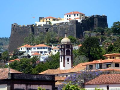
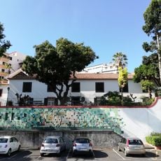
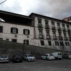
Fortaleza do Pico is a fort on a hill above Funchal with thick stone walls and defensive positions facing the Atlantic Ocean. The site has multiple buildings and structures that create different areas within the fortification.
The fort was built between 1601 and 1640 during the Iberian Union to protect Madeira from pirate raids on the prosperous port. It was a response to growing threats from corsairs during that era.
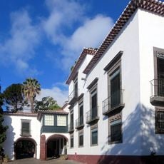
The chapel inside shows how religious and military life were woven together in Portuguese forts of the 17th century. Visitors can still sense this connection as they walk through the rooms today.
The site sits on a hill and is best reached by established paths, so good footwear is recommended. The location offers broad views over the harbor and city below, making clear days especially rewarding for a visit.
After its time as a defensive installation, the fort was converted into a naval radio station and became known as Pico-Rádio. This technological transformation shows how military structures could adapt to new needs over the centuries.
Location: São Pedro
GPS coordinates: 32.65093,-16.91633
Latest update: December 13, 2025 12:41
Museu Quinta das Cruzes
229 m
Capela de Nossa Senhora da Saúde
379 m
Casa-Museu Frederico de Freitas
391 m
Museu de História Natural do Funchal
412 m
Universo de Memórias João Carlos Abreu
280 m
The St. Andrew's Presbyterian Church of Funchal
285 m
Residência Santa Clara
279 m
Solar dos Canaviais
341 m
Quinta da Ribeira
318 m
Quinta da rua do Paiol
384 m
Ponte de São Paulo
243 m
Edifício na calçada de Santa Clara, n.º 38
401 m
Edifício na calçada de Santa Clara, n.º 26
368 m
Capela de São Paulo
178 m
Edifício na rua da Saúde, n.º 40
393 m
Quinta do Pico dos Frias
115 m
Edifício na rua da Carreira, n.º 215
300 m
Edifício na rua da Mouraria, n.º 25
404 m
Edifício na rua das Mercês, n.º 69
376 m
Edifício na rua da Mouraria, n.º 12
405 m
City walls of Funchal (Rua Pimenta de Aguiar)
207 m
Edifício na travessa das Capuchinhas, n.º 33
344 m
Edifício na travessa das Capuchinhas, n.º 35
344 m
Edifício na travessa das Capuchinhas, n.º 43
370 m
Solar e Capela de Nossa Senhora da Conceição
285 m
Visible tracts of Ribeira de São João walls (1st section)
310 m
Visible tracts of Ribeira de São João walls (4th and 5th sections)
260 m
Gate at rua do Castelo, n.º 4
111 mVisited this place? Tap the stars to rate it and share your experience / photos with the community! Try now! You can cancel it anytime.
Discover hidden gems everywhere you go!
From secret cafés to breathtaking viewpoints, skip the crowded tourist spots and find places that match your style. Our app makes it easy with voice search, smart filtering, route optimization, and insider tips from travelers worldwide. Download now for the complete mobile experience.
A unique approach to discovering new places❞
— Le Figaro
All the places worth exploring❞
— France Info
A tailor-made excursion in just a few clicks❞
— 20 Minutes