
Maćija, Berggipfel in Serbien
Location: Serbia
Elevation above the sea: 298 m
GPS coordinates: 44.10750,21.46694
Latest update: June 4, 2025 19:47
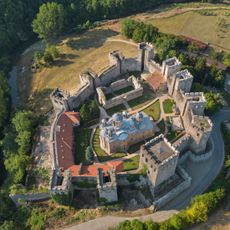
Manasija monastery
765 m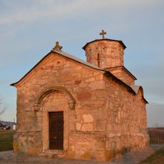
Église de la Nativité-de-la-Mère-de-Dieu de Beljajka
5.8 km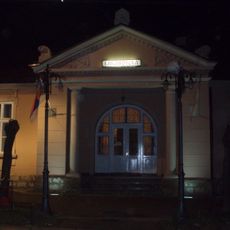
National Library "Resavska škola" Despotovac
2.6 km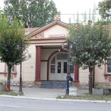
Bâtiment de la bibliothèque nationale « Resavska škola » à Despotovac
2.8 km
Prlovo
10.3 km
Ðula-Straža
8.3 km
Belo Brdo
11.2 km
Šarene Vode
6.7 km
Belo Brdo
7.6 km
Oštri Vrh
5.1 km
Vujičko Brdo
10.9 km
Rapatna
6.1 km
Babin Vrh
9.1 km
Srednji Vrh
10 km
Oštri Vrh
7.4 km
Ðula (tumoy sa bukid sa Serbya, lat 44,07, long 21,57)
9.4 km
Nabat
3.4 km
Krš
3.1 km
Sorina Padina
5.7 km
Gurnovica
9.7 km
Poljanska Glava
8.6 km
Veliko Brdo
11.3 km
Gorunjski Vrh
6 km
Glavčina
7.4 km
Trstenjak
8.7 km
Koševo
5.6 km
Čukare
6.9 km
Komarski Breg
7.3 kmReviews
Visited this place? Tap the stars to rate it and share your experience / photos with the community! Try now! You can cancel it anytime.
Discover hidden gems everywhere you go!
From secret cafés to breathtaking viewpoints, skip the crowded tourist spots and find places that match your style. Our app makes it easy with voice search, smart filtering, route optimization, and insider tips from travelers worldwide. Download now for the complete mobile experience.

A unique approach to discovering new places❞
— Le Figaro
All the places worth exploring❞
— France Info
A tailor-made excursion in just a few clicks❞
— 20 Minutes