Chest opened
+${chestReward.xp} XP
Explorer
NOUVEAU ×${chestReward.collectible.quantity}
tapez pour fermer
Chest locked

Open chests in the app

Around Us is built for your phone — chests unlock when you walk, explore and capture nearby places.

Enable Location

We need your location to show you interesting places around you

Discover nearby places

Find interesting locations and hidden gems around you

Precise directions

Get accurate directions and distances to places

Your location is never shared with other users. It's only used when you tap the location button.

Shumshu

Log in to your account

Start exploring — it's free

Trusted by 72,891 travelers worldwide

Continue with Google
Continue with Apple
or

We will send you a code to connect

By continuing, you accept our Terms and Conditions and our Privacy Policy

Check your inbox

We've sent a pincode in your inbox. Please enter the code below.

Shumshu
Discussion Reviews 1 Photos
69.2k Popularity

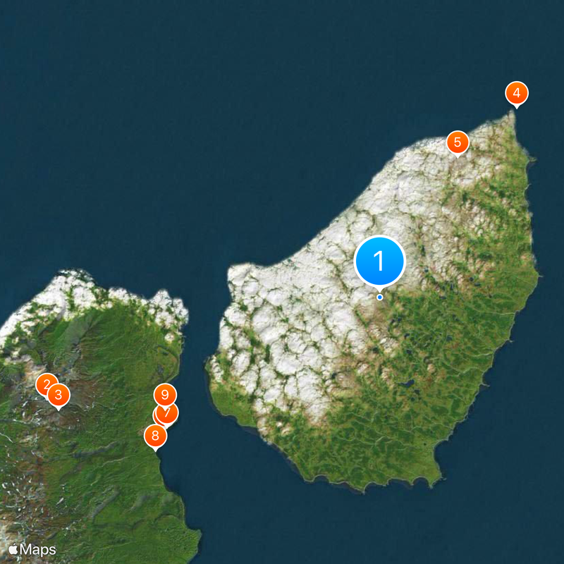
Shumshu, Northern island in Kuril archipelago, Russia

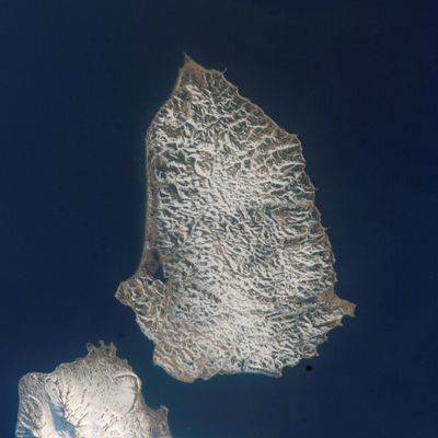
Shumshu forms the northernmost landmass in the Kuril chain and stretches across flat tundra, wetlands, and numerous small freshwater lakes. The highest point reaches roughly 190 meters and the entire land area covers approximately 388 square kilometers between the Sea of Okhotsk and the Pacific Ocean.

During World War II Japan occupied the territory and built military bases with dozens of tanks and thousands of soldiers. In August 1945 the Soviet Union launched an invasion that lasted several days and marked one of the final major land battles of the war.

The original name comes from the Ainu language and means good island, referring to the fishing grounds and seal colonies that sustained their communities. Today scattered foundations and metal fragments recall the military past, while researchers observe bird migrations across the marshlands.

Visitors need special permission from Russian authorities because the territory lies within a restricted military zone. Travel typically involves chartered boats or helicopters from Kamchatka and depends heavily on weather conditions.

Rusted Japanese Type 97 Chi-Ha tanks lie scattered across the tundra and marshes, some half sunken into the ground. In places gun turrets or track links still protrude from the grass and recall the final battle in the Pacific War.

The community of curious travelers

AroundUs brings together thousands of curated places, local tips, and hidden gems, enriched daily by 60,000 contributors worldwide.

Start exploring
Elevation above the sea
189 m
Part of
North Kurils
GPS coordinates
50.75000,156.35000
Latest update
December 13, 2025 17:54
Around this place
Ebeko
Russian Federation

Ebeko

24.6 km
Russian Federation

Vulcan Neozhidannyy

24 km
Russian Federation

Здесь бывают сивучи

16.6 km
Russian Federation

Перевёрнутый танк

11.4 km
Russian Federation

Остов корабля

17.9 km
Russian Federation

Tur Rock

17.6 km
Russian Federation

Остов корабля

19.2 km
Russian Federation

Кладбище кораблей

17.1 km

Пляж с черным песком

19.1 km
Russian Federation

Я люблю Северо-Курильск

18.8 km
Russian Federation

Купель

18.5 km
Russian Federation

Обелиск памяти

14.6 km
Russian Federation

Стелла памяти погибшему городу

17 km
Russian Federation

Стелла Северо-Курильск

18.1 km
Russian Federation

Мемориал погибшему городу

18.9 km
Russian Federation

Памятник рыбакам

18.6 km
Russian Federation

Memorial

11.9 km
Russian Federation

Memorial

11.9 km
Russian Federation

Memorial

11.9 km
Russian Federation

Memorial

11.5 km
Russian Federation

Мемориальный комплекс советским солдатам, погибшим на Северных Курилах

17.9 km
Russian Federation

Казакам-первопроходцам островов Шумшу и Парамушир

18.8 km
Russian Federation

Аэродром Китанодай

16.6 km
Russian Federation

Воинам-освободителям Курильских островов

18.8 km
Russian Federation

Пограничникам освобождавших и охранявшим северные Курильские острова

18.8 km
Russian Federation

Воинам-освободителям северных Курильских островов

18.9 km
Russian Federation

Воинам-освободителям северных Курильских островов

18.9 km
Russian Federation

Alenka

24.4 km
Show the full map
Reviews
Share your experience

No review yet

Discussions
Start a discussion...

No discussion yet

Administrative divisions
« Shumshu - Northern island in Kuril archipelago, Russia » is provided by Around Us (aroundus.com). Images and texts are derived from Wikimedia project under a Creative Commons license. You are allowed to copy, distribute, and modify copies of this page, under the conditions set by the license, as long as this note is clearly visible.

Discover hidden gems everywhere you go!

From secret cafés to breathtaking viewpoints, skip the crowded tourist spots and find places that match your style. Our app makes it easy with voice search, smart filtering, route optimization, and insider tips from travelers worldwide. Download now for the complete mobile experience.

Around Us App Screenshot

A unique approach to discovering new places

Le Figaro

All the places worth exploring

France Info

A tailor-made excursion in just a few clicks

20 Minutes

Around Us
Travel Guide & Maps
Download

Send to your phone

QR Code
1

Open the camera app on your mobile.

2

Point at the QR code with your camera. A notification will appear.

3

Tap the notification to open the link.