Enable Location

We need your location to show you interesting places around you

Discover nearby places

Find interesting locations and hidden gems around you

Precise directions

Get accurate directions and distances to places

Your location is never shared with other users. It's only used when you tap the location button.

Mount Yamantau

Log in to your account

Start exploring — it's free

Trusted by 61,991 travelers worldwide

Continue with Google
Continue with Apple
or

We will send you a code to connect

By continuing, you accept our Terms and Conditions and our Privacy Policy

Check your inbox

We've sent a pincode in your inbox. Please enter the code below.

Mount Yamantau

Mount Yamantau, Mountain summit in Beloretsky District, Bashkortostan, Russia.

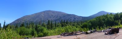
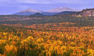
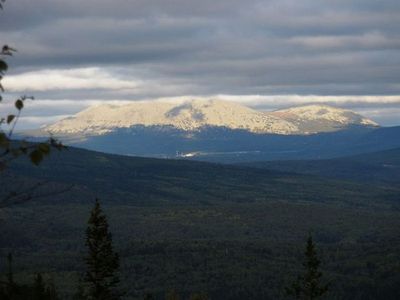
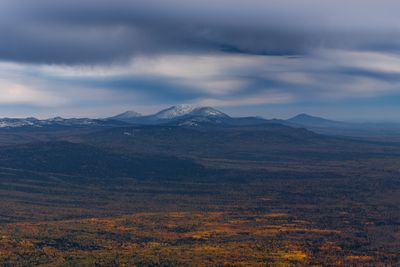
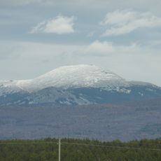
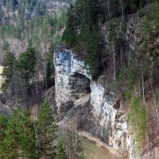
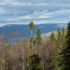
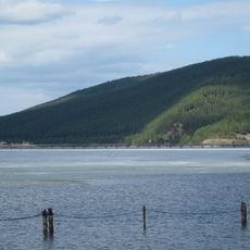
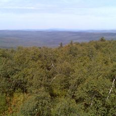
Mount Yamantau is a summit in Bashkortostan, Russia, rising to 1,640 meters (5,380 feet) and featuring two separate peaks with flat plateau formations at their tops. Mixed forests blanket the lower slopes, while the upper sections consist of rock outcrops and alpine meadows.

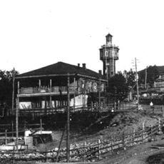
The mountain remained remote and difficult to reach until extensive construction began in the 1990s following the dissolution of the Soviet Union. Satellite images documented the building of large facilities and infrastructure in what was otherwise an uninhabited landscape.

The name Yamantau comes from the Bashkir language, combining words for ‚bad' or ‚evil' with the term for mountain. Bears roam this area frequently, shaping local naming traditions and stories told by people living nearby.

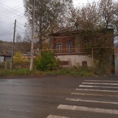
The area is closed to visitors and controlled by military units that restrict access to all parts of the mountain. The surroundings are secured with fencing and checkpoints, so approaching is not possible.

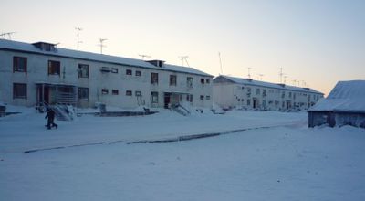
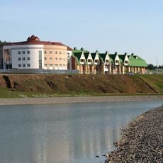
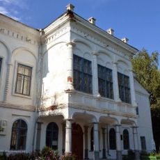
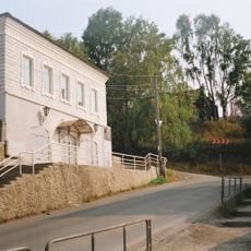
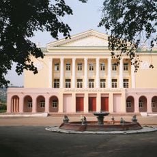
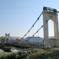
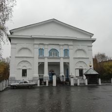
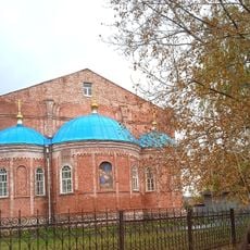
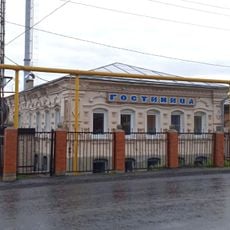
Beneath the peaks sits the closed town of Mezhgorye, founded in 1995 and accessible only with special permits. The town includes railway connections and facilities originally designed to accommodate several tens of thousands of people.

The community of curious travelers

AroundUs brings together thousands of curated places, local tips, and hidden gems, enriched daily by 60,000 contributors worldwide.

Start exploring
Location
Inception
2003
Elevation above the sea
1,640 m
Part of
Southern Ural
Address
Mount Yamantau, Republic of Bashkortostan, Russia, 453570
GPS coordinates
54.25490,58.10401
Latest update
December 13, 2025 17:50
Around this place
Iremel
Russian Federation

Iremel

61.2 km
Bannoye Lake
Russian Federation

Bannoye Lake

82 km
Ignateva Cave
Russian Federation

Ignateva Cave

74.7 km
South Ural Nature Reserve
Russian Federation

South Ural Nature Reserve

17.5 km
Atysh waterfall
Russian Federation

Atysh waterfall

63.5 km
Askyn Ice Cave
Russian Federation

Askyn Ice Cave

78 km
Zigalga National Park
Russian Federation

Zigalga National Park

46.3 km
Assy
Russian Federation

Assy

37.6 km
Beloretsky footbridge
Russian Federation

Beloretsky footbridge

36.4 km
Altyn-Solok
Russian Federation

Altyn-Solok

73 km
Tyulyuk
Russian Federation

Tyulyuk

73.3 km
Белорет заводы
Russian Federation

Белорет заводы

36.7 km
Аквариум
Russian Federation

Аквариум

59.7 km
Атиш (печера)
Russian Federation

Атиш (печера)

63.5 km
Заповедная пещера
Russian Federation

Заповедная пещера

63.5 km
Tashyar
Russian Federation

Tashyar

58.9 km
Kyzyl-Yar
Russian Federation

Kyzyl-Yar

47.1 km
Zuyakovsky School of History Museum
Russian Federation

Zuyakovsky School of History Museum

50.4 km
Sukhaya Atya Cave
Russian Federation

Sukhaya Atya Cave

79.8 km
Церковь Введения во храм Пресвятой Богородицы (Тюлюк)
Russian Federation

Церковь Введения во храм Пресвятой Богородицы (Тюлюк)

58.7 km
Дом Белосельских-Белозерских (Катав-Ивановск)
Russian Federation

Дом Белосельских-Белозерских (Катав-Ивановск)

56.5 km
Дом купцов Патриных (Усть-Катав)
Russian Federation

Дом купцов Патриных (Усть-Катав)

75 km
Дворец культуры вагоностроителей им. Т.Я. Белоконева (Усть-Катав)
Russian Federation

Дворец культуры вагоностроителей им. Т.Я. Белоконева (Усть-Катав)

75.4 km
Брянский мост (Усть-Катав)
Russian Federation

Брянский мост (Усть-Катав)

75.7 km
Церковь Иоанна Предтечи (Катав-Ивановск)
Russian Federation

Церковь Иоанна Предтечи (Катав-Ивановск)

56.4 km
Церковь Рождества Христова (Юрюзань)
Russian Federation

Церковь Рождества Христова (Юрюзань)

70.5 km
Serebryakov house (Yuryuzan)
Russian Federation

Serebryakov house (Yuryuzan)

70.2 km
Abaimov mansion (Yuryuzan)
Russian Federation

Abaimov mansion (Yuryuzan)

70.5 km
Show the full map
« Mount Yamantau - Mountain summit in Beloretsky District, Bashkortostan, Russia » is provided by Around Us (aroundus.com). Images and texts are derived from Wikimedia project under a Creative Commons license. You are allowed to copy, distribute, and modify copies of this page, under the conditions set by the license, as long as this note is clearly visible.

Discover hidden gems everywhere you go!

From secret cafés to breathtaking viewpoints, skip the crowded tourist spots and find places that match your style. Our app makes it easy with voice search, smart filtering, route optimization, and insider tips from travelers worldwide. Download now for the complete mobile experience.

Around Us App Screenshot

A unique approach to discovering new places

Le Figaro

All the places worth exploring

France Info

A tailor-made excursion in just a few clicks

20 Minutes

Around Us
Travel Guide & Maps
Download

Send to your phone

QR Code
1

Open the camera app on your mobile.

2

Point at the QR code with your camera. A notification will appear.

3

Tap the notification to open the link.