Chest opened
+${chestReward.xp} XP
Explorer
NOUVEAU ×${chestReward.collectible.quantity}
tapez pour fermer
Chest locked

Open chests in the app

Around Us is built for your phone — chests unlock when you walk, explore and capture nearby places.

Enable Location

We need your location to show you interesting places around you

Discover nearby places

Find interesting locations and hidden gems around you

Precise directions

Get accurate directions and distances to places

Your location is never shared with other users. It's only used when you tap the location button.

Log in to your account

Start exploring — it's free

Trusted by 72,878 travelers worldwide

Continue with Google
Continue with Apple
or

We will send you a code to connect

By continuing, you accept our Terms and Conditions and our Privacy Policy

Check your inbox

We've sent a pincode in your inbox. Please enter the code below.

Discussion Reviews Photo
3k Popularity

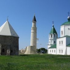
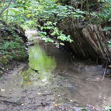
Aşlı, Medieval hillfort in Tetyushsky District, Russia.

Aşlı is an archaeological site with the remains of a medieval settlement positioned on elevated ground near the Volga region. The visible ruins include sections of defensive walls, residential spaces, and work areas distributed across the landscape.

The settlement was an active center throughout the medieval period until the early 13th century, when military conflict destroyed it. This destruction marked a turning point in the political landscape and development of the region.

The site reveals how medieval communities organized their daily activities through remnants of workshops and craft areas scattered across the terrain. These traces show the practical skills and daily routines of people who once lived here.

The site is best visited during warmer months when the archaeological structures are easier to see and navigate. It helps to check local conditions beforehand, as the area remains relatively undeveloped with limited facilities.

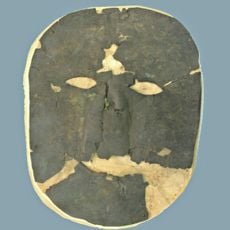
Excavations in 1949 and 1950 uncovered a burial ground at this location with Islamic burial practices from the 11th century. This suggests the settlement was a place where different cultures and trade networks met.

The community of curious travelers

AroundUs brings together thousands of curated places, local tips, and hidden gems, enriched daily by 60,000 contributors worldwide.

Start exploring
GPS coordinates
54.82139,48.73528
Latest update
December 8, 2025 21:04
Around this place
President Bridge
Russian Federation

President Bridge

54.7 km
Bolghar Gord
Russian Federation

Bolghar Gord

26.8 km
Emperor Bridge
Russian Federation

Emperor Bridge

59.3 km
Volzhsko-Kamsky Nature Reserve
Russian Federation

Volzhsko-Kamsky Nature Reserve

50.6 km
Russian Federation

Yo-monument in Ulyanovsk

60.2 km
White Mosque
Russian Federation

White Mosque

26.4 km
Resurrection church, Ulyanovsk
Russian Federation

Resurrection church, Ulyanovsk

58.9 km
Yurievskaya Cave
Russian Federation

Yurievskaya Cave

55.7 km
Simbirsk Classical Gymnasium
Russian Federation

Simbirsk Classical Gymnasium

60.2 km
Monument to Nikolai Karamzin in Ulyanovsk
Russian Federation

Monument to Nikolai Karamzin in Ulyanovsk

60.1 km
Old cemetery, Ulyanovsk
Russian Federation

Old cemetery, Ulyanovsk

60.1 km
Ulyanovsk Oblast Local Museum
Russian Federation

Ulyanovsk Oblast Local Museum

60.2 km
Bolgar Historical and Archaeological Complex
Russian Federation

Bolgar Historical and Archaeological Complex

27 km
Trud Stadium
Russian Federation

Trud Stadium

60.2 km
Russian Federation

Bogdan Khitrovo monument in Ulyanovsk

59.9 km
Russian Federation

Simbir suv tashuvchisi

59.5 km
Church of the Resurrection of Christ, Ulyanovsk
Russian Federation

Church of the Resurrection of Christ, Ulyanovsk

60 km
Undorsky Mineral Spring
Russian Federation

Undorsky Mineral Spring

33.5 km
Undory Paleontology museum
Russian Federation

Undory Paleontology museum

32.4 km
Monument to Karl Marx in Ulyanovsk
Russian Federation

Monument to Karl Marx in Ulyanovsk

60.2 km
Syukeyevo Caves
Russian Federation

Syukeyevo Caves

35.2 km
Храм Рождества Христова (Ульяновск)
Russian Federation

Храм Рождества Христова (Ульяновск)

59.9 km
Kul Gali haykali, Ulyanovsk
Russian Federation

Kul Gali haykali, Ulyanovsk

58.3 km
Gipsy-1
Russian Federation

Gipsy-1

55.8 km
Noble Assembly Building, Ulyanovsk
Russian Federation

Noble Assembly Building, Ulyanovsk

60.1 km
Танкеевский могильник
Russian Federation

Танкеевский могильник

24.9 km
Церковь Троицы Живоначальной (Тетюши)
Russian Federation

Церковь Троицы Живоначальной (Тетюши)

15 km
170 км (разъезд)
Russian Federation

170 км (разъезд)

49.9 km
Show the full map
Reviews
Share your experience

No review yet

Discussions
Start a discussion...

No discussion yet

« Aşlı - Medieval hillfort in Tetyushsky District, Russia » is provided by Around Us (aroundus.com). Images and texts are derived from Wikimedia project under a Creative Commons license. You are allowed to copy, distribute, and modify copies of this page, under the conditions set by the license, as long as this note is clearly visible.

Discover hidden gems everywhere you go!

From secret cafés to breathtaking viewpoints, skip the crowded tourist spots and find places that match your style. Our app makes it easy with voice search, smart filtering, route optimization, and insider tips from travelers worldwide. Download now for the complete mobile experience.

Around Us App Screenshot

A unique approach to discovering new places

Le Figaro

All the places worth exploring

France Info

A tailor-made excursion in just a few clicks

20 Minutes

Around Us
Travel Guide & Maps
Download

Send to your phone

QR Code
1

Open the camera app on your mobile.

2

Point at the QR code with your camera. A notification will appear.

3

Tap the notification to open the link.