Alexander Graben, Natural monument in Dubovsky District, Russia
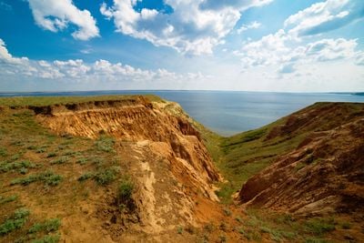
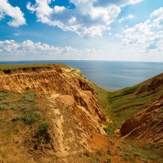
Alexander Graben is a tectonic depression near the Suvodskaya stanitsa in the Dubovsky District, Volgograd Oblast, cutting about 6–7 km along the Volgograd Reservoir shore and widening southward to 1.5 km. Its sunken layers of Paleogene and Neogene rock, dropped as much as 200 m, appear in the reservoir bluff as a vertical section of reddish strata between the usual glauconitic sands.
I. F. Sintsov described the coastal bluffs near the stanitsa Alexandrovskaya (now Suvodskaya) in 1870, but A. P. Pavlov is credited with the full discovery: in an 1896 report he identified the displacement of rock layers between the stanitsa and the village of Proleyka. In 1907 his student A. D. Arkhangelsky refined the age of the strata, and in 1930 the site received the name Alexander Graben. It became a regional nature monument on 25 February 1993.
The graben takes its name from the former stanitsa Alexandrovskaya, now Suvodskaya; it received the name Alexander Graben in 1930. Visitors can see the same sequence of Paleogene and Neogene layers that geologist A. P. Pavlov described in 1896, when he reported displaced rock strata between the stanitsa and the village of Proleyka.
The graben lies on the bank of the Volgograd Reservoir near the Suvodskaya stanitsa, between it and Gorny Balykley, ending at Suvodsky Yar bay. It is best seen from the shore or from the water. Off-road driving and parking outside public and farm roads are prohibited within the 16-hectare monument.
Visible layers of sedimentary rock here document how the land changed through different geological time periods. This natural record makes it valuable for anyone interested in Earth's history.
The community of curious travelers
AroundUs brings together thousands of curated places, local tips, and hidden gems, enriched daily by 94,485 contributors worldwide.