·

Enable Location

We need your location to show you interesting places around you

Discover nearby places

Find interesting locations and hidden gems around you

Precise directions

Get accurate directions and distances to places

Your location is never shared with other users. It's only used when you tap the location button.

Poľská Tomanová

Log in to your account

Start exploring — it's free

Trusted by 62,634 travelers worldwide

Continue with Google
Continue with Apple
or

We will send you a code to connect

By continuing, you accept our Terms and Conditions and our Privacy Policy

Check your inbox

We've sent a pincode in your inbox. Please enter the code below.

Poľská Tomanová

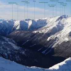
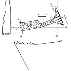
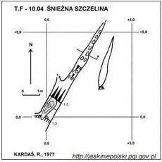
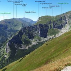
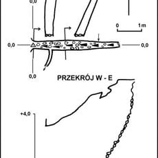
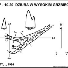
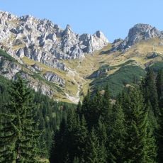
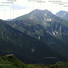
Poľská Tomanová, Mountain summit at Slovakia-Poland border, Western Tatras.

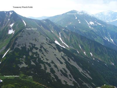
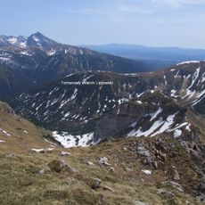
Poľská Tomanová is a mountain summit along the Slovakia-Poland border in the Western Tatras, standing at 1977 meters. The slopes feature grassy terrain with multiple avalanche channels carved into the northern face.

The first ascent took place in 1838 when geologist Ludwik Zejszner reached the summit, marking an important step in exploring the Western Tatras. This early climb contributed to the scientific mapping of the mountain range.

The name reflects the shared border region between two countries and appears in local records using both Slovak and Polish versions. The peak holds connecting significance for people on both sides of the frontier.

Public access to the summit is not permitted, and no marked hiking trails lead to the top due to environmental protection measures. Visitors should focus instead on the accessible trails in the surrounding Tatras.

Waters from the northern slopes flow into the Tomanova valley and then connect with the Čierny Dunajec river through a network of mountain streams. This water system naturally links the two countries across the border.

The community of curious travelers

AroundUs brings together thousands of curated places, local tips, and hidden gems, enriched daily by 60,000 contributors worldwide.

Start exploring
Location
Elevation above the sea
1,977 m
GPS coordinates
49.21331,19.90234
Latest update
December 14, 2025 18:09
« Poľská Tomanová - Mountain summit at Slovakia-Poland border, Western Tatras » is provided by Around Us (aroundus.com). Images and texts are derived from Wikimedia project under a Creative Commons license. You are allowed to copy, distribute, and modify copies of this page, under the conditions set by the license, as long as this note is clearly visible.

Discover hidden gems everywhere you go!

From secret cafés to breathtaking viewpoints, skip the crowded tourist spots and find places that match your style. Our app makes it easy with voice search, smart filtering, route optimization, and insider tips from travelers worldwide. Download now for the complete mobile experience.

Around Us App Screenshot

A unique approach to discovering new places

Le Figaro

All the places worth exploring

France Info

A tailor-made excursion in just a few clicks

20 Minutes

Around Us
Travel Guide & Maps
Download

Send to your phone

QR Code
1

Open the camera app on your mobile.

2

Point at the QR code with your camera. A notification will appear.

3

Tap the notification to open the link.