Nam Tok Ton Dat Fa, Wasserfall in Thailand
Location: Songkhla
Elevation above the sea: 159 m
GPS coordinates: 6.59639,100.57750
Latest update: November 17, 2025 15:40

Khao Nam Khang National Park
4.9 km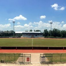
Na Thawi District Stadium
19.8 km
Wat Na Thawi
21.2 km
Wat Nai Wang
20.5 km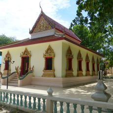
Wat Phang La
21.6 km
Wat Khuha
29.9 km
Wat Hua Thanon
17.8 km
Wat Mae Chi Sukkhi
27.4 km
Nam Tok Ton Lat
1.2 km
Nam Tok Hu Ton
29.9 km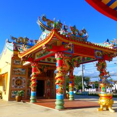
Chao Sai Thi Hukchao shrine
26.2 km
Wat Yang Thong
26.8 km
Padang Golf Universiti Utara Malaysia
15.4 km
Rimba Rekreasi Bukit Wang
32.6 km
Wat Ton Phayom
27.9 km
Puncak Janing
25 km
Sime Darby Lake
16.6 km
Flower Clock of UUM
16.4 km
Tasik Guthrie
16.6 km
Black Forest Golf & Country Club
20.5 km
Tapak Terpelihara Geowarisan Kedah Padang Sanai
33.8 km
I ♥ Perlis @ Bukit Jernih
34.5 km
Scenic viewpoint
32.8 km
Scenic viewpoint
29.6 km
Scenic viewpoint
29.1 km
Wayside shrine, Buddhism, house of prayer, place of worship
28.6 km
Air Terjun Tirai
23.5 km
น้ำตกโตนลาด
1.4 kmReviews
Visited this place? Tap the stars to rate it and share your experience / photos with the community! Try now! You can cancel it anytime.
Discover hidden gems everywhere you go!
From secret cafés to breathtaking viewpoints, skip the crowded tourist spots and find places that match your style. Our app makes it easy with voice search, smart filtering, route optimization, and insider tips from travelers worldwide. Download now for the complete mobile experience.

A unique approach to discovering new places❞
— Le Figaro
All the places worth exploring❞
— France Info
A tailor-made excursion in just a few clicks❞
— 20 Minutes