Khorugh, Administrative capital in Gorno-Badakhshan, Tajikistan
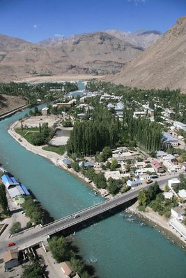
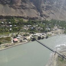
Khorugh is the administrative capital of Gorno-Badakhshan and sits at 2,200 meters elevation in the Pamir Mountains, where the Gunt River merges with the Pyandzh River. The city spreads across this mountain valley and provides access to surrounding peaks and the Afghan border.
The city came under Russian control in the late 19th century and was designated the regional capital in 1925. This decision made it the administrative center for Gorno-Badakhshan.
The Khorugh Regional Museum displays collections reflecting the distinct ethnic groups and languages found throughout the region. The city itself is a place where this diversity shapes daily life and different traditions coexist.
Khorugh Airport serves small aircraft, while the Pamir Highway connects the city to Dushanbe and Kyrgyzstan. Winter conditions regularly affect transportation and require flexibility when planning travel.
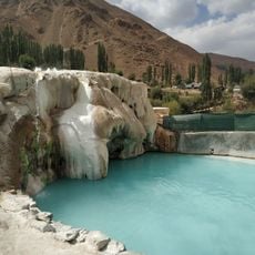
The Pamir Botanical Garden has maintained around 4,000 plant species since 1940, testing their survival in this extreme mountain setting. The garden serves as a research center showing how plants thrive at such high elevation.
The community of curious travelers
AroundUs brings together thousands of curated places, local tips, and hidden gems, enriched daily by 60,000 contributors worldwide.