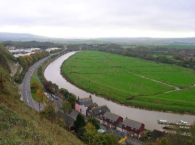
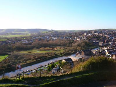
River Ouse, River network in West Sussex, England
The River Ouse is a river system in West Sussex that flows from Lower Beeding through the Sussex countryside and reaches the English Channel at Newhaven. It winds through various settlements and creates a natural corridor through the rural landscape.
The river appears in records from 1086 as a tidal inlet and shaped the region's development over many centuries. Embankment construction and drainage work transformed the waterway and the wetlands around it.
The Sussex Ouse Valley Way follows the river for 67 kilometers, connecting local communities through a network of walking paths and recreational areas.
The riverbanks are largely accessible for walks along the water in most sections. Be aware that some paths can flood seasonally and the terrain varies depending on which part you visit.
The river system encompasses 750 miles of waterways, collecting water from 250 square miles of surrounding terrain through streams and tributaries.
The community of curious travelers
AroundUs brings together thousands of curated places, local tips, and hidden gems, enriched daily by 60,000 contributors worldwide.