Enable Location

We need your location to show you interesting places around you

Discover nearby places

Find interesting locations and hidden gems around you

Precise directions

Get accurate directions and distances to places

Your location is never shared with other users. It's only used when you tap the location button.

Lundy

Log in to your account

Start exploring — it's free

Trusted by 69,457 travelers worldwide

Continue with Google
Continue with Apple
or

We will send you a code to connect

By continuing, you accept our Terms and Conditions and our Privacy Policy

Check your inbox

We've sent a pincode in your inbox. Please enter the code below.

Discussion Reviews 2 Photos
111k Popularity

Lundy, Site of Special Scientific Interest in Bristol Channel, England

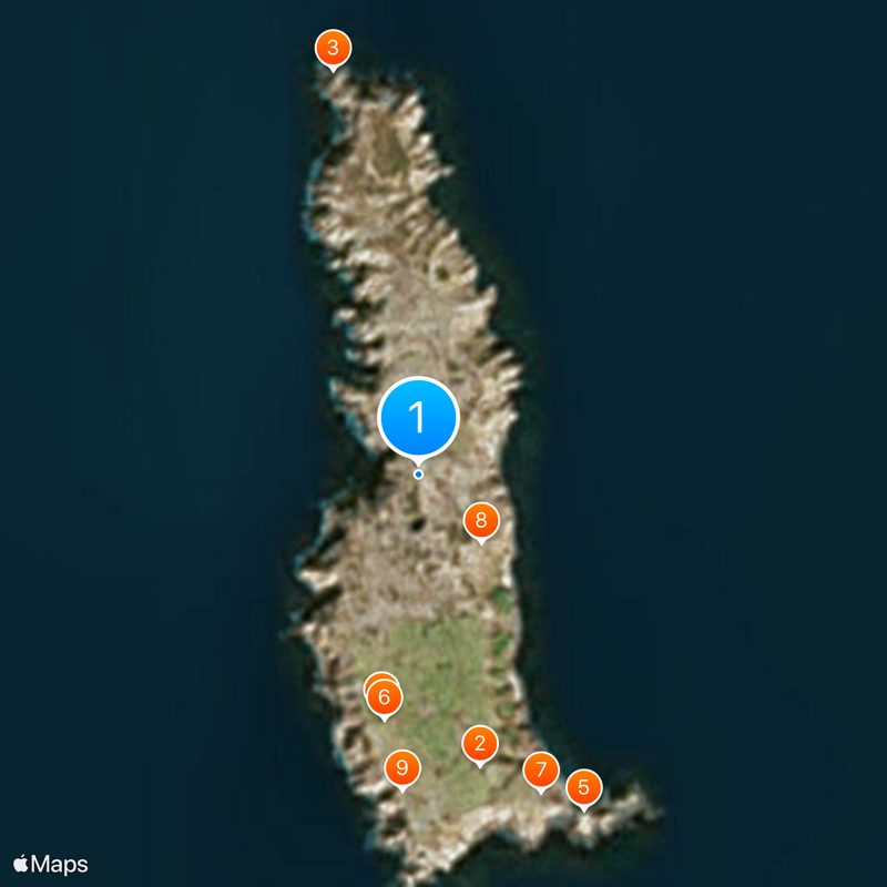
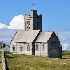
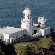
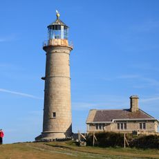
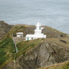
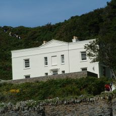
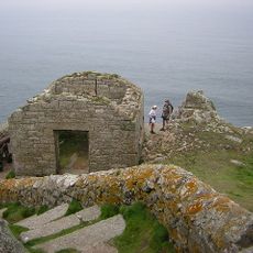
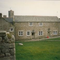
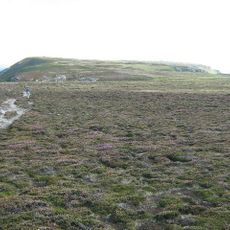
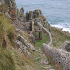
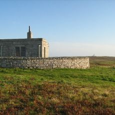
Lundy is a granite island in the Bristol Channel in England, extending three miles in length and half a mile in width. The island sits where the Atlantic Ocean meets the Bristol Channel, offering a mix of cliffs, grassland and a few buildings scattered across the terrain.

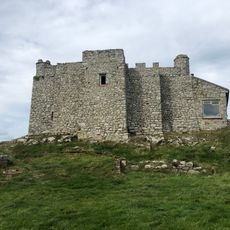
The island's name, derived from Old Norse, first appeared in records from 1189 and reflects its long connection to seafaring communities. Over the centuries it changed hands several times and served different purposes, from a pirate stronghold to a private estate.

The island maintains its own postal system with Puffin stamps, a tradition from the early twentieth century. Visitors can buy these local stamps and mail postcards from here, each letter receiving a special postmark from this small island territory.

Visitors reach the island through ferry services from Ilfracombe or Bideford, with helicopter transfers available during winter months. The crossing takes around two hours by boat, so expect changing sea conditions and bring appropriate clothing.

The waters around the island became the United Kingdom's first Marine Conservation Zone in 2010, protecting different marine habitats. Divers and snorkelers can observe seals, rare coral species and shipwrecks from different centuries at certain spots here.

The community of curious travelers

AroundUs brings together thousands of curated places, local tips, and hidden gems, enriched daily by 60,000 contributors worldwide.

Start exploring
Location
GPS coordinates
51.18000,-4.67000
Latest update
March 5, 2026 18:58
Around this place
St Helen's Church, Lundy
United Kingdom

St Helen's Church, Lundy

1.8 km
Lundy North Lighthouse
United Kingdom

Lundy North Lighthouse

2.5 km
Lundy Old Light
United Kingdom

Lundy Old Light

1.4 km
Lundy South Lighthouse
United Kingdom

Lundy South Lighthouse

2.2 km
Chapel remains, cemetery and prehistoric settlement on Beacon Hill, Lundy
United Kingdom

Chapel remains, cemetery and prehistoric settlement on Beacon Hill, Lundy

1.5 km
Marisco Castle
United Kingdom

Marisco Castle

2 km
Granite quarry on East Sidelands, Lundy
United Kingdom

Granite quarry on East Sidelands, Lundy

553 m
United Kingdom

Standing stone and cairn 490m south of The Old Lighthouse, Lundy

1.9 km
Millcombe House
United Kingdom

Millcombe House

1.7 km
United Kingdom

Cairn 500m north of The Old Lighthouse, Lundy

947 m
Fog battery at Battery Point, Lundy
United Kingdom

Fog battery at Battery Point, Lundy

997 m
United Kingdom

Standing stone 200m west of St Helen's Church, Lundy

1.7 km
United Kingdom

Standing stone on Ackland's Moor 170m north east of The Old Lighthouse, Lundy

1.3 km
The Old House
United Kingdom

The Old House

1.7 km
United Kingdom

The Widow's Tenement medieval settlement and prehistoric settlement sites, Lundy

1.2 km
Prehistoric settlement at North End, Lundy
United Kingdom

Prehistoric settlement at North End, Lundy

2 km
Fog Signal Battery
United Kingdom

Fog Signal Battery

1.1 km
United Kingdom

Standing stone 100m north east of The Old Lighthouse, Lundy

1.4 km
United Kingdom

Medieval settlement immediately south of Halfway Wall, Lundy

163 m
United Kingdom

Cairn 100m north of Halfway Wall, Lundy

313 m
United Kingdom

Standing stone 220m south of Quarterwall Cottages, Lundy

1 km
Cliff Path Wall To Battery, East North East Of Battery Cottages
United Kingdom

Cliff Path Wall To Battery, East North East Of Battery Cottages

991 m
United Kingdom

Cairn 300m south west of Tibbett's Lookout, Lundy

524 m
Tibbetts
United Kingdom

Tibbetts

681 m
United Kingdom

Standing stone 250m south west of St Helen's Church, Lundy

2 km
United Kingdom

Cairn 270m west of Tibbett's Lookout, Lundy

591 m
United Kingdom

Standing stone 190m south of The Old Lighthouse, Lundy

1.6 km
Magazine And Privies About 15 Metres North East Of Fog Signal Battery
United Kingdom

Magazine And Privies About 15 Metres North East Of Fog Signal Battery

1.1 km
Show the full map
Reviews
Share your experience

No review yet

Discussions
Start a discussion...

No discussion yet

« Lundy - Site of Special Scientific Interest in Bristol Channel, England » is provided by Around Us (aroundus.com). Images and texts are derived from Wikimedia project under a Creative Commons license. You are allowed to copy, distribute, and modify copies of this page, under the conditions set by the license, as long as this note is clearly visible.

Discover hidden gems everywhere you go!

From secret cafés to breathtaking viewpoints, skip the crowded tourist spots and find places that match your style. Our app makes it easy with voice search, smart filtering, route optimization, and insider tips from travelers worldwide. Download now for the complete mobile experience.

Around Us App Screenshot

A unique approach to discovering new places

Le Figaro

All the places worth exploring

France Info

A tailor-made excursion in just a few clicks

20 Minutes

Around Us
Travel Guide & Maps
Download

Send to your phone

QR Code
1

Open the camera app on your mobile.

2

Point at the QR code with your camera. A notification will appear.

3

Tap the notification to open the link.