Filey, Seaside town in North Yorkshire, England
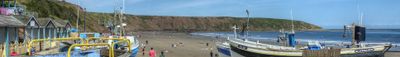
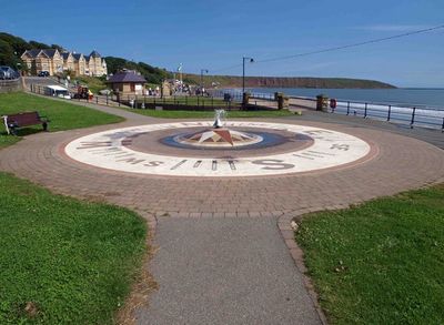
Filey is a seaside town on the North Sea coast in North Yorkshire with a five-mile stretch of sandy beach suitable for walking and relaxation. The town features a working harbor and natural rock formations extending into the sea that provide shelter for fishing boats.
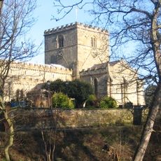
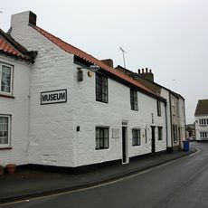
A Roman signal station from the 4th century once stood here, showing the strategic value of this coastal location across centuries. The settlement later became a fishing community that depended on the sea for its livelihood.
The fishing village heritage remains visible in the working harbor and the way locals relate to the sea as part of daily life. Boats still use the natural protection of Filey Brigg, continuing traditions that shaped the community for generations.
The town is accessible by train via the Yorkshire Coast Line, and several long-distance walking trails including Cleveland Way and Yorkshire Wolds Way end here. Visitors should prepare for changeable coastal weather and wear comfortable shoes for the various walking routes.
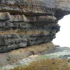
Filey Brigg is a natural rock peninsula jutting far into the North Sea that uniquely shields the harbor from harsh winds coming from the north. This geological formation has been crucial to fishing for centuries and continues to define the town's character today.
Location: Scarborough
Location: North Yorkshire
Website: https://fileytowncouncil.co.uk
GPS coordinates: 54.21010,-0.28930
Latest update: December 20, 2025 00:09
Church of St Oswald
355 m
Passage Beds
1.3 km
Filey Museum
186 m41, Church Street
265 m13, Church Street
179 m35, Church Street
251 m43 and 45, Church Street
271 m
Numbers 23 To 28 Including The Hyland Hotel
539 mThe Foords Hotel
233 m
Royal Crescent Court And Railings To Front And Sides And 4 Lamp Standards To Front
468 mNorthcliffe Cottage
211 m
Filey War Memorial Archway
123 mDovecote Approximately 20 Metres To North-East Of Church Cliff Farmhouse
437 m24-38, Rutland Street
304 mNumbers 1 To 7 And Iron Railings To Entrance Steps
319 mFarm Buildings Approximately 20 Metres To West Of Church Cliff Farm
433 mGates And Gate-Piers To Northcliffe House
198 m8-14, The Crescent
351 mThe Lodge And The Coach-House
237 m15-21, The Crescent
395 mRoman signal station, Carr Naze
1.4 kmRound barrow SE of Moor Farm
4 kmNos 27 And 29, Nos 31 And 33 (West House) And Nos 35 To 41 With Iron Railings To Entrance Steps
208 m8 And 10, Queen Street
180 mLangford Villa
652 mBrig Cinema
146 mGrand Theatre
49 mNorthcliffe House
213 mVisited this place? Tap the stars to rate it and share your experience / photos with the community! Try now! You can cancel it anytime.
Discover hidden gems everywhere you go!
From secret cafés to breathtaking viewpoints, skip the crowded tourist spots and find places that match your style. Our app makes it easy with voice search, smart filtering, route optimization, and insider tips from travelers worldwide. Download now for the complete mobile experience.
A unique approach to discovering new places❞
— Le Figaro
All the places worth exploring❞
— France Info
A tailor-made excursion in just a few clicks❞
— 20 Minutes