Broch of West Burrafirth

Log in to your account

AroundUs is a community-driven map of interesting places, built by curious explorers like you. It grows with every review, story, and photo you share.
Connect to save your favorite spots, contribute locations, and create personalized routes.
Continue with Google
Continue with Apple
Continue with X
Continue with Facebook
Continue with email
By continuing, you accept our Terms and Conditions and our Privacy Policy
Create an account

Broch of West Burrafirth

Add to collection
Map
Suggest a change
Share

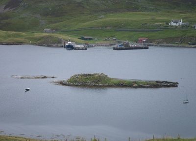
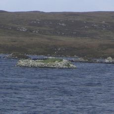
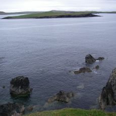
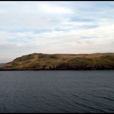
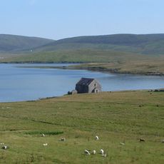
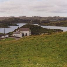
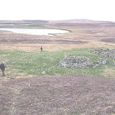
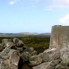
Broch of West Burrafirth, Iron Age broch on Holm of Hebrista islet, Shetland Islands, Scotland.

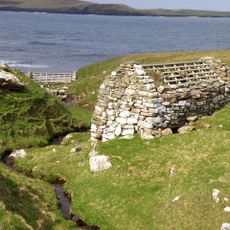
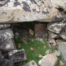
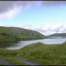
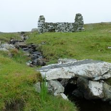
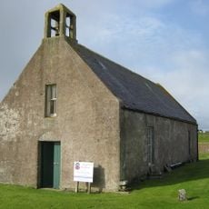
The Broch of West Burrafirth is an Iron Age stone structure located on a rocky islet within West Burra Firth. The building contains four internal mural cells and two guard chambers positioned near the entrance passage.

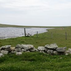
The site received its Norse name Borgarfjörð in the 13th century, reflecting the fortified position that served as a defensive stronghold. This name reflects the later Norwegian settlement in the Shetland Islands.

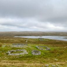
The broch shows how people built fortified homes in Iron Age Scotland, with thick stone walls designed to withstand harsh coastal weather. The internal layout reveals how inhabitants organized their daily life within a circular structure.

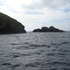
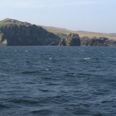
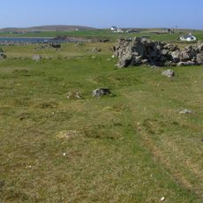
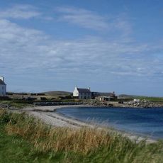
The site is accessible only by boat or during low tide when water levels allow land access across the shallow water. Visitors should check tide tables and prepare for wet conditions when traveling to this remote location.

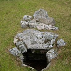
Two of the four remaining internal cells display an unusual dumb-bell shape with narrow passages connecting them. This distinctive architectural feature sets this broch apart from other similar structures of the same period.

GPS coordinates: 60.29822,-1.53828

Latest update: December 14, 2025 13:05

Photos
Around this place
Stanydale Temple
United Kingdom

Stanydale Temple

7.5 km
Huxter, Norse Mill
United Kingdom

Huxter, Norse Mill

8.4 km
Burga Water,dun 2400m S of Voe of Snarraness
United Kingdom

Burga Water,dun 2400m S of Voe of Snarraness

3.9 km
Cairns of Melby
United Kingdom

Cairns of Melby

6.5 km
Muckle Roe lighthouse
United Kingdom

Muckle Roe lighthouse

7.4 km
Vementry,chambered cairn,Muckle Ward
United Kingdom

Vementry,chambered cairn,Muckle Ward

5.4 km
Loch of Watsness,broch E of
United Kingdom

Loch of Watsness,broch E of

10.4 km
Loch of Watsness,linear earthwork W of
United Kingdom

Loch of Watsness,linear earthwork W of

10.5 km
Noonsbrough,burnt mound
United Kingdom

Noonsbrough,burnt mound

3.9 km
Longa Ness,chambered cairn,farmsteads and field system,Noonsbrough
United Kingdom

Longa Ness,chambered cairn,farmsteads and field system,Noonsbrough

3.2 km
Swarbacks Head,gun emplacements
United Kingdom

Swarbacks Head,gun emplacements

5.8 km
Trolligarts,chambered cairn,homestead and field system SE of
United Kingdom

Trolligarts,chambered cairn,homestead and field system SE of

4.9 km
Semblister, Semblister Church
United Kingdom

Semblister, Semblister Church

10.6 km
Footbridge, Norse Mills, Loch Of Breck
United Kingdom

Footbridge, Norse Mills, Loch Of Breck

9.6 km
Voe of Snarraness
United Kingdom

Voe of Snarraness

2.4 km
Melby House
United Kingdom

Melby House

7 km
Vementry, Norse Mill
United Kingdom

Vementry, Norse Mill

6.1 km
Papa Stour, Biggings, Kirk And Kirkyard
United Kingdom

Papa Stour, Biggings, Kirk And Kirkyard

8.4 km
Burrastow House
United Kingdom

Burrastow House

10 km
Loch of Huxter, broch
United Kingdom

Loch of Huxter, broch

8.3 km
Loch of Seligeo burnt mound
United Kingdom

Loch of Seligeo burnt mound

10.1 km
Northbanks,settlement and burnt mound E of,Papa Stour
United Kingdom

Northbanks,settlement and burnt mound E of,Papa Stour

8.2 km
Sandness, St Margaret's Kirk And Graveyard
United Kingdom

Sandness, St Margaret's Kirk And Graveyard

6.5 km
Craw Knowe,chambered cairn
United Kingdom

Craw Knowe,chambered cairn

10.2 km
Ward of Browland,chambered cairn
United Kingdom

Ward of Browland,chambered cairn

5.7 km
Melby, North House
United Kingdom

Melby, North House

7 km
Scord of Brouster, settlement and field system 205m W of Brouster
United Kingdom

Scord of Brouster, settlement and field system 205m W of Brouster

5.6 km
Bay of Garth
United Kingdom

Bay of Garth

4.1 km
Show the full map
Reviews

Visited this place? Tap the stars to rate it and share your experience / photos with the community! Try now! You can cancel it anytime.

« Broch of West Burrafirth - Iron Age broch on Holm of Hebrista islet, Shetland Islands, Scotland » is provided by Around Us (aroundus.com). Images and texts are derived from Wikimedia project under a Creative Commons license. You are allowed to copy, distribute, and modify copies of this page, under the conditions set by the license, as long as this note is clearly visible.

Discover hidden gems everywhere you go!

From secret cafés to breathtaking viewpoints, skip the crowded tourist spots and find places that match your style. Our app makes it easy with voice search, smart filtering, route optimization, and insider tips from travelers worldwide. Download now for the complete mobile experience.

Around Us App Screenshot

A unique approach to discovering new places

Le Figaro

All the places worth exploring

France Info

A tailor-made excursion in just a few clicks

20 Minutes