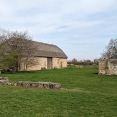
Denny Abbey, Medieval abbey and archaeological site in Waterbeach, England
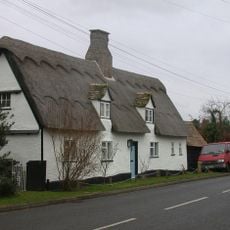
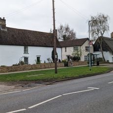
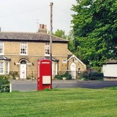
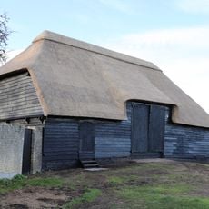
Denny Abbey is a medieval monastery site with archaeological remains north of Cambridge. The location combines preserved buildings and structures with a farming museum that displays historical equipment and items from the region.
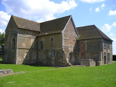
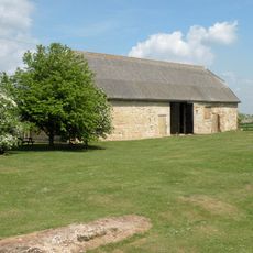
The abbey was founded in 1159 as a Benedictine monastery and later housed Knights Templars and Franciscan nuns. After dissolution in 1539, the grounds became a working farm and remained agricultural for centuries.
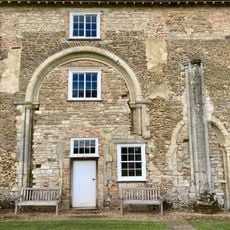
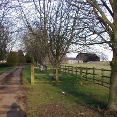
The grounds reveal how religious communities organized their daily lives and which spaces they needed for worship, work, and living. You can still see the different areas arranged for prayer, labor, and shelter from various periods.
The grounds are accessible for visitors to explore the ruins and museum at their own pace. A cafe and shop provide refreshments and information, while workshops are offered regularly throughout the year.
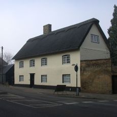
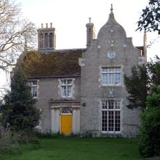
The site displays architecture from three different religious orders, including a Norman doorway and medieval floor tiles. These layers reveal how different communities shaped the place during their occupation.
Location: Waterbeach
Inception: 12 century
Website: https://english-heritage.org.uk/visit/places/denny-abbey-and-the-farmland-museum
GPS coordinates: 52.29360,0.18654
Latest update: December 10, 2025 16:28
Church of St John
3.4 km
Denny Abbey & The Farmland Museum
40 m
Parish Church of All Saints
3.4 km
Church of All Saints
3.7 km
Chequers Public House
4.3 km
Waterbeach War Memorial
3.3 km
Denny Abbey Refectory
49 m
Eye Hall
4.8 km
White Cottage
3.9 km
Pond Farmhouse
4 km
Car Dyke (Waterbeach)
3.8 km
Milestone Half Mile North Of Goose Hall At Ngr 485 679
860 m
Glebe Cottage
3.9 km
Milestone Half Mile South Of Green End Junction And Goose Hall At Ngr 484 664
2.1 km
Length of Car Dyke between Green End and Top Moor
1.4 km
The Limes
4.5 km
K6 Telephone Box
3.1 km
Barn To North Of Denny Abbey
105 m
Milestone South Of Junction With Waterbeach Road At Ngr 487 649
3.5 km
The Conservators House
4.1 km
34, High Street
3.8 km
324, High Street
4.5 km
Milestone One And One Half Miles North Of Goose Hall At Ngr 492 693
949 m
337 And 339, High Street
4.5 km
Cottenham War Memorial
4.3 km
56, Denmark Road
4 km
Tithe Barn The East Of Number 14 (The Old Rectory)
3.4 km
Milestone, N of entrance to School Farm, Chittering
2.6 kmVisited this place? Tap the stars to rate it and share your experience / photos with the community! Try now! You can cancel it anytime.
Discover hidden gems everywhere you go!
From secret cafés to breathtaking viewpoints, skip the crowded tourist spots and find places that match your style. Our app makes it easy with voice search, smart filtering, route optimization, and insider tips from travelers worldwide. Download now for the complete mobile experience.
A unique approach to discovering new places❞
— Le Figaro
All the places worth exploring❞
— France Info
A tailor-made excursion in just a few clicks❞
— 20 Minutes