Enable Location

We need your location to show you interesting places around you

Discover nearby places

Find interesting locations and hidden gems around you

Precise directions

Get accurate directions and distances to places

Your location is never shared with other users. It's only used when you tap the location button.

Kingdom of Sussex

Log in to your account

Start exploring — it's free

Trusted by 67,570 travelers worldwide

Continue with Google
Continue with Apple
or

We will send you a code to connect

By continuing, you accept our Terms and Conditions and our Privacy Policy

Check your inbox

We've sent a pincode in your inbox. Please enter the code below.

Kingdom of Sussex
Discussion Reviews 1 Photos
70.1k Popularity

Kingdom of Sussex, Anglo-Saxon kingdom in southern England.

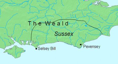
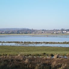
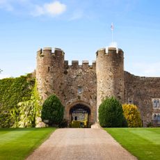
The Kingdom of Sussex was an Anglo-Saxon realm in southern England that spread across the modern counties of East and West Sussex. It stretched from the English Channel coast to the dense woodlands of the Weald inland.

The realm emerged around 477 when Germanic leaders established control over the local population and founded new settlements. Over centuries it maintained independence until the 9th century, when it gradually became absorbed into the expanding Kingdom of Wessex.

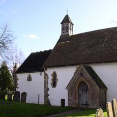
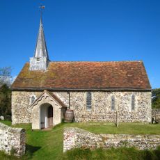
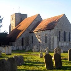
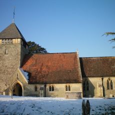
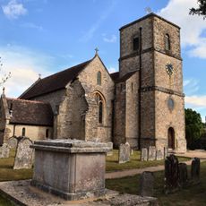
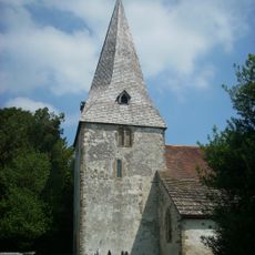
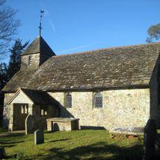
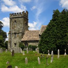
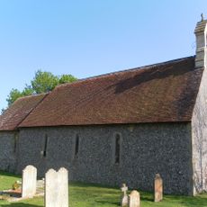
The name Sussex comes from "South Saxons" and reflects the Germanic people who settled here centuries ago. Christianity took root in this region through missionary activity, transforming local beliefs and leaving lasting marks on the community.

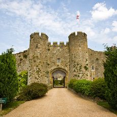
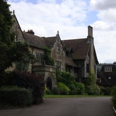
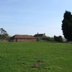
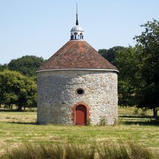
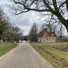
Today visitors can explore the territory and understand its geographic span from the coastline to the forest regions by traveling through modern Sussex. The landscape holds numerous archaeological sites and museums that offer insights into daily life during this early medieval period.

The southern population here was one of the last Anglo-Saxon groups to convert to Christianity, possibly due to geographic isolation created by the forests. This delayed conversion made the religious transformation in the 7th century a distinctive moment in English church history.

The community of curious travelers

AroundUs brings together thousands of curated places, local tips, and hidden gems, enriched daily by 60,000 contributors worldwide.

Start exploring
Inception
477
GPS coordinates
50.91667,-0.50000
Latest update
December 18, 2025 11:41
Around this place
Amberley Castle
United Kingdom

Amberley Castle

2.9 km
Amberley Museum and Heritage Centre
United Kingdom

Amberley Museum and Heritage Centre

3.3 km
St Botolph's Church, Hardham
United Kingdom

St Botolph's Church, Hardham

3.9 km
Pulborough Brooks
United Kingdom

Pulborough Brooks

2.8 km
The Abbey, Storrington
United Kingdom

The Abbey, Storrington

3.1 km
Greatham Church
United Kingdom

Greatham Church

2.2 km
Hardham Priory
United Kingdom

Hardham Priory

3.8 km
Amberley Castle
United Kingdom

Amberley Castle

2.9 km
The Parish Church of St Michael and All Angels
United Kingdom

The Parish Church of St Michael and All Angels

2.9 km
The Parish Church of St Giles
United Kingdom

The Parish Church of St Giles

4 km
The Parish Church of St Mary the Virgin
United Kingdom

The Parish Church of St Mary the Virgin

3.1 km
The Parish Church of St John the Evangelist
United Kingdom

The Parish Church of St John the Evangelist

4 km
Wiggonholt Church
United Kingdom

Wiggonholt Church

2.7 km
Church of St Peter, Parham
United Kingdom

Church of St Peter, Parham

418 m
The Parish Church of St Nicholas
United Kingdom

The Parish Church of St Nicholas

4.3 km
The Dovecot At Parham Park To The North East Of The House
United Kingdom

The Dovecot At Parham Park To The North East Of The House

659 m
The Old Market Rooms  The White Horse Hotel
United Kingdom

The Old Market Rooms The White Horse Hotel

3.2 km
The Black Horse Inn
United Kingdom

The Black Horse Inn

2.5 km
Storrington Library
United Kingdom

Storrington Library

3.2 km
Prattendens
United Kingdom

Prattendens

4.3 km
Storrington War Memorial
United Kingdom

Storrington War Memorial

3.1 km
The Stables And Laundry Wing At Parham Park To The North Of The House
United Kingdom

The Stables And Laundry Wing At Parham Park To The North Of The House

513 m
Rackham Banks: A cross dyke and Itford Hill style settlement on Rackham Hill, 900m SSE of Oldbottom Barn
United Kingdom

Rackham Banks: A cross dyke and Itford Hill style settlement on Rackham Hill, 900m SSE of Oldbottom Barn

1.6 km
Douglas Lodge
United Kingdom

Douglas Lodge

1.4 km
Hardham Priory Farmhouse
United Kingdom

Hardham Priory Farmhouse

3.7 km
Bowl barrow on Springhead Hill, 750m SSW of Springhead Farm
United Kingdom

Bowl barrow on Springhead Hill, 750m SSW of Springhead Farm

1.6 km
Bury War Memorial, West Sussex
United Kingdom

Bury War Memorial, West Sussex

4 km
Timberley Viaduct
United Kingdom

Timberley Viaduct

3.2 km
Show the full map
Reviews
Share your experience

No review yet

Discussions
Start a discussion...

No discussion yet

« Kingdom of Sussex - Anglo-Saxon kingdom in southern England » is provided by Around Us (aroundus.com). Images and texts are derived from Wikimedia project under a Creative Commons license. You are allowed to copy, distribute, and modify copies of this page, under the conditions set by the license, as long as this note is clearly visible.

Discover hidden gems everywhere you go!

From secret cafés to breathtaking viewpoints, skip the crowded tourist spots and find places that match your style. Our app makes it easy with voice search, smart filtering, route optimization, and insider tips from travelers worldwide. Download now for the complete mobile experience.

Around Us App Screenshot

A unique approach to discovering new places

Le Figaro

All the places worth exploring

France Info

A tailor-made excursion in just a few clicks

20 Minutes

Around Us
Travel Guide & Maps
Download

Send to your phone

QR Code
1

Open the camera app on your mobile.

2

Point at the QR code with your camera. A notification will appear.

3

Tap the notification to open the link.