Enable Location

We need your location to show you interesting places around you

Discover nearby places

Find interesting locations and hidden gems around you

Precise directions

Get accurate directions and distances to places

Your location is never shared with other users. It's only used when you tap the location button.

Eddystone Lighthouse

Log in to your account

Start exploring — it's free

Trusted by 61,560 travelers worldwide

Continue with Google
Continue with Apple
or

We will send you a code to connect

By continuing, you accept our Terms and Conditions and our Privacy Policy

Check your inbox

We've sent a pincode in your inbox. Please enter the code below.

Eddystone Lighthouse

Eddystone Lighthouse, Maritime lighthouse in Eddystone Rocks, England.

Description

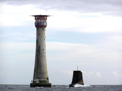
Eddystone Lighthouse is a stone tower on Eddystone Rocks off the coast of Devon, rising 49 meters above sea level. The cylindrical structure carries a lantern and helipad at the top, while its base rests on the submerged rocks.

History

James Nicholas Douglass completed the fourth and current tower in 1882, after three earlier structures were destroyed by storms and fire since 1698. His design learned from the failures of predecessors and created a lasting solution for this difficult location.

Culture

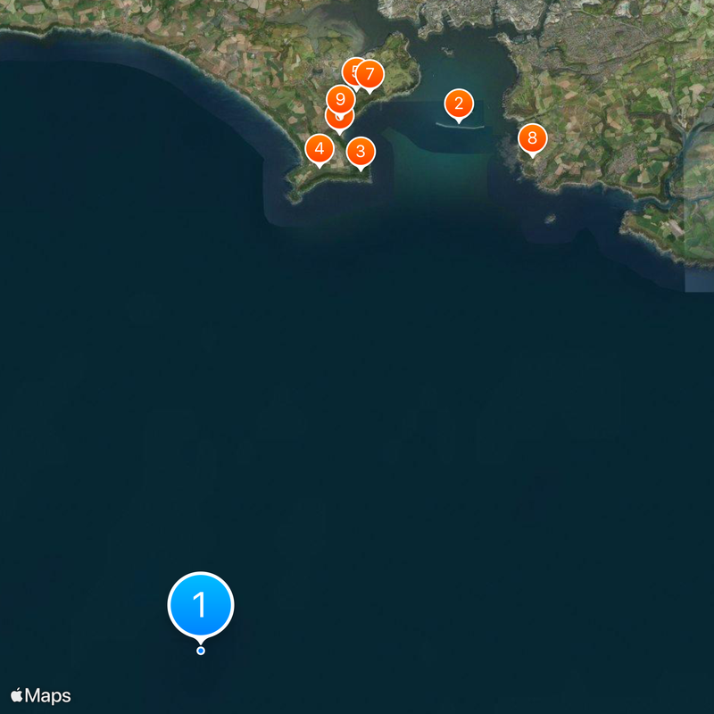
The name comes from the rocks that posed a danger to ships for centuries and gave the tower its purpose. Today it serves as a reference point for sailors navigating one of Europe's busiest shipping lanes.

Practical

The automated light system flashes twice every ten seconds and can be seen up to 17 nautical miles away. A helipad on the roof allows maintenance crews to reach the tower for regular equipment checks.

Did you know?

Solar panels have powered the entire operation since 1999, making the tower an early adopter of renewable energy in maritime navigation. This conversion eliminated the need for regular fuel deliveries by helicopter.

Location
Inception
1882
Architects
James Nicholas Douglass
Height
49 m
Made from material
stone
GPS coordinates
50.18375,-4.26804
Latest update
December 15, 2025 04:39

AroundUs brings together thousands of curated places, local tips, and hidden gems, enriched daily by 60,000 contributors worldwide. Discover all places nearby (Devon).

Around this place
Penlee Battery
United Kingdom

Penlee Battery

16.1 km
Church of St Germanus
United Kingdom

Church of St Germanus

15.8 km
Church of St Andrew
United Kingdom

Church of St Andrew

17 km
Polhawn Fort
United Kingdom

Polhawn Fort

15.7 km
Rame Head
United Kingdom

Rame Head

14.8 km
Chapel Of St Michael
United Kingdom

Chapel Of St Michael

14.8 km
Queen Adelaides Chapel
United Kingdom

Queen Adelaides Chapel

16 km
United Kingdom

Austen Monument In The Churchyard About One Metre East Of North Transept Of Church Of St Germanus

15.8 km
United Kingdom

Wight Monument In The Churchyard About 6 Metres North East Of Chancel Of Church Of St Germanus

15.8 km
United Kingdom

Jago Monument In The Churchyard About 13 Metres North East Of Chancel Of Church Of St Germanus

15.8 km
United Kingdom

Davies Monument In The Churchyard About 6 Metres North Of North Transept Of Church Of St Germanus

15.8 km
United Kingdom

Gray Monument In The Churchyard About 5 Metres East Of North Vestry Of Church Of St Germanus

15.8 km
United Kingdom

Williams Monument In The Churchyard About 6 Metres South Of South Chapel Of Church Of St Germanus

15.8 km
United Kingdom

Bond Monument And Unidentified Monument In The Churchyard About 11 Metres North Of North Transept Of Church Of St Germanus

15.8 km
United Kingdom

Verco Monument In The Churchyard About 13 Metres North Of North Vestry Of Church Of St Germanus

15.8 km
United Kingdom

Gordon Monument In The Churchyard About 5 Metres South Of South Chapel Of Church Of St Germanus

15.8 km
United Kingdom

Verco Monument In The Churchyard About 13 Metres North Of North Vestry Church Of St Germanus

15.8 km
Promontory fort, medieval chapel of St Michael's and Second World War radar station at Rame Head
United Kingdom

Promontory fort, medieval chapel of St Michael's and Second World War radar station at Rame Head

14.8 km
United Kingdom

Vine Cottage And Atached Garden Walls

17.1 km
United Kingdom

Penlee Lodge

17 km
United Kingdom

Royal Commission Fortification: unfinished battery at Knatterbury

16.6 km
United Kingdom

Rame Barton Farmhouse

15.9 km
United Kingdom

Penlee Cottages

16.8 km
United Kingdom

Ellis Monument In The Churchyard About 13 Metres North West Of Tower Of Church Of St Germanus

15.8 km
United Kingdom

Rose Cottage

16.8 km
United Kingdom

Pyke Monument In The Churchyard About 6 Metres East Of South Aisle Of Church Of St Germanus

15.8 km
United Kingdom

Wickell Monument In The Churchyard About 8 Metres North East Of Chancel Of Church Of St Germanus

15.8 km
United Kingdom

Royal Commission fortifications at Forder Hill including two musketry lines and a road block

17 km
Show the full map
« Eddystone Lighthouse - Maritime lighthouse in Eddystone Rocks, England » is provided by Around Us (aroundus.com). Images and texts are derived from Wikimedia project under a Creative Commons license. You are allowed to copy, distribute, and modify copies of this page, under the conditions set by the license, as long as this note is clearly visible.

Discover hidden gems everywhere you go!

From secret cafés to breathtaking viewpoints, skip the crowded tourist spots and find places that match your style. Our app makes it easy with voice search, smart filtering, route optimization, and insider tips from travelers worldwide. Download now for the complete mobile experience.

Around Us App Screenshot

A unique approach to discovering new places

Le Figaro

All the places worth exploring

France Info

A tailor-made excursion in just a few clicks

20 Minutes

Around Us
Travel Guide & Maps
Download

Send to your phone

QR Code
1

Open the camera app on your mobile.

2

Point at the QR code with your camera. A notification will appear.

3

Tap the notification to open the link.