Enable Location

We need your location to show you interesting places around you

Discover nearby places

Find interesting locations and hidden gems around you

Precise directions

Get accurate directions and distances to places

Your location is never shared with other users. It's only used when you tap the location button.

Brockworth

Log in to your account

Start exploring — it's free

Trusted by 62,273 travelers worldwide

Continue with Google
Continue with Apple
or

We will send you a code to connect

By continuing, you accept our Terms and Conditions and our Privacy Policy

Check your inbox

We've sent a pincode in your inbox. Please enter the code below.

Brockworth, Administrative division in Tewkesbury, England

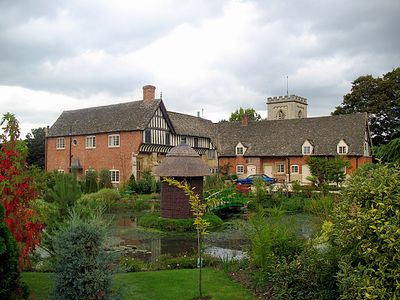
Brockworth is a civil parish and village in Tewkesbury, Gloucestershire, situated northeast of Gloucester. The settlement combines residential areas with open green spaces and is defined by its historic church and rural character.

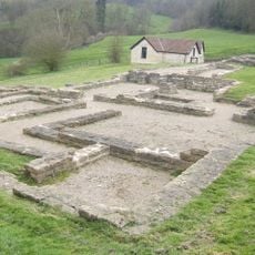
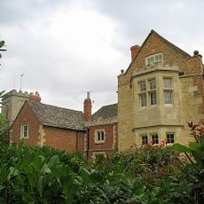
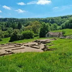
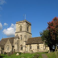
The settlement took shape around the 7th century following the Battle of Dyrham, with its name derived from Saxon words meaning 'brook in an enclosure'. St. George's Church, built in the 1100s, marked the place as an established community.

St. George's Church has shaped the village center since the 1100s and continues to serve as a focal point for the local community. The structure reflects how religious sites anchor the identity of small English villages and their everyday rhythms.

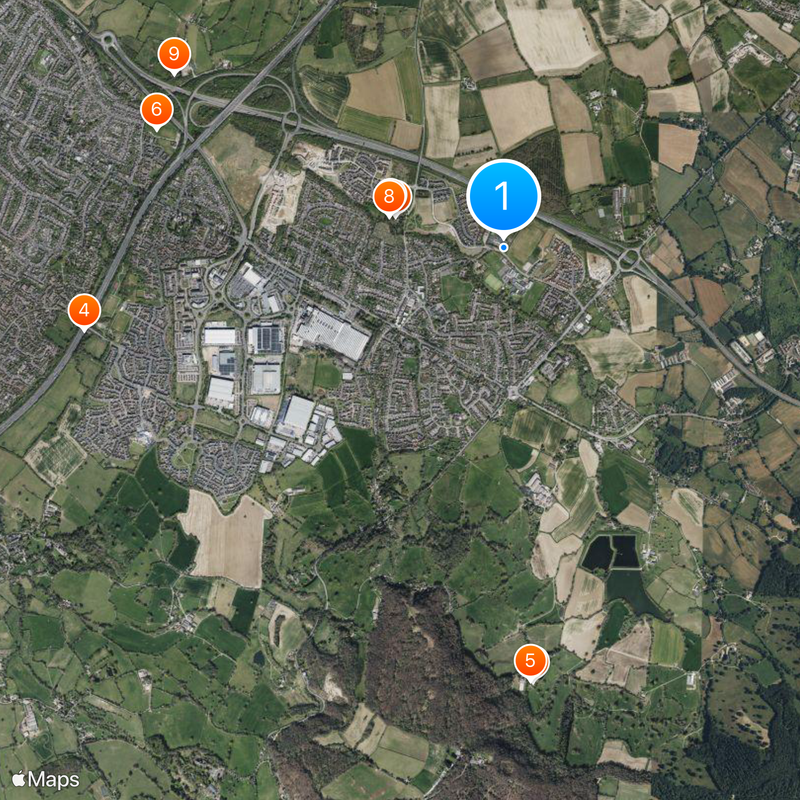
The village has regular bus connections to nearby Gloucester and Cheltenham, making it accessible without a car. Visitors can easily explore the church, green spaces, and local center on foot.

An aircraft factory operated in the village and conducted the first test flight of a turbo-jet powered plane in 1941. This surprising industrial chapter connects the quiet rural settlement to British aviation breakthroughs.

The community of curious travelers

AroundUs brings together thousands of curated places, local tips, and hidden gems, enriched daily by 60,000 contributors worldwide.

Start exploring
Location
GPS coordinates
51.85000,-2.15000
Latest update
December 20, 2025 15:04
Around this place
Villa rustica of Great Witcombe
United Kingdom

Villa rustica of Great Witcombe

2.6 km
Brockworth Court
United Kingdom

Brockworth Court

670 m
Hucclecote Meadows
United Kingdom

Hucclecote Meadows

2.6 km
Great Witcombe Roman Villa
United Kingdom

Great Witcombe Roman Villa

2.6 km
United Kingdom

Hucclecote Roman villa

2.2 km
Church of St George
United Kingdom

Church of St George

705 m
United Kingdom

Unidentified Monument In The Churchyard Of The Church Of St George, Circa 2 Metres South East Of The Porch

708 m
United Kingdom

The Noake

2.2 km
United Kingdom

14, Vicarage Lane

508 m
United Kingdom

Woodcott

2.3 km
United Kingdom

Wall South Of Brockworth Court

676 m
United Kingdom

Outbuilding And Horse Engine House, Circa 15 Metres North Of The Tithe Barn At Brockwell Court

682 m
United Kingdom

Little Witcombe House

1.6 km
United Kingdom

Barn, Noake Court Farm

2 km
United Kingdom

High Brotheridge camp, Buckholt

2.9 km
Tithe Barn Circa 8 Metres North East Of Brockworth Court
United Kingdom

Tithe Barn Circa 8 Metres North East Of Brockworth Court

667 m
Milestone, Painswick Road
United Kingdom

Milestone, Painswick Road

1.9 km
Milestone, Ermin Street; 70m E jcn Vicarage Lane in front No 89
United Kingdom

Milestone, Ermin Street; 70m E jcn Vicarage Lane in front No 89

741 m
United Kingdom

Well Close Farm

2.3 km
United Kingdom

73, Ermin Street

780 m
United Kingdom

Well Head Circa 100 Metres East Of Brockworth Court

568 m
United Kingdom

Cooper's Hill Farm

2.5 km
United Kingdom

Cross Shaft Base In The Churchyard Of The Church Of St George, Circa 25 Metres South Of The Chancel

683 m
United Kingdom

Open Fronted Shelter Shed North East Of Brockworth Court

636 m
United Kingdom

Six Monuments In The Churchyard Of The Church Of St George 6 To 10 Metres South Of The Chancel

696 m
United Kingdom

24, Vicarage Lane

479 m
United Kingdom

Cheese Rolling

2.2 km
United Kingdom

Scenic viewpoint

2.2 km
Show the full map
« Brockworth - Administrative division in Tewkesbury, England » is provided by Around Us (aroundus.com). Images and texts are derived from Wikimedia project under a Creative Commons license. You are allowed to copy, distribute, and modify copies of this page, under the conditions set by the license, as long as this note is clearly visible.

Discover hidden gems everywhere you go!

From secret cafés to breathtaking viewpoints, skip the crowded tourist spots and find places that match your style. Our app makes it easy with voice search, smart filtering, route optimization, and insider tips from travelers worldwide. Download now for the complete mobile experience.

Around Us App Screenshot

A unique approach to discovering new places

Le Figaro

All the places worth exploring

France Info

A tailor-made excursion in just a few clicks

20 Minutes

Around Us
Travel Guide & Maps
Download

Send to your phone

QR Code
1

Open the camera app on your mobile.

2

Point at the QR code with your camera. A notification will appear.

3

Tap the notification to open the link.