Shaftesbury, Market town in Dorset, England
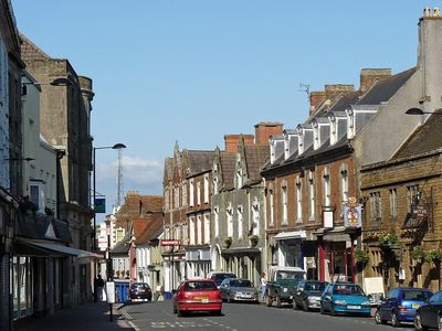
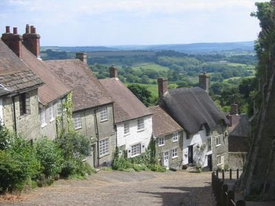
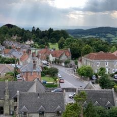
Shaftesbury is a market town on a greensand hill in Dorset, England, sitting 215 meters (705 feet) above sea level on a ridge with views over the Blackmore Vale. The settlement extends along several steep streets radiating from a central crossroads, where shops and public buildings cluster around a small market square.
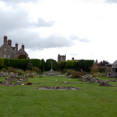
King Alfred founded a fortified settlement here in 880 to protect the kingdom from Viking raids. His daughter Æthelgifu established an abbey eight years later, which became one of the richest in England until Henry VIII dissolved it in 1539.
The Chivers family used the local spring waters in the 19th century to produce refreshments, making the clean well water part of the town's identity. Today, old pump houses and well housings recall the time when water from here was sold across much of England.
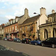
The central area is walkable, though several streets involve steep inclines that can become slippery in wet weather. Most shops and facilities sit within a compact zone along High Street and Bell Street, making orientation straightforward.
Every February, the surroundings turn into a white bloom when around 60,000 snowdrops flower along roadsides and in small gardens. Locals mark out paths during this period for visitors who want to experience the winter flowering on short walks.
Location: Dorset
Website: http://shaftesburytown.co.uk
GPS coordinates: 51.00660,-2.19800
Latest update: December 5, 2025 16:36
Shaftesbury Abbey
151 m
Westminster Memorial Hospital
262 m
Shaftesbury Town Hall
124 m
Church of St John the Evangelist
740 m
Church of St Peter
130 m
Church of St James
763 m
Former Church of the Holy Trinity
97 m
Shaftsbury Congregational Church
189 m
Castle Hill House (Maternity Annexe To Westminster Memorial Hospital)
214 m
The Ship Inn
62 m
Two Brewers Inn
355 m
The Mitre Inn
133 m
The Kings Arms Public House
62 m
Entrance To Oldmarket Playhouse And Arts Centre
52 m
Tout Hill House
261 m
Shaftesbury War Memorial
241 m
Mile Post To East Of Mead House
1 km
King Alfred's Kitchen
100 m
Lamp Standard And War Memorial
461 m
9, High Street
71 m
Mile Post Outside No 56
465 m
Boundary Wall Enclosing Grounds To Abbey House On South And West Sides With Gate Piers
233 m
Boundary Wall flanking Park Walk on north side in curtilage of the following properties:- Nos 17 & 19 High Street, Nos 6 & 8 Church Lane, Priory House, Church Lane, and the remains of Shaftesbury Abbey
169 m
The Old Parsonage
141 m
The Fountain Inn With Attached House (No 2 Breach Lane)
384 m
16, 18 And 18A, High Street
83 m
Premises Occupied By The Midland Bank The Butt Of Sherry Wine Bar
57 m
Park Wall
166 mVisited this place? Tap the stars to rate it and share your experience / photos with the community! Try now! You can cancel it anytime.
Discover hidden gems everywhere you go!
From secret cafés to breathtaking viewpoints, skip the crowded tourist spots and find places that match your style. Our app makes it easy with voice search, smart filtering, route optimization, and insider tips from travelers worldwide. Download now for the complete mobile experience.
A unique approach to discovering new places❞
— Le Figaro
All the places worth exploring❞
— France Info
A tailor-made excursion in just a few clicks❞
— 20 Minutes