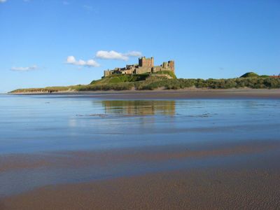
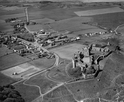
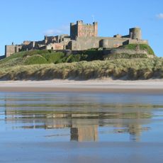
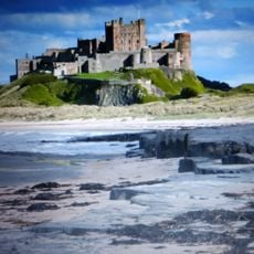
Bamburgh, Coastal village on the North Sea in Northumberland, England
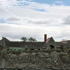
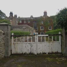
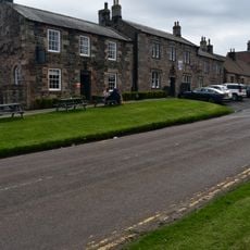
Bamburgh is a village on the North Sea coast in Northumberland county in northeast England. The settlement stretches along a long sandy beach, while above it on a dark basalt outcrop sits a large castle that shapes the entire village skyline.
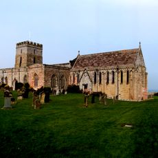
The settlement began as a Celtic-British fortress called Din Guarie around the year 420 and became the capital of the kingdom of Bernicia until about 547. King Aidan founded a church outside the castle walls in the 7th century, turning the village into a religious center.
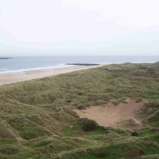
The name comes from Anglo-Saxon King Bebba, whose wooden fortress stood here in the 6th century and was later replaced with stone walls. Locals use the beach year-round for walks and watch seabirds along the dunes.
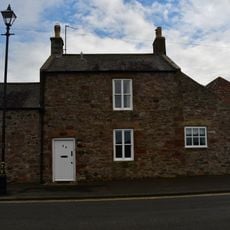
Several footpaths lead from the village to the beach and along the coast, though some sections become harder to walk during high tide. The village offers accommodation and restaurants within walking distance of the castle grounds.
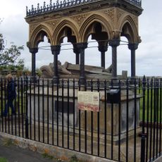
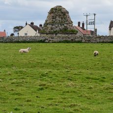
Archaeologists found remains of 110 people from the 7th and 8th centuries in the Bowl Hole graveyard below the castle between 1998 and 2007. This discovery shows how important the site was for early Christian burials in northern England.
Location: Northumberland
Inception: 1910
GPS coordinates: 55.60400,-1.72220
Latest update: December 13, 2025 15:31
Bamburgh Castle
923 m
St Aidan's Church, Bamburgh
520 m
Monument To Grace Darling Circa 30 Yards West Of Church Of St Aidan
477 m
Bamburgh Dunes
1.3 km
Bamburgh Lighthouse
1.4 km
Grace Darling Museum
429 m
Bamburgh Lighthouse
1.4 kmCanisbay Cottage
1.5 km
The Lord Crewe Arms
650 m
The Castle Hotel
486 m
Windmill At North End Of Bamburgh Castle
901 m
The Post Office
611 m
The Village Store
631 m12 13 And 14, Armstrong Cottages
1.5 kmBamburgh Siege Castle
706 m
9 And 10, Front Street
509 m
Farmbuildings Circa 50 Yards East Of Spindlestone Farmhouse
2.8 km
Farmbuildings Circa 50 Yards North East Of Bamburgh Hall
576 m
Armstrong House
679 m
Walled Garden At West End Of The Grove
421 m
Churchyard Wall And Gateway East And South Of Church Of St Aidan
498 mShoreston Cottage And Midcote With Linking Walls And Outhouse
3.4 km
Dovecote circa 50 yards south of Armstrong House
647 m
17-22, Front Street
574 m
Shoreston House
3.4 km
The Toby Jug Restaurant
665 m
7, Radcliffe Road
410 m
Wynding House
696 mVisited this place? Tap the stars to rate it and share your experience / photos with the community! Try now! You can cancel it anytime.
Discover hidden gems everywhere you go!
From secret cafés to breathtaking viewpoints, skip the crowded tourist spots and find places that match your style. Our app makes it easy with voice search, smart filtering, route optimization, and insider tips from travelers worldwide. Download now for the complete mobile experience.
A unique approach to discovering new places❞
— Le Figaro
All the places worth exploring❞
— France Info
A tailor-made excursion in just a few clicks❞
— 20 Minutes