Enable Location

We need your location to show you interesting places around you

Discover nearby places

Find interesting locations and hidden gems around you

Precise directions

Get accurate directions and distances to places

Your location is never shared with other users. It's only used when you tap the location button.

Hardin County

Log in to your account

Start exploring — it's free

Trusted by 62,834 travelers worldwide

Continue with Google
Continue with Apple
or

We will send you a code to connect

By continuing, you accept our Terms and Conditions and our Privacy Policy

Check your inbox

We've sent a pincode in your inbox. Please enter the code below.

Hardin County, County administrative division in Iowa, United States

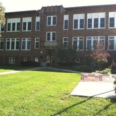
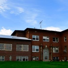
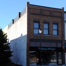
Hardin County is an administrative division in central Iowa with extensive agricultural land, several residential communities, and various public facilities. The area includes twelve incorporated towns and villages that vary in size and economic focus.

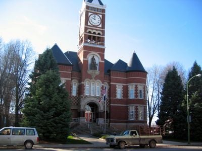
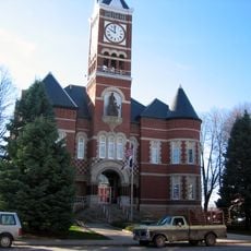
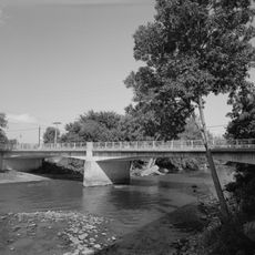
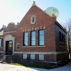
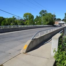
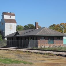
The county was established in 1851 and Eldora became its administrative seat to manage the growing population in the region. In the following decades, infrastructure and transportation routes developed to connect the farming communities.

The communities here maintain farming traditions and organize regular gatherings where neighbors connect and share their lives together. These local meetings shape how people relate to one another and give the rural landscape its social rhythm.

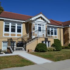
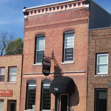
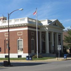
The main town of Eldora houses several administrative offices where visitors can get information, access public records, and handle permits. It is helpful to contact the relevant offices beforehand to clarify specific hours and requirements for your needs.

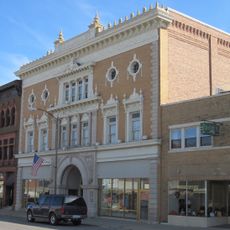
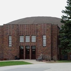
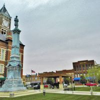
Iowa Falls is the largest city in the county and was historically an important transportation hub for the region. This city attracted industry and commerce early on, setting it apart from the smaller surrounding farming towns.

The community of curious travelers

AroundUs brings together thousands of curated places, local tips, and hidden gems, enriched daily by 60,000 contributors worldwide.

Start exploring
Location
Inception
1851
Capital city
Eldora
Shares border with
Franklin County, Story County, Marshall County, Butler County, Grundy County, Hamilton County, Wright County
GPS coordinates
42.37389,-93.24472
Latest update
December 8, 2025 13:43
Around this place
Metropolitan Opera House
United States of America

Metropolitan Opera House

15.9 km
Hardin County Courthouse
United States of America

Hardin County Courthouse

12.4 km
First Congregational Church
United States of America

First Congregational Church

12.2 km
Honey Creek Friends' Meetinghouse
United States of America

Honey Creek Friends' Meetinghouse

14.5 km
Washington Avenue Bridge
United States of America

Washington Avenue Bridge

16.4 km
Edgewood School of Domestic Arts
United States of America

Edgewood School of Domestic Arts

16.8 km
Mills Tower Historic District
United States of America

Mills Tower Historic District

16.6 km
Princess Sweet Shop
United States of America

Princess Sweet Shop

16.3 km
Folkert Mound Group
United States of America

Folkert Mound Group

16.2 km
Alden Public Library
United States of America

Alden Public Library

19 km
New Providence School Gymnasium
United States of America

New Providence School Gymnasium

11.5 km
Alden Bridge
United States of America

Alden Bridge

19.6 km
Former Eldora Public Library
United States of America

Former Eldora Public Library

12.1 km
Estes Park Band Shell
United States of America

Estes Park Band Shell

16.4 km
Slayton Farms-Round Barn
United States of America

Slayton Farms-Round Barn

16.1 km
Union Cemetery Gardener's Cottage
United States of America

Union Cemetery Gardener's Cottage

17.3 km
Civilian Conservation Corps-Prisoner of War Recreation Hall
United States of America

Civilian Conservation Corps-Prisoner of War Recreation Hall

13.1 km
Carnegie-Ellsworth Public Library
United States of America

Carnegie-Ellsworth Public Library

16.5 km
Glenn and Nell Kurtz Lustron Home and Garage
United States of America

Glenn and Nell Kurtz Lustron Home and Garage

16.5 km
First National Bank
United States of America

First National Bank

16.3 km
Steamboat Rock Consolidated Schools Building
United States of America

Steamboat Rock Consolidated Schools Building

15.2 km
Hardin County Home Historic District
United States of America

Hardin County Home Historic District

8.4 km
W.R.C. Hall
United States of America

W.R.C. Hall

16.3 km
River Street Bridge
United States of America

River Street Bridge

16.1 km
United States Post Office
United States of America

United States Post Office

16.4 km
Eldora Downtown Historic District
United States of America

Eldora Downtown Historic District

12.1 km
McClanahan Block
United States of America

McClanahan Block

16.3 km
Illinois Central Combination Depot-Ackley
United States of America

Illinois Central Combination Depot-Ackley

25.6 km
Show the full map
Administrative divisions
« Hardin County - County administrative division in Iowa, United States » is provided by Around Us (aroundus.com). Images and texts are derived from Wikimedia project under a Creative Commons license. You are allowed to copy, distribute, and modify copies of this page, under the conditions set by the license, as long as this note is clearly visible.

Discover hidden gems everywhere you go!

From secret cafés to breathtaking viewpoints, skip the crowded tourist spots and find places that match your style. Our app makes it easy with voice search, smart filtering, route optimization, and insider tips from travelers worldwide. Download now for the complete mobile experience.

Around Us App Screenshot

A unique approach to discovering new places

Le Figaro

All the places worth exploring

France Info

A tailor-made excursion in just a few clicks

20 Minutes

Around Us
Travel Guide & Maps
Download

Send to your phone

QR Code
1

Open the camera app on your mobile.

2

Point at the QR code with your camera. A notification will appear.

3

Tap the notification to open the link.