Enable Location

We need your location to show you interesting places around you

Discover nearby places

Find interesting locations and hidden gems around you

Precise directions

Get accurate directions and distances to places

Your location is never shared with other users. It's only used when you tap the location button.

Franklin County

Log in to your account

Start exploring — it's free

Trusted by 62,835 travelers worldwide

Continue with Google
Continue with Apple
or

We will send you a code to connect

By continuing, you accept our Terms and Conditions and our Privacy Policy

Check your inbox

We've sent a pincode in your inbox. Please enter the code below.

Franklin County, County in north-central Iowa, United States

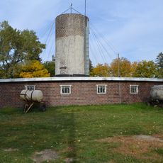
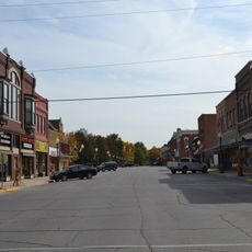
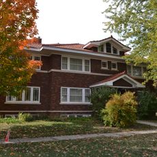
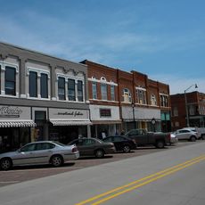
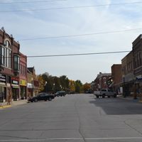
Franklin County is an administrative division in north-central Iowa with Hampton serving as the county seat. The area encompasses farmland, small towns, and rural communities connected by state and federal highways.

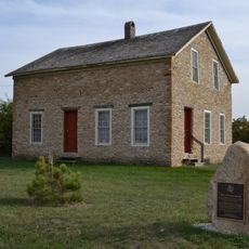
The county was established in 1851 and named after Benjamin Franklin during Iowa's early territorial period. It developed as an agricultural settlement as communities grew throughout the 19th century.

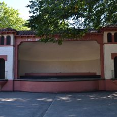
The annual Franklin County Fair in July draws crowds with rodeo events and performances by touring musicians at the fairgrounds. The gathering reflects how rural communities here celebrate their agricultural heritage and local traditions.

Interstate 35 and U.S. Highway 65 provide main access through the region, along with state highways connecting the smaller towns. Plan ahead when visiting, as services and attractions are spread across rural areas rather than concentrated in one location.

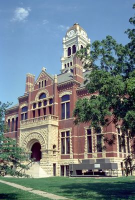
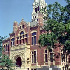
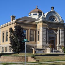
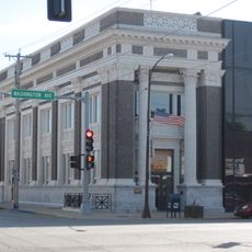
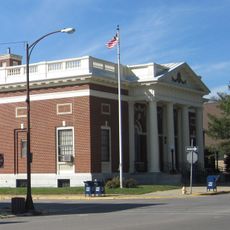
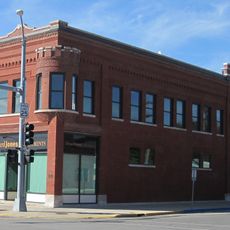
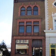
The Franklin County Courthouse in Hampton, built in 1891, has been listed on the National Register of Historic Places since 1976. The building stands out as an example of the architectural style from that era and remains a notable landmark in town.

The community of curious travelers

AroundUs brings together thousands of curated places, local tips, and hidden gems, enriched daily by 60,000 contributors worldwide.

Start exploring
Location
Inception
1851
Capital city
Hampton
Shares border with
Cerro Gordo County, Hardin County, Floyd County, Butler County, Grundy County, Hancock County, Wright County, Hamilton County
GPS coordinates
42.73083,-93.26750
Latest update
December 10, 2025 15:58
Around this place
Beeds Lake State Park
United States of America

Beeds Lake State Park

4.8 km
Franklin County Courthouse
United States of America

Franklin County Courthouse

4.9 km
Reeve Electric Association Plant
United States of America

Reeve Electric Association Plant

5.6 km
Franklin County Sheriff's Residence and Jail
United States of America

Franklin County Sheriff's Residence and Jail

5.1 km
Washington Avenue Bridge
United States of America

Washington Avenue Bridge

23.5 km
Edgewood School of Domestic Arts
United States of America

Edgewood School of Domestic Arts

23 km
Mills Tower Historic District
United States of America

Mills Tower Historic District

23.2 km
Princess Sweet Shop
United States of America

Princess Sweet Shop

23.5 km
Maysville Schoolhouse
United States of America

Maysville Schoolhouse

9.1 km
Herman Wood Round Barn
United States of America

Herman Wood Round Barn

19.3 km
Estes Park Band Shell
United States of America

Estes Park Band Shell

23.4 km
St. John's Lutheran Church
United States of America

St. John's Lutheran Church

6.1 km
Union Cemetery Gardener's Cottage
United States of America

Union Cemetery Gardener's Cottage

22.6 km
Dr. O.B. Harriman House
United States of America

Dr. O.B. Harriman House

4 km
Franklin County G. A. R. Soldiers' Memorial Hall
United States of America

Franklin County G. A. R. Soldiers' Memorial Hall

5.1 km
Quasdorf Blacksmith and Wagon Shop
United States of America

Quasdorf Blacksmith and Wagon Shop

20.7 km
Carnegie-Ellsworth Public Library
United States of America

Carnegie-Ellsworth Public Library

23.3 km
First National Bank
United States of America

First National Bank

23.5 km
W.R.C. Hall
United States of America

W.R.C. Hall

23.5 km
United States Post Office
United States of America

United States Post Office

23.4 km
Hampton Double Square Historic District
United States of America

Hampton Double Square Historic District

5 km
H.E. Boehmler House
United States of America

H.E. Boehmler House

5.2 km
Sentinel Block
United States of America

Sentinel Block

23.5 km
Fillmore Block
United States of America

Fillmore Block

20.7 km
Washington Avenue Commercial Historic District
United States of America

Washington Avenue Commercial Historic District

23.5 km
Ellsworth-Jones Building
United States of America

Ellsworth-Jones Building

23.5 km
Leander Reeve House
United States of America

Leander Reeve House

10.4 km
Beeds Lake State Park, Civilian Conservation Corps Area
United States of America

Beeds Lake State Park, Civilian Conservation Corps Area

4.6 km
Show the full map
Administrative divisions
« Franklin County - County in north-central Iowa, United States » is provided by Around Us (aroundus.com). Images and texts are derived from Wikimedia project under a Creative Commons license. You are allowed to copy, distribute, and modify copies of this page, under the conditions set by the license, as long as this note is clearly visible.

Discover hidden gems everywhere you go!

From secret cafés to breathtaking viewpoints, skip the crowded tourist spots and find places that match your style. Our app makes it easy with voice search, smart filtering, route optimization, and insider tips from travelers worldwide. Download now for the complete mobile experience.

Around Us App Screenshot

A unique approach to discovering new places

Le Figaro

All the places worth exploring

France Info

A tailor-made excursion in just a few clicks

20 Minutes

Around Us
Travel Guide & Maps
Download

Send to your phone

QR Code
1

Open the camera app on your mobile.

2

Point at the QR code with your camera. A notification will appear.

3

Tap the notification to open the link.