Enable Location

We need your location to show you interesting places around you

Discover nearby places

Find interesting locations and hidden gems around you

Precise directions

Get accurate directions and distances to places

Your location is never shared with other users. It's only used when you tap the location button.

Logan County

Log in to your account

Start exploring — it's free

Trusted by 62,504 travelers worldwide

Continue with Google
Continue with Apple
or

We will send you a code to connect

By continuing, you accept our Terms and Conditions and our Privacy Policy

Check your inbox

We've sent a pincode in your inbox. Please enter the code below.

Logan County, County administrative division in southwestern West Virginia, United States.

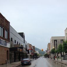
Logan County is an administrative division in southwestern West Virginia that stretches along the Guyandotte River. The county features mountainous terrain with numerous coal mining operations and small towns centered around the mining industry.

The county was established in 1824 from portions of neighboring territories and named after Chief Logan, a Mingo leader. This creation reflected the expanding European settlement moving deeper into Appalachia during that era.

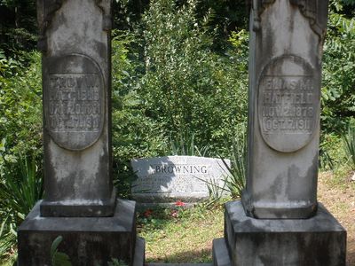
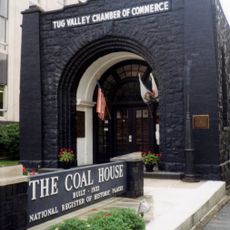
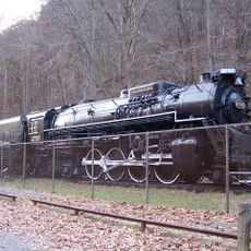
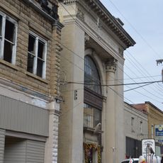
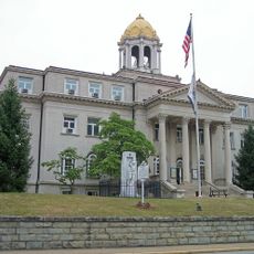
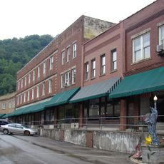
The region maintains strong ties to coal mining heritage, with mining communities scattered throughout the county. Logan city serves as the administrative center where the local community gathers and conducts its daily affairs.

The area is easily reached via U.S. Highway 52 and U.S. Highway 119, which connect to neighboring regions. Roads wind through the mountainous landscape, so drivers should expect curves and plan time accordingly.

In 1921, the region witnessed the Battle of Blair Mountain when approximately 10,000 coal miners confronted law enforcement in armed conflict. This event remains one of the largest labor uprisings the United States has ever experienced.

The community of curious travelers

AroundUs brings together thousands of curated places, local tips, and hidden gems, enriched daily by 60,000 contributors worldwide.

Start exploring
Location
Inception
January 12, 1824
Capital city
Logan
Shares border with
Lincoln County, Mingo County, Wyoming County, Boone County
GPS coordinates
37.83000,-81.94000
Latest update
December 20, 2025 01:50
Around this place
Coal House
United States of America

Coal House

34.5 km
Chief Logan State Park
United States of America

Chief Logan State Park

9.9 km
Chesapeake and Ohio 2755
United States of America

Chesapeake and Ohio 2755

9.3 km
United States of America

Elven C. Smith House

34.2 km
Madison National Bank
United States of America

Madison National Bank

28 km
Boone County Courthouse
United States of America

Boone County Courthouse

28.4 km
Whitesville School
United States of America

Whitesville School

39.3 km
Williamson Historic District
United States of America

Williamson Historic District

34.1 km
Matewan Depot Replica Welcome Center and Museum
United States of America

Matewan Depot Replica Welcome Center and Museum

30.6 km
Matewan Historic District
United States of America

Matewan Historic District

30.4 km
United States of America

Chafin House

4.4 km
United States of America

Horse Creek Public Fishing Area

34.9 km
United States of America

R D Bailey Lake Wildlife Management Area

33 km
United States of America

Amherst Theatre

14 km
United States of America

Blair Mountain

8.2 km
United States of America

Wyoming County Historical Museum

31 km
United States of America

Hatfield Cemetery

25.6 km
United States of America

Logan Country Club Golf Course

18.2 km
United States of America

Riverview Country Club

22.5 km
United States of America

Clear Fork Valley Golf Course

30.8 km
United States of America

Triadelphia Country Club Golf Course

16.1 km
United States of America

Tug Valley Country Club

31.1 km
United States of America

Twisted Gun Golf Club

26.2 km
United States of America

Hatfield McCoy Feud Site Tours

30.5 km
United States of America

AirBoat Rides and Tours

30.4 km

Delbarton Opry House

25.2 km

Amphitheater

32 km
United States of America

Chesapeake and Ohio Railway 2755

9.3 km
Show the full map
« Logan County - County administrative division in southwestern West Virginia, United States » is provided by Around Us (aroundus.com). Images and texts are derived from Wikimedia project under a Creative Commons license. You are allowed to copy, distribute, and modify copies of this page, under the conditions set by the license, as long as this note is clearly visible.

Discover hidden gems everywhere you go!

From secret cafés to breathtaking viewpoints, skip the crowded tourist spots and find places that match your style. Our app makes it easy with voice search, smart filtering, route optimization, and insider tips from travelers worldwide. Download now for the complete mobile experience.

Around Us App Screenshot

A unique approach to discovering new places

Le Figaro

All the places worth exploring

France Info

A tailor-made excursion in just a few clicks

20 Minutes

Around Us
Travel Guide & Maps
Download

Send to your phone

QR Code
1

Open the camera app on your mobile.

2

Point at the QR code with your camera. A notification will appear.

3

Tap the notification to open the link.