St. Marys River, Natural river boundary in Michigan, United States
St. Marys River connects Lake Superior to Lake Huron and flows through a landscape of rapids and large islands that divide its channels. The waterway forms the international boundary between Michigan and Ontario.
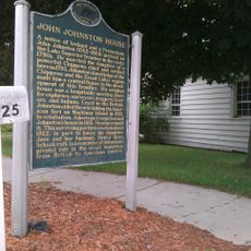
French explorer Étienne Brûlé first navigated the rapids in 1621, opening the route to European exploration of the region. This crossing established the waterway as a crucial passage for fur traders and later industrial development.
Indigenous peoples relied on these waters for sustenance and trade for centuries before European arrival. The rapids themselves held deep meaning in their relationship with the landscape.
The area is best accessed from shore or by boat, though strong currents require experienced operators for safe navigation. Visitors should stay aware of heavy shipping traffic and keep distance from large vessels moving through the channels.
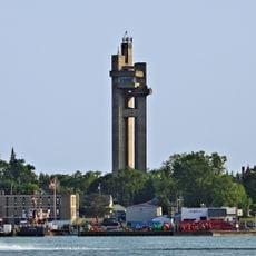
The Edison Sault Hydroelectric Station harnesses the natural power of the rapids to generate electricity and ranks among North America's longest hydroelectric facilities. This installation shows how the waterway serves dual purposes for both commerce and energy production.
The community of curious travelers
AroundUs brings together thousands of curated places, local tips, and hidden gems, enriched daily by 60,000 contributors worldwide.