Chest opened
+${chestReward.xp} XP
Explorer
NOUVEAU ×${chestReward.collectible.quantity}
tapez pour fermer

See the monuments around you in AR Open chests in the app

Around Us is built for your phone — point your camera at the streets and discover the monuments and places around you in augmented reality. Around Us is built for your phone — chests unlock when you walk, explore and capture nearby places.

•

Enable Location

We need your location to show you interesting places around you

Discover nearby places

Find interesting locations and hidden gems around you

Precise directions

Get accurate directions and distances to places

Your location is never shared with other users. It's only used when you tap the location button.

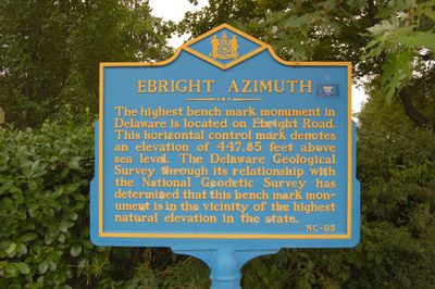
Ebright Azimuth

Log in to your account

Start exploring — it's free

Trusted by 89,878 travelers worldwide

Continue with Google
Continue with Apple
or

We will send you a code to connect

By continuing, you accept our Terms and Conditions and our Privacy Policy

Check your inbox

We've sent a pincode in your inbox. Please enter the code below.

Ebright Azimuth
Discussion Reviews 1 Photos
21.7k Popularity

Ebright Azimuth, Summit at Barkley, Delaware

Audio guide · About one minute
Preparing your audio guide… The audio guide could not be loaded, please retry.Sign in to listen to the audio guide

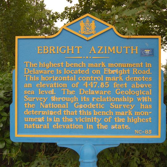
Ebright Azimuth is Delaware's highest point, located near the Pennsylvania state line at 448 feet above sea level. The site consists of a modest marker and survey benchmark at a quiet road intersection that marks this geographic boundary.

The site was named after James and Grant Ebright, former property owners who maintained the land where the benchmark was established. A radio transmission tower was built nearby in the 1940s as part of a long-distance communications network.

Local resident Doreen Kupchick maintains a register of visitors at her home and assists people in discovering the geographic significance of this location.

The location sits at the intersection of Ebright Road and Ramblewood Drive, roughly 6 miles north of Wilmington and is easy to reach by car. A nearby residence provides information for visitors interested in exploring this northernmost point in the state.

The site sits directly on the state boundary, with the actual boundary marker positioned right on the border line itself. Visitors can step from one state to another by crossing the marker.

The community of curious travelers

AroundUs brings together thousands of curated places, local tips, and hidden gems, enriched daily by 60,000 contributors worldwide.
Start exploring
Location
Elevation above the sea
137 m
GPS coordinates
39.83608,-75.51908
Latest update
September 16, 2026 19:29
Around this place
First State National Historical Park
United States of America

First State National Historical Park

2.5 mi
Brandywine Creek State Park
United States of America

Brandywine Creek State Park

3.2 mi
Kuerner Farm
United States of America

Kuerner Farm

3.8 mi
Covenant Fellowship Church
United States of America

Covenant Fellowship Church

3 mi
Concord Friends Meetinghouse
United States of America

Concord Friends Meetinghouse

3.4 mi
Newark Union Burial Ground
United States of America

Newark Union Burial Ground

3.4 mi
Twaddell's Mill and House
United States of America

Twaddell's Mill and House

3.8 mi
William Painter Farm
United States of America

William Painter Farm

3.4 mi
Booth Farm
United States of America

Booth Farm

2 mi
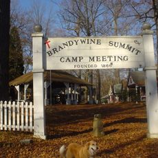
Brandywine Summit Camp Meeting
United States of America

Brandywine Summit Camp Meeting

1.8 mi
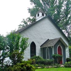
Mount Lebanon Methodist Episcopal Church
United States of America

Mount Lebanon Methodist Episcopal Church

3.7 mi
Nicholas Newlin House
United States of America

Nicholas Newlin House

3.5 mi
William Hicklen House
United States of America

William Hicklen House

2 mi
Abner Cloud House
United States of America

Abner Cloud House

2.5 mi
William Young House
United States of America

William Young House

3.8 mi
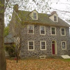
William Talley House
United States of America

William Talley House

1.9 mi
Twin Bridges Rural Historic District
United States of America

Twin Bridges Rural Historic District

3.7 mi
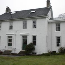
Joshua Pyle House and Wagon Barn
United States of America

Joshua Pyle House and Wagon Barn

1.1 mi
Handwrought
United States of America

Handwrought

3.1 mi
Ivyside Farm
United States of America

Ivyside Farm

2.4 mi
St. John's Church
United States of America

St. John's Church

3 mi
Ardens Historic District
United States of America

Ardens Historic District

2.4 mi
Concordville Historic District
United States of America

Concordville Historic District

3.4 mi
Newlin Grist Mill Park
United States of America

Newlin Grist Mill Park

3.5 mi
Smith's Bridge
United States of America

Smith's Bridge

3.2 mi
United States of America

Waterfall

3.8 mi
United States of America

Waterfall

3.8 mi
United States of America

Waterfall

3.8 mi
Show the full map
Reviews
Share your experience

No review yet

Discussions
Start a discussion...

No discussion yet

« Ebright Azimuth - Summit at Barkley, Delaware » is provided by Around Us (aroundus.com). Images and texts are derived from Wikimedia project under a Creative Commons license. You are allowed to copy, distribute, and modify copies of this page, under the conditions set by the license, as long as this note is clearly visible.

Discover hidden gems everywhere you go!

From secret cafés to breathtaking viewpoints, skip the crowded tourist spots and find places that match your style. Our app makes it easy with voice search, smart filtering, route optimization, and insider tips from travelers worldwide. Download now for the complete mobile experience.

Around Us App Screenshot
❝

A unique approach to discovering new places❞

— Le Figaro

❝

All the places worth exploring❞

— France Info

❝

A tailor-made excursion in just a few clicks❞

— 20 Minutes

Around Us
Travel Guide & Maps
Download

Send to your phone

QR Code
1

Open the camera app on your mobile.

2

Point at the QR code with your camera. A notification will appear.

3

Tap the notification to open the link.