Rattlesnake Mountain, Mountain summit in Farmington, Connecticut, US.
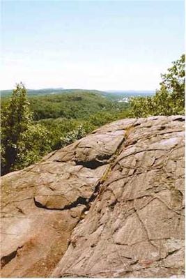
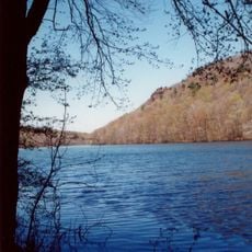
Rattlesnake Mountain is a summit in Farmington, Connecticut, that forms part of the Metacomet Ridge running along the western edge of the Connecticut River Valley. Its eastern face is marked by steep cliffs made of igneous rock, giving it a sharp profile when seen from the valley floor.
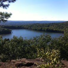
Before European settlers arrived in the Connecticut River Valley, Native American tribes used the high ground here to watch over the surrounding land and move through the region. The ridge later became a reference point for travelers as the valley was gradually settled and farmed.
The name comes from early settlers who noticed rattlesnakes in the area and used the animals to mark the land in their descriptions. That habit of naming hills after local wildlife was common across New England and many of those names have stayed on maps ever since.
The climb is steep in places, so good footwear and enough water make a real difference on the way up. It is worth leaving plenty of time for both the ascent and the return, since the trail can be tiring even for those used to hiking.
The rock underfoot is basalt formed during the Triassic period, around 200 million years ago, when this part of North America was being pulled apart by tectonic forces. The same geological event that cracked the land here eventually helped open the Atlantic Ocean.
The community of curious travelers
AroundUs brings together thousands of curated places, local tips, and hidden gems, enriched daily by 60,000 contributors worldwide.