Chest opened
+${chestReward.xp} XP
Explorer
NOUVEAU ×${chestReward.collectible.quantity}
tapez pour fermer
Chest locked

Open chests in the app

Around Us is built for your phone — chests unlock when you walk, explore and capture nearby places.

Enable Location

We need your location to show you interesting places around you

Discover nearby places

Find interesting locations and hidden gems around you

Precise directions

Get accurate directions and distances to places

Your location is never shared with other users. It's only used when you tap the location button.

Northborough

Log in to your account

Start exploring — it's free

Trusted by 72,878 travelers worldwide

Continue with Google
Continue with Apple
or

We will send you a code to connect

By continuing, you accept our Terms and Conditions and our Privacy Policy

Check your inbox

We've sent a pincode in your inbox. Please enter the code below.

Discussion Reviews 3 Photos
21.9k Popularity

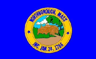
Northborough, Administrative town in Worcester County, Massachusetts

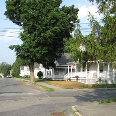
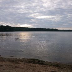
Northborough is a town in Worcester County, Massachusetts, with residential neighborhoods, commercial districts, and natural spaces. The community sits near tributaries of the Assabet River, creating varied terrain throughout the area.

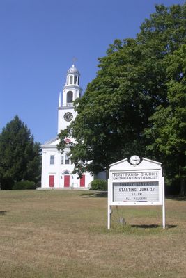
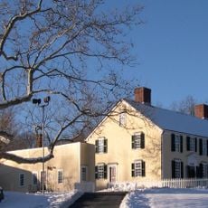
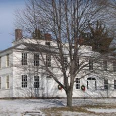
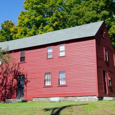
The settlement began in 1656 as part of the Sudbury Plantation and became a town in 1775. This change happened during the American independence period when communities were reorganizing as formal towns.

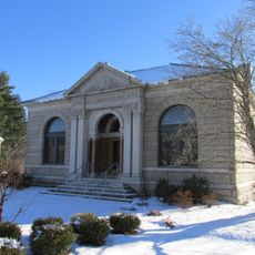
The Northborough Free Library, established in 1868, functions as a central educational resource, receiving dedicated funding from the town's annual budget.

Access to local facilities is available through road networks throughout the area, with bus stops providing connections to neighboring communities. Visitors should be aware of winter weather, as harsh seasons can affect road conditions and travel times.

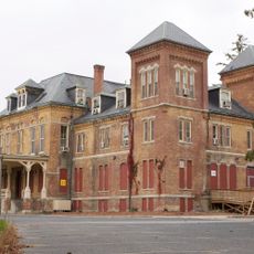
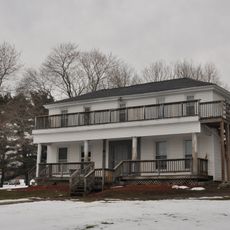
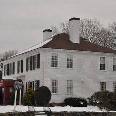
The former Town Hall has a notably large French Mansard roof section. This architectural feature is considered one of the most expansive ever documented in the United States.

The community of curious travelers

AroundUs brings together thousands of curated places, local tips, and hidden gems, enriched daily by 60,000 contributors worldwide.

Start exploring
Location
Inception
1672
Elevation above the sea
91 m
Shares border with
Westborough, Southborough
GPS coordinates
42.32058,-71.63799
Latest update
December 23, 2025 21:12
Around this place
Westborough State Hospital
United States of America

Westborough State Hospital

3.1 km
New England Sports Center
United States of America

New England Sports Center

5.9 km
Lyman School for Boys
United States of America

Lyman School for Boys

3.8 km
General Artemas Ward House
United States of America

General Artemas Ward House

5.6 km
Maplewood Cemetery
United States of America

Maplewood Cemetery

7.2 km
Nathan Fisher House
United States of America

Nathan Fisher House

4.2 km
Bullard House
United States of America

Bullard House

6.8 km
Maples Cottage
United States of America

Maples Cottage

4 km
Capt. Peter Rice House
United States of America

Capt. Peter Rice House

6 km
Berlin Town Hall
United States of America

Berlin Town Hall

6.8 km
Brigham Cemetery
United States of America

Brigham Cemetery

6.8 km
Northborough Free Library
United States of America

Northborough Free Library

251 m
Vintonville Historic District
United States of America

Vintonville Historic District

6.5 km
Pleasant Street Historic District
United States of America

Pleasant Street Historic District

6.9 km
West Main Street Historic District
United States of America

West Main Street Historic District

7.1 km
United States of America

Old Vienna Kaffeehaus

6.1 km
Joseph Lothrop House
United States of America

Joseph Lothrop House

4.2 km
United States of America

Bartlett Pond

1.6 km
United States of America

Westborough Stadium 12

3.8 km
United States of America

Cedar Hill

3.6 km
United States of America

Williams Lake

6.1 km
Lake Chauncy Public Beach
United States of America

Lake Chauncy Public Beach

4.1 km
United States of America

West Main Street Historic District

6.4 km
United States of America

Indian Meadows Golf Course

3.7 km
United States of America

Westborough Country Club

6.1 km
United States of America

Juniper Hill Golf Course

1.6 km
United States of America

Scenic viewpoint

3.6 km
United States of America

North View

5 km
Show the full map
Reviews
Share your experience

No review yet

Discussions
Start a discussion...

No discussion yet

« Northborough - Administrative town in Worcester County, Massachusetts » is provided by Around Us (aroundus.com). Images and texts are derived from Wikimedia project under a Creative Commons license. You are allowed to copy, distribute, and modify copies of this page, under the conditions set by the license, as long as this note is clearly visible.

Discover hidden gems everywhere you go!

From secret cafés to breathtaking viewpoints, skip the crowded tourist spots and find places that match your style. Our app makes it easy with voice search, smart filtering, route optimization, and insider tips from travelers worldwide. Download now for the complete mobile experience.

Around Us App Screenshot

A unique approach to discovering new places

Le Figaro

All the places worth exploring

France Info

A tailor-made excursion in just a few clicks

20 Minutes

Around Us
Travel Guide & Maps
Download

Send to your phone

QR Code
1

Open the camera app on your mobile.

2

Point at the QR code with your camera. A notification will appear.

3

Tap the notification to open the link.