Enable Location

We need your location to show you interesting places around you

Discover nearby places

Find interesting locations and hidden gems around you

Precise directions

Get accurate directions and distances to places

Your location is never shared with other users. It's only used when you tap the location button.

Bank Street Historic District

Log in to your account

Start exploring — it's free

Trusted by 61,456 travelers worldwide

Continue with Google
Continue with Apple
or

We will send you a code to connect

By continuing, you accept our Terms and Conditions and our Privacy Policy

Check your inbox

We've sent a pincode in your inbox. Please enter the code below.

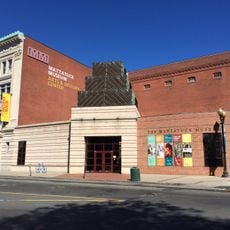
Bank Street Historic District, Historic district in Waterbury, United States.

Description

Bank Street Historic District consists of four attached brick commercial buildings positioned on the east side of Bank Street between Grand Street and Interstate 84. The structures retain their original mixed-use layout with retail spaces on the ground floor and office and residential areas on upper levels.

History

The buildings were constructed in the late 1800s during Waterbury's industrial growth, reflecting the city's commercial expansion of that period. They were recognized by the National Register of Historic Places in 1983 for their architectural importance.

Culture

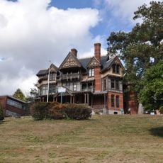
The buildings display Georgian Revival, Queen Anne, and Richardsonian Romanesque architectural styles with decorative stonework and cast iron details. These visual features show the craftsmanship and design preferences of merchants who built here during the city's economic peak.

Practical

The district is located directly along Bank Street and is easily accessible on foot, with proximity to Interstate 84 indicating a central position in the city. Visitors should note that some buildings house active businesses and restaurants, so certain areas may have limited public access.

Did you know?

One of the buildings, named after a local newspaper, has housed the same family restaurant since the 1920s. This long-running business connection gives the location a living link to the community that stretches back generations.

Location
GPS coordinates
41.55278,-73.04111
Latest update
December 14, 2025 14:41

AroundUs brings together thousands of curated places, local tips, and hidden gems, enriched daily by 60,000 contributors worldwide. Discover all places nearby (Connecticut).

Around this place
Holy Land USA
United States of America

Holy Land USA

1.1 km
Mattatuck Museum
United States of America

Mattatuck Museum

519 m
Waterbury Municipal Center Complex
United States of America

Waterbury Municipal Center Complex

241 m
Hancock Brook Trail
United States of America

Hancock Brook Trail

5.7 km
Whittemore Glen State Park
United States of America

Whittemore Glen State Park

5 km
Benedict-Miller House
United States of America

Benedict-Miller House

991 m
Beth El Synagogue
United States of America

Beth El Synagogue

1.6 km
Bronson B. Tuttle House
United States of America

Bronson B. Tuttle House

6.5 km
Statue of Christopher Columbus
United States of America

Statue of Christopher Columbus

291 m
Waterbury Brass Company
United States of America

Waterbury Brass Company

2.4 km
John Kendrick House
United States of America

John Kendrick House

377 m
Josiah Bronson House
United States of America

Josiah Bronson House

7 km
George S. Abbott Building
United States of America

George S. Abbott Building

675 m
Southwest District School
United States of America

Southwest District School

5.5 km
Sheffield Street Bridge
United States of America

Sheffield Street Bridge

5 km
Enoch Hibbard House and George Granniss House
United States of America

Enoch Hibbard House and George Granniss House

399 m
Overlook Historic District
United States of America

Overlook Historic District

1.8 km
United States Post Office–Naugatuck Main
United States of America

United States Post Office–Naugatuck Main

6.9 km
David Hotchkiss House
United States of America

David Hotchkiss House

6.5 km
Naugatuck Center Historic District
United States of America

Naugatuck Center Historic District

7 km
Middlebury Center Historic District
United States of America

Middlebury Center Historic District

7.5 km
Washington Avenue Bridge
United States of America

Washington Avenue Bridge

990 m
Matthews and Willard Factory
United States of America

Matthews and Willard Factory

601 m
Wolcott Green Historic District
United States of America

Wolcott Green Historic District

7.7 km
Nathaniel Richardson House
United States of America

Nathaniel Richardson House

4.5 km
American Italian Civic Club Park
United States of America

American Italian Civic Club Park

4.3 km
Palace Theater
United States of America

Palace Theater

333 m
Moai Easter Island Statue
United States of America

Moai Easter Island Statue

566 m
Show the full map
« Bank Street Historic District - Historic district in Waterbury, United States » is provided by Around Us (aroundus.com). Images and texts are derived from Wikimedia project under a Creative Commons license. You are allowed to copy, distribute, and modify copies of this page, under the conditions set by the license, as long as this note is clearly visible.

Discover hidden gems everywhere you go!

From secret cafés to breathtaking viewpoints, skip the crowded tourist spots and find places that match your style. Our app makes it easy with voice search, smart filtering, route optimization, and insider tips from travelers worldwide. Download now for the complete mobile experience.

Around Us App Screenshot

A unique approach to discovering new places

Le Figaro

All the places worth exploring

France Info

A tailor-made excursion in just a few clicks

20 Minutes

Around Us
Travel Guide & Maps
Download

Send to your phone

QR Code
1

Open the camera app on your mobile.

2

Point at the QR code with your camera. A notification will appear.

3

Tap the notification to open the link.