Enable Location

We need your location to show you interesting places around you

Discover nearby places

Find interesting locations and hidden gems around you

Precise directions

Get accurate directions and distances to places

Your location is never shared with other users. It's only used when you tap the location button.

Brightwood

Log in to your account

Start exploring — it's free

Trusted by 63,604 travelers worldwide

Continue with Google
Continue with Apple
or

We will send you a code to connect

By continuing, you accept our Terms and Conditions and our Privacy Policy

Check your inbox

We've sent a pincode in your inbox. Please enter the code below.

Brightwood
Discussion Reviews 1 Photos
8.5k Popularity

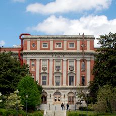
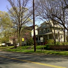
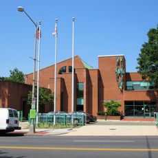
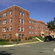
Brightwood, Residential neighborhood in Northwest Washington DC, United States

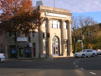
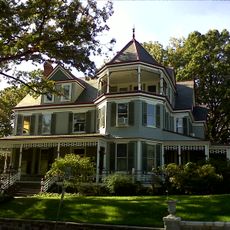
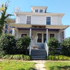
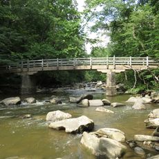
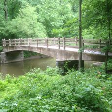
Brightwood is a residential neighborhood in northwest Washington D.C. with a mix of single-family homes and apartment buildings lining tree-covered streets. Green spaces and proximity to Rock Creek Park define its character and layout.

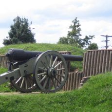
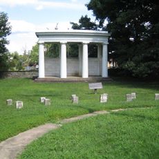
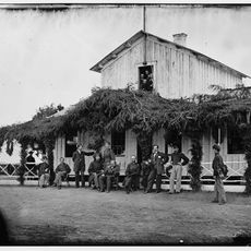
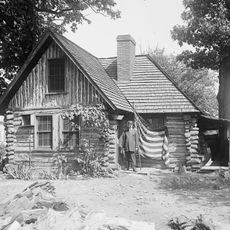
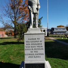
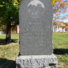
The area took its current name in the 1840s after being called Crystal Springs, and became strategically important during the Civil War with the construction of Fort Stevens. This site marked a critical moment in the conflict's final years.

Walk along Georgia Avenue and you will find Ethiopian and Salvadoran grocery stores, restaurants, and shops that reflect the neighborhood's strong immigrant communities today.

Multiple bus routes connect the neighborhood to downtown Washington D.C. and nearby recreational areas in Rock Creek Park. The strong public transportation network and nearby green spaces make it easy to navigate and explore the area.

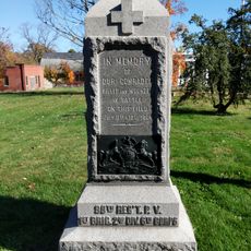
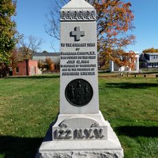
Fort Stevens, located here, is where President Abraham Lincoln came under direct fire in 1864 when Confederate forces attacked near the capital. This unexpected encounter brought the battle surprisingly close to the heart of government.

The community of curious travelers

AroundUs brings together thousands of curated places, local tips, and hidden gems, enriched daily by 60,000 contributors worldwide.

Start exploring
Location
GPS coordinates
38.96519,-77.02721
Latest update
December 10, 2025 16:01
Around this place
Hughes Memorial Tower
United States of America

Hughes Memorial Tower

237 m
Fort Stevens
United States of America

Fort Stevens

168 m
Brightwood Park
United States of America

Brightwood Park

1.2 km
Battleground National Cemetery
United States of America

Battleground National Cemetery

598 m
Fort Slocum
United States of America

Fort Slocum

1.3 km
Joaquin Miller Cabin
United States of America

Joaquin Miller Cabin

1.7 km
Cady-Lee
United States of America

Cady-Lee

1.6 km
Building 40
United States of America

Building 40

1.2 km
Takoma Park Historic District
United States of America

Takoma Park Historic District

1.9 km
Juanita E. Thornton/Shepherd Park Neighborhood Library
United States of America

Juanita E. Thornton/Shepherd Park Neighborhood Library

1.6 km
Fort View Apartments
United States of America

Fort View Apartments

373 m
Takoma Park Neighborhood Library
United States of America

Takoma Park Neighborhood Library

1.2 km
Ross Drive Bridge
United States of America

Ross Drive Bridge

2.1 km
98th Pennsylvania Volunteer Monument
United States of America

98th Pennsylvania Volunteer Monument

629 m
122nd New York Volunteer Monument
United States of America

122nd New York Volunteer Monument

634 m
25th New York Volunteer Cavalry Monument
United States of America

25th New York Volunteer Cavalry Monument

624 m
150th Ohio National Guard Monument
United States of America

150th Ohio National Guard Monument

638 m
Rhizome
United States of America

Rhizome

1.4 km
Takoma Park Seventh Day Adventist Church
United States of America

Takoma Park Seventh Day Adventist Church

1.6 km
Penguin Fountain
United States of America

Penguin Fountain

1.1 km
Takoma Theatre
United States of America

Takoma Theatre

1.2 km
Takoma Business Center
United States of America

Takoma Business Center

1.6 km
The Hampshire
United States of America

The Hampshire

1.9 km
Rapids Footbridge
United States of America

Rapids Footbridge

1.9 km
Thomas-Siegler Carriage House
United States of America

Thomas-Siegler Carriage House

1.7 km
Takoma Community Garden
United States of America

Takoma Community Garden

1.1 km
Riley Spring Bridge
United States of America

Riley Spring Bridge

2 km
Joyce Road Bridge
United States of America

Joyce Road Bridge

1.4 km
Show the full map
Reviews
Share your experience

No review yet

Discussions
Start a discussion...

No discussion yet

« Brightwood - Residential neighborhood in Northwest Washington DC, United States » is provided by Around Us (aroundus.com). Images and texts are derived from Wikimedia project under a Creative Commons license. You are allowed to copy, distribute, and modify copies of this page, under the conditions set by the license, as long as this note is clearly visible.

Discover hidden gems everywhere you go!

From secret cafés to breathtaking viewpoints, skip the crowded tourist spots and find places that match your style. Our app makes it easy with voice search, smart filtering, route optimization, and insider tips from travelers worldwide. Download now for the complete mobile experience.

Around Us App Screenshot

A unique approach to discovering new places

Le Figaro

All the places worth exploring

France Info

A tailor-made excursion in just a few clicks

20 Minutes

Around Us
Travel Guide & Maps
Download

Send to your phone

QR Code
1

Open the camera app on your mobile.

2

Point at the QR code with your camera. A notification will appear.

3

Tap the notification to open the link.