Enable Location

We need your location to show you interesting places around you

Discover nearby places

Find interesting locations and hidden gems around you

Precise directions

Get accurate directions and distances to places

Your location is never shared with other users. It's only used when you tap the location button.

Bunker Hill Historic District

Log in to your account

Start exploring — it's free

Trusted by 63,118 travelers worldwide

Continue with Google
Continue with Apple
or

We will send you a code to connect

By continuing, you accept our Terms and Conditions and our Privacy Policy

Check your inbox

We've sent a pincode in your inbox. Please enter the code below.

Discussion Reviews 1 Photos
1.5k Popularity

Bunker Hill Historic District, Historic district in Berkeley County, West Virginia, United States.

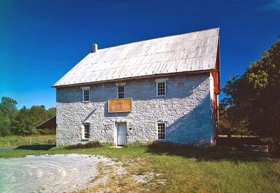
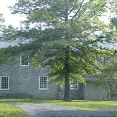
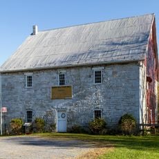
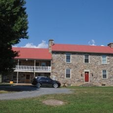
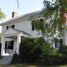
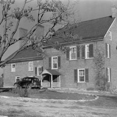
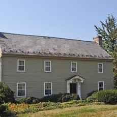
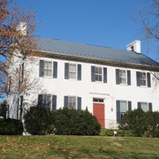
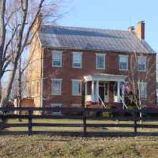
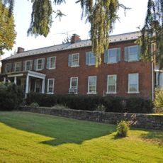
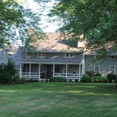
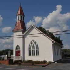
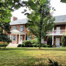
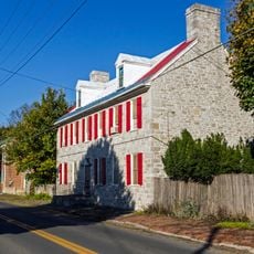
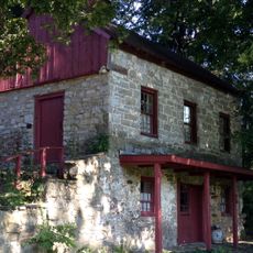
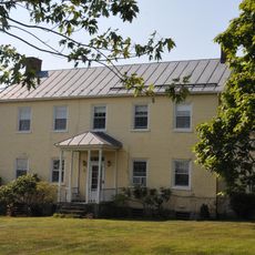
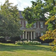
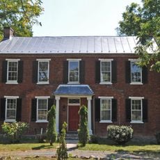
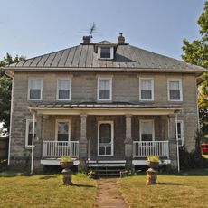
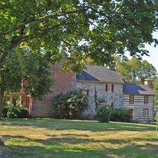
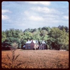
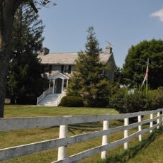
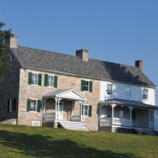
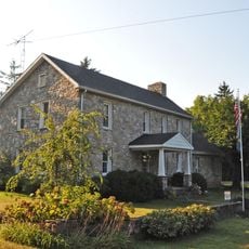
Bunker Hill Historic District is a settlement area in West Virginia with numerous preserved structures built in Greek Revival style from the 1800s. The area contains residences, commercial buildings, mills, and churches positioned on a slope at roughly 170 meters elevation.

In the early 1800s, General Elisha Boyd established an industrial center with mills, brick production, and a trading post on his property. The settlement grew as a commercial hub for the surrounding area and has maintained its essential structure since that time.

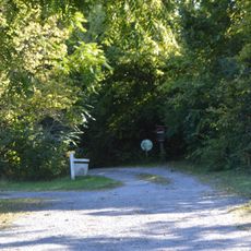
The district reflects the early industrial development of the region through its preserved buildings and street patterns that visitors can still observe today. Walking through the area, one sees how commerce and daily life were organized around mills, shops, and gathering places that residents used for generations.

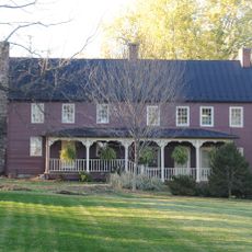
The district consists of several buildings spread across the area, requiring time to explore on foot and see the various structures. Starting with a general overview and then focusing on individual buildings helps visitors notice architectural details and get a fuller sense of the layout.

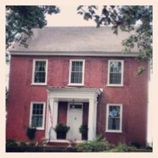
The area was once divided into distinct social zones, with a separate residential section for African American residents who settled there after the Civil War. This aspect of its social past remains visible in how the area is organized today.

The community of curious travelers

AroundUs brings together thousands of curated places, local tips, and hidden gems, enriched daily by 60,000 contributors worldwide.

Start exploring
Location
Architectural style
Greek Revival architecture
Elevation above the sea
171 m
GPS coordinates
39.33220,-78.05360
Latest update
December 14, 2025 14:45
Around this place
Morgan Morgan Monument
United States of America

Morgan Morgan Monument

346 m
Hopewell Friends Meeting House
United States of America

Hopewell Friends Meeting House

10 km
Mill Creek Historic District
United States of America

Mill Creek Historic District

1.7 km
Mary Park Wilson House
United States of America

Mary Park Wilson House

6.4 km
Morgan-Gold House
United States of America

Morgan-Gold House

2.1 km
William Wilson House
United States of America

William Wilson House

6.6 km
Gilbert and Samuel McKown House
United States of America

Gilbert and Samuel McKown House

5 km
Cleridge
United States of America

Cleridge

12 km
Glendale Farm
United States of America

Glendale Farm

11.9 km
William G. Morgan House
United States of America

William G. Morgan House

3.8 km
John Drinker House
United States of America

John Drinker House

2.8 km
Thomas Brown House
United States of America

Thomas Brown House

6.9 km
Tabler's Station Historic District
United States of America

Tabler's Station Historic District

8.3 km
Ar-Qua Springs
United States of America

Ar-Qua Springs

8.5 km
Middleway Historic District
United States of America

Middleway Historic District

6.9 km
Hays-Gerrard House
United States of America

Hays-Gerrard House

5.6 km
James Nathanial Burwell House
United States of America

James Nathanial Burwell House

4.7 km
Campbellton
United States of America

Campbellton

8.3 km
Washington Gold House
United States of America

Washington Gold House

5.4 km
George Schlack House
United States of America

George Schlack House

4.1 km
Redbud Hollow
United States of America

Redbud Hollow

7.2 km
Crumley-Lynn-Lodge House
United States of America

Crumley-Lynn-Lodge House

8.2 km
Henry J. Seibert II House
United States of America

Henry J. Seibert II House

12.1 km
John, David, and Jacob Rees House
United States of America

John, David, and Jacob Rees House

4.4 km
Elias Pitzer House
United States of America

Elias Pitzer House

10.7 km
Morris Rees III House
United States of America

Morris Rees III House

3.9 km
Thunder Hill Farm
United States of America

Thunder Hill Farm

5.7 km
Lee-Throckmorton-McDonald House
United States of America

Lee-Throckmorton-McDonald House

6.3 km
Show the full map
Reviews
Share your experience

No review yet

Discussions
Start a discussion...

No discussion yet

« Bunker Hill Historic District - Historic district in Berkeley County, West Virginia, United States » is provided by Around Us (aroundus.com). Images and texts are derived from Wikimedia project under a Creative Commons license. You are allowed to copy, distribute, and modify copies of this page, under the conditions set by the license, as long as this note is clearly visible.

Discover hidden gems everywhere you go!

From secret cafés to breathtaking viewpoints, skip the crowded tourist spots and find places that match your style. Our app makes it easy with voice search, smart filtering, route optimization, and insider tips from travelers worldwide. Download now for the complete mobile experience.

Around Us App Screenshot

A unique approach to discovering new places

Le Figaro

All the places worth exploring

France Info

A tailor-made excursion in just a few clicks

20 Minutes

Around Us
Travel Guide & Maps
Download

Send to your phone

QR Code
1

Open the camera app on your mobile.

2

Point at the QR code with your camera. A notification will appear.

3

Tap the notification to open the link.