Enable Location

We need your location to show you interesting places around you

Discover nearby places

Find interesting locations and hidden gems around you

Precise directions

Get accurate directions and distances to places

Your location is never shared with other users. It's only used when you tap the location button.

Cabotville Common Historic District

Log in to your account

Start exploring — it's free

Trusted by 62,520 travelers worldwide

Continue with Google
Continue with Apple
or

We will send you a code to connect

By continuing, you accept our Terms and Conditions and our Privacy Policy

Check your inbox

We've sent a pincode in your inbox. Please enter the code below.

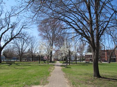
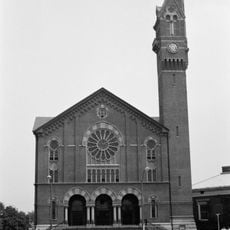
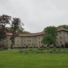
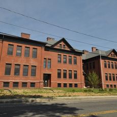
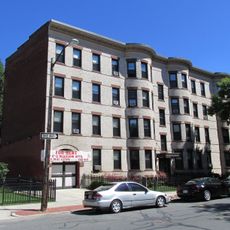
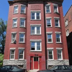
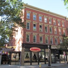
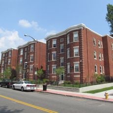
Cabotville Common Historic District, Historic district in Chicopee, Massachusetts, United States

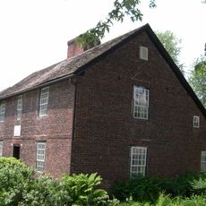
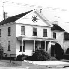
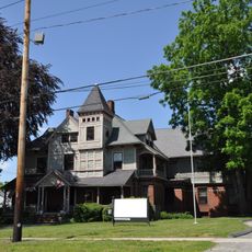
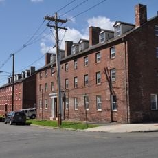
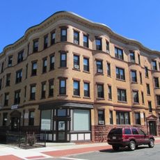
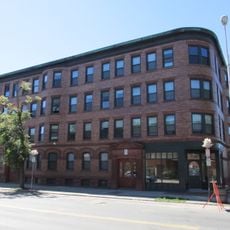
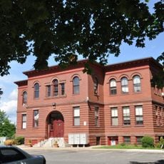
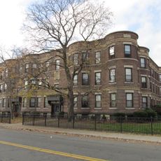
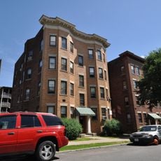
Cabotville Common Historic District is a residential area in Chicopee featuring homes built mainly between 1846 and 1870 that surround a central park. The buildings show construction styles from the 1800s and were originally built for middle-level mill workers and their families.

The district grew in the mid-1800s as part of the textile mill expansion in the region. Workers and their families moved here to be close to their jobs, while factory owners lived in separate, more exclusive areas.

The buildings show different architectural styles that reflect what the residents valued and could afford. Walking through, you notice how construction methods and decoration details changed from house to house as families updated their homes over time.

The district sits within a residential neighborhood and can be explored on foot, allowing you to see the outside of homes and the central park. The best time to visit is during daylight when you can clearly see the architectural details and design elements of the buildings.

The central park was originally shared grazing land where residents kept animals, before it became a public park in the late 1800s. This transformation shows how urban spaces changed to meet the evolving needs of the community.

The community of curious travelers

AroundUs brings together thousands of curated places, local tips, and hidden gems, enriched daily by 60,000 contributors worldwide.

Start exploring
Location
GPS coordinates
42.14500,-72.61167
Latest update
December 14, 2025 18:04
Around this place
Josiah Day House
United States of America

Josiah Day House

4.3 km
Basilica of St. Stanislaus
United States of America

Basilica of St. Stanislaus

1.4 km
Edward Bellamy House
United States of America

Edward Bellamy House

2.6 km
City Hall
United States of America

City Hall

463 m
Chicopee Public Library
United States of America

Chicopee Public Library

1.1 km
Polish National Home
United States of America

Polish National Home

163 m
Springfield Street Historic District
United States of America

Springfield Street Historic District

654 m
Our Mother of Sorrows Monastery and Retreat Center
United States of America

Our Mother of Sorrows Monastery and Retreat Center

3.4 km
Thomas D. Page House
United States of America

Thomas D. Page House

3.1 km
Dwight Manufacturing Company Housing District
United States of America

Dwight Manufacturing Company Housing District

191 m
Calhoun Apartments
United States of America

Calhoun Apartments

3.3 km
Hooker Apartments
United States of America

Hooker Apartments

3.2 km
Chapin National Bank Building
United States of America

Chapin National Bank Building

4.7 km
Valentine School
United States of America

Valentine School

701 m
Laurel Hall
United States of America

Laurel Hall

4 km
Carreau Block
United States of America

Carreau Block

4.4 km
Hiberian Block
United States of America

Hiberian Block

4.7 km
Produce Exchange Building
United States of America

Produce Exchange Building

4.5 km
Willy's Overland Block
United States of America

Willy's Overland Block

4.7 km
Downtown Springfield Railroad District
United States of America

Downtown Springfield Railroad District

4.4 km
Chapin School
United States of America

Chapin School

4.4 km
Verona Apartments
United States of America

Verona Apartments

3.5 km
Ethel Apartment House
United States of America

Ethel Apartment House

4 km
Wells Block
United States of America

Wells Block

4.7 km
Upper Worthington Historic District
United States of America

Upper Worthington Historic District

4.4 km
Belle and Franklin Streets Historic District
United States of America

Belle and Franklin Streets Historic District

4 km
Memorial Square District
United States of America

Memorial Square District

3.9 km
Paramount Theater
United States of America

Paramount Theater

4.7 km
Show the full map
« Cabotville Common Historic District - Historic district in Chicopee, Massachusetts, United States » is provided by Around Us (aroundus.com). Images and texts are derived from Wikimedia project under a Creative Commons license. You are allowed to copy, distribute, and modify copies of this page, under the conditions set by the license, as long as this note is clearly visible.

Discover hidden gems everywhere you go!

From secret cafés to breathtaking viewpoints, skip the crowded tourist spots and find places that match your style. Our app makes it easy with voice search, smart filtering, route optimization, and insider tips from travelers worldwide. Download now for the complete mobile experience.

Around Us App Screenshot

A unique approach to discovering new places

Le Figaro

All the places worth exploring

France Info

A tailor-made excursion in just a few clicks

20 Minutes

Around Us
Travel Guide & Maps
Download

Send to your phone

QR Code
1

Open the camera app on your mobile.

2

Point at the QR code with your camera. A notification will appear.

3

Tap the notification to open the link.