Chest opened
+${chestReward.xp} XP
Explorer
NOUVEAU ×${chestReward.collectible.quantity}
tapez pour fermer
Chest locked

Open chests in the app

Around Us is built for your phone — chests unlock when you walk, explore and capture nearby places.

Enable Location

We need your location to show you interesting places around you

Discover nearby places

Find interesting locations and hidden gems around you

Precise directions

Get accurate directions and distances to places

Your location is never shared with other users. It's only used when you tap the location button.

Log in to your account

Start exploring — it's free

Trusted by 73,051 travelers worldwide

Continue with Google
Continue with Apple
or

We will send you a code to connect

By continuing, you accept our Terms and Conditions and our Privacy Policy

Check your inbox

We've sent a pincode in your inbox. Please enter the code below.

Cleveland Air Route Traffic Control Center
Discussion Reviews Photo
6.7k Popularity

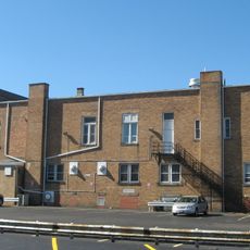
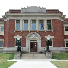
Cleveland Air Route Traffic Control Center, Air traffic control facility in Oberlin, Ohio, United States.

The Cleveland Air Route Traffic Control Center is an air traffic control facility in Oberlin that oversees airspace across seven states and southern Ontario. The complex uses radar and computer systems to manage flights heading to and from major airports including Chicago, Detroit, and New York.

The facility was founded in 1936 at Cleveland Municipal Airport before moving to Oberlin in 1961 as air traffic grew. A new building opened in 1969 to house the expanded operations needed for managing increased flight volumes across the region.

The center serves as a training hub where air traffic controllers learn and refine their skills through hands-on simulation work. This mission shapes the daily work of professionals who keep air travel safe across a major region.

The facility is located on a dedicated campus outside the city and can only be visited with prior permission. Tours require security clearance and advance booking since this is a federal government installation.

The facility played a role in one of the most significant moments in American aviation history when controllers here monitored radio communications during a critical incident. The events of that day demonstrated the quick thinking and professionalism of staff working under extreme pressure.

The community of curious travelers

AroundUs brings together thousands of curated places, local tips, and hidden gems, enriched daily by 60,000 contributors worldwide.

Start exploring
Location
GPS coordinates
41.29730,-82.20640
Latest update
December 10, 2025 15:50
Around this place
Weltzheimer/Johnson House
United States of America

Weltzheimer/Johnson House

2.8 km
Allen Memorial Art Museum
United States of America

Allen Memorial Art Museum

958 m
Apollo Theatre
United States of America

Apollo Theatre

1.1 km
Charles Berry Bridge
United States of America

Charles Berry Bridge

19.4 km
Lorain Palace Theatre
United States of America

Lorain Palace Theatre

18.9 km
Mosher House
United States of America

Mosher House

16 km
Wilson Bruce Evans House
United States of America

Wilson Bruce Evans House

1.3 km
Tappan Square
United States of America

Tappan Square

1.1 km
Vermilion Light
United States of America

Vermilion Light

19.5 km
Lorain West Breakwater Light
United States of America

Lorain West Breakwater Light

20.1 km
John Mercer Langston House
United States of America

John Mercer Langston House

752 m
Eagles Building
United States of America

Eagles Building

18.9 km
Tank House
United States of America

Tank House

943 m
Congregational Church of Christ
United States of America

Congregational Church of Christ

1 km
Evangelical and Reformed Church
United States of America

Evangelical and Reformed Church

19.1 km
Old St. Patrick's Church
United States of America

Old St. Patrick's Church

13.7 km
Franks Site
United States of America

Franks Site

16.4 km
Masonic Temple Building
United States of America

Masonic Temple Building

19.2 km
Old St. John's Church
United States of America

Old St. John's Church

11.2 km
Dean Road Bridge
United States of America

Dean Road Bridge

12.9 km
Amherst Town Hall
United States of America

Amherst Town Hall

11.4 km
Reamer Barn
United States of America

Reamer Barn

3.3 km
First Baptist Church
United States of America

First Baptist Church

19.1 km
Carlos Avery House
United States of America

Carlos Avery House

9.9 km
Elyria Elks Club
United States of America

Elyria Elks Club

11.3 km
Lorain Historical Society - Carnegie Center
United States of America

Lorain Historical Society - Carnegie Center

18.4 km
Captain Alva Bradley House
United States of America

Captain Alva Bradley House

19.4 km
Burrell Homestead
United States of America

Burrell Homestead

19.5 km
Show the full map
Reviews
Share your experience

No review yet

Discussions
Start a discussion...

No discussion yet

« Cleveland Air Route Traffic Control Center - Air traffic control facility in Oberlin, Ohio, United States » is provided by Around Us (aroundus.com). Images and texts are derived from Wikimedia project under a Creative Commons license. You are allowed to copy, distribute, and modify copies of this page, under the conditions set by the license, as long as this note is clearly visible.

Discover hidden gems everywhere you go!

From secret cafés to breathtaking viewpoints, skip the crowded tourist spots and find places that match your style. Our app makes it easy with voice search, smart filtering, route optimization, and insider tips from travelers worldwide. Download now for the complete mobile experience.

Around Us App Screenshot

A unique approach to discovering new places

Le Figaro

All the places worth exploring

France Info

A tailor-made excursion in just a few clicks

20 Minutes

Around Us
Travel Guide & Maps
Download

Send to your phone

QR Code
1

Open the camera app on your mobile.

2

Point at the QR code with your camera. A notification will appear.

3

Tap the notification to open the link.