Enable Location

We need your location to show you interesting places around you

Discover nearby places

Find interesting locations and hidden gems around you

Precise directions

Get accurate directions and distances to places

Your location is never shared with other users. It's only used when you tap the location button.

Aldeia do Mato

Log in to your account

Start exploring — it's free

Trusted by 62,051 travelers worldwide

Continue with Google
Continue with Apple
or

We will send you a code to connect

By continuing, you accept our Terms and Conditions and our Privacy Policy

Check your inbox

We've sent a pincode in your inbox. Please enter the code below.

Aldeia do Mato

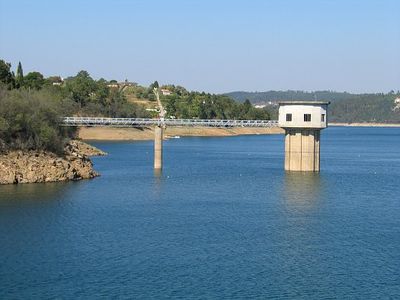
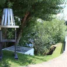
Aldeia do Mato, River beach near Castelo do Bode Dam, Santarém, Portugal.

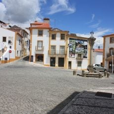
Aldeia do Mato sits along the Castelo do Bode Reservoir and merges village buildings with water and pine forests. The settlement spreads beside the lakeshore with open water access and green spaces woven throughout the residential areas.

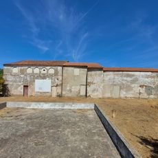
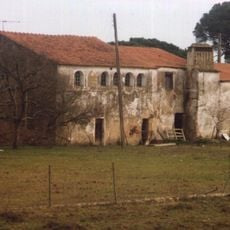
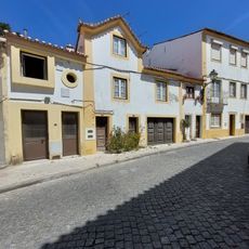
The settlement took shape in the 13th century as a forest community where residents lived from olive and pine cultivation. The dam construction in 1951 reshaped the landscape and created the water body that exists today.

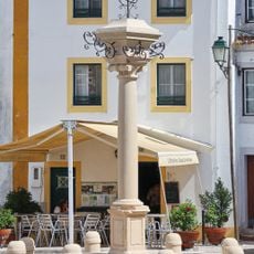
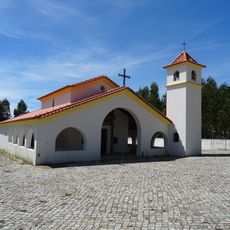
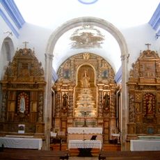
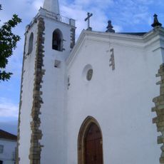
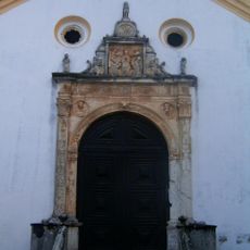
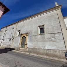
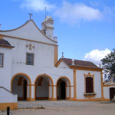
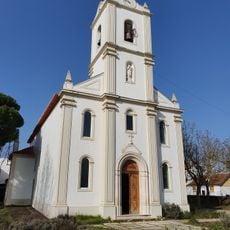
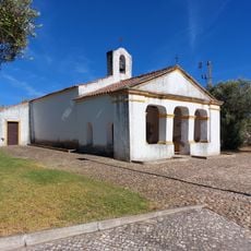
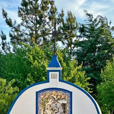
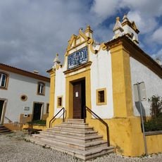
The Church of Santa Maria Madalena sits at the village center and shapes how locals use the main spaces around it. The building gives the community a focal point where people naturally gather and pause.

The location is open year-round with lighter water and beach activity in warmer months. The best time for water-based pursuits is May through October when equipment and instruction are most readily available.

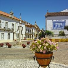
The village occupies land where olive groves once grew before being submerged beneath the reservoir waters. This hidden chapter means visitors can sense the layered story beneath the surface when looking across the lake.

The community of curious travelers

AroundUs brings together thousands of curated places, local tips, and hidden gems, enriched daily by 60,000 contributors worldwide.

Start exploring
Location
GPS coordinates
39.53807,-8.26555
Latest update
December 14, 2025 12:27
Around this place
Parque de Astronomia
Portugal

Parque de Astronomia

6.9 km
Pelourinho de Constância
Portugal

Pelourinho de Constância

9.5 km
Convento de Santo António
Portugal

Convento de Santo António

8.9 km
Santuário de Nossa Senhora do Tojo
Portugal

Santuário de Nossa Senhora do Tojo

4.9 km
Igreja do Mosteiro de Nossa Senhora da Caridade, incluindo o seu recheio
Portugal

Igreja do Mosteiro de Nossa Senhora da Caridade, incluindo o seu recheio

9 km
Igreja Matriz do Sardoal
Portugal

Igreja Matriz do Sardoal

9.1 km
Homenagem ao Actor Taborda
Portugal

Homenagem ao Actor Taborda

10 km
Church of Carvalhal
Portugal

Church of Carvalhal

6.6 km
Igreja da Santa Casa da Misericórdia do Sardoal
Portugal

Igreja da Santa Casa da Misericórdia do Sardoal

9 km
Pórtico da Igreja do Convento da Esperança (teatro velho) e o pátio (antigo claustro) das três cisternas que lhe fica na rectaguarda
Portugal

Pórtico da Igreja do Convento da Esperança (teatro velho) e o pátio (antigo claustro) das três cisternas que lhe fica na rectaguarda

9.9 km
Convento de Nossa Senhora da Caridade
Portugal

Convento de Nossa Senhora da Caridade

9 km
Igreja Paroquial de Alferrarede
Portugal

Igreja Paroquial de Alferrarede

9.2 km
Dois nichos padrões da primeira passagem de Nuno Álvares, em São João de Abrançalha
Portugal

Dois nichos padrões da primeira passagem de Nuno Álvares, em São João de Abrançalha

8.6 km
Aqueduto do Convento de Santo António
Portugal

Aqueduto do Convento de Santo António

9 km
Anta 1 do Vale da Laje
Portugal

Anta 1 do Vale da Laje

3.7 km
Quartel da Arte Contemporânea de Abrantes
Portugal

Quartel da Arte Contemporânea de Abrantes

9.9 km
Ruínas do Convento de Santo António, na Quinta da Arca, e o aqueduto
Portugal

Ruínas do Convento de Santo António, na Quinta da Arca, e o aqueduto

8.9 km
Ermida de São Lourenço
Portugal

Ermida de São Lourenço

8.3 km
Fonte de São José
Portugal

Fonte de São José

9.5 km
Núcleo Histórico de Constância
Portugal

Núcleo Histórico de Constância

9.5 km
Ruínas do Antigo Palácio da Torre
Portugal

Ruínas do Antigo Palácio da Torre

9.5 km
Casa na Rua Actor Taborda, 54 e 56
Portugal

Casa na Rua Actor Taborda, 54 e 56

10 km
Ermida de Santa Ana
Portugal

Ermida de Santa Ana

10 km
Câmara Municipal de Sardoal
Portugal

Câmara Municipal de Sardoal

9 km
Casa dos Arcos ou Casa de Camões
Portugal

Casa dos Arcos ou Casa de Camões

9.4 km
Pelourinho do Sardoal
Portugal

Pelourinho do Sardoal

9 km
Escola Industrial e Comercial de Abrantes
Portugal

Escola Industrial e Comercial de Abrantes

9.8 km
Jardim do Alto de Santo António
Portugal

Jardim do Alto de Santo António

9.9 km
Show the full map
« Aldeia do Mato - River beach near Castelo do Bode Dam, Santarém, Portugal » is provided by Around Us (aroundus.com). Images and texts are derived from Wikimedia project under a Creative Commons license. You are allowed to copy, distribute, and modify copies of this page, under the conditions set by the license, as long as this note is clearly visible.

Discover hidden gems everywhere you go!

From secret cafés to breathtaking viewpoints, skip the crowded tourist spots and find places that match your style. Our app makes it easy with voice search, smart filtering, route optimization, and insider tips from travelers worldwide. Download now for the complete mobile experience.

Around Us App Screenshot

A unique approach to discovering new places

Le Figaro

All the places worth exploring

France Info

A tailor-made excursion in just a few clicks

20 Minutes

Around Us
Travel Guide & Maps
Download

Send to your phone

QR Code
1

Open the camera app on your mobile.

2

Point at the QR code with your camera. A notification will appear.

3

Tap the notification to open the link.