Chest opened
+${chestReward.xp} XP
Explorer
NOUVEAU ×${chestReward.collectible.quantity}
tapez pour fermer

See the monuments around you in AR Open chests in the app

Around Us is built for your phone — point your camera at the streets and discover the monuments and places around you in augmented reality. Around Us is built for your phone — chests unlock when you walk, explore and capture nearby places.

•

Enable Location

We need your location to show you interesting places around you

Discover nearby places

Find interesting locations and hidden gems around you

Precise directions

Get accurate directions and distances to places

Your location is never shared with other users. It's only used when you tap the location button.

Mga

Log in to your account

Start exploring — it's free

Trusted by 91,667 travelers worldwide

Continue with Google
Continue with Apple
or

We will send you a code to connect

By continuing, you accept our Terms and Conditions and our Privacy Policy

Check your inbox

We've sent a pincode in your inbox. Please enter the code below.

Mga, Urban settlement in Kirovsky District, Russia

Mga is an urban-type settlement in the Kirovsky District situated along the Mga River where railway lines intersect. The place blends railway infrastructure with the natural setting of the river valley in Leningrad Oblast.

The settlement began in 1901 as a railway station community that developed into an important transportation hub for the region. During World War II, the place fell under German control, which disrupted the vital rail connections serving Leningrad.

The settlement takes its name from the Mga River that flows through the area, reflecting deep linguistic roots in the Finno-Ugric language traditions of the region. The place functions today as an ordinary working community where daily life centers on railway operations and local connection.

The settlement is most easily reached by the railway connections that cross the region, offering good train service for access. The climate here is continental, so plan your visit during the warmer months when conditions are most comfortable for exploring.

The forests surrounding the settlement regularly yield military artifacts and equipment from World War II when archaeologists and locals explore the area. These discoveries offer a tangible connection to the warfare that shaped the region's past.

The community of curious travelers

AroundUs brings together thousands of curated places, local tips, and hidden gems, enriched daily by 91,667 contributors worldwide.

Start exploring
Inception
1901
GPS coordinates
59.75750,31.05778
Latest update
October 9, 2026 15:48
Around this place
Nevsky Pyatachok & Nevskaya Dubrovka
Russian Federation

Nevsky Pyatachok & Nevskaya Dubrovka

6.9 mi
Hill of Glory monument
Russian Federation

Hill of Glory monument

10.6 mi
Russian Federation

Ивановские пороги

10.5 mi
Kuzminsky railway bridge
Russian Federation

Kuzminsky railway bridge

7.9 mi
Ivanovsky Patch
Russian Federation

Ivanovsky Patch

10.5 mi
Ghost Village monument
Russian Federation

Ghost Village monument

6.6 mi
Nevsky porog
Russian Federation

Nevsky porog

10.7 mi
Церковь иконы Божией Матери «Взыскание погибших» (Дубровка)
Russian Federation

Церковь иконы Божией Матери «Взыскание погибших» (Дубровка)

7.6 mi
Saint John the Almoner Church
Russian Federation

Saint John the Almoner Church

9.6 mi
«Синявинские высоты». Место ожесточенных боев советских войск с немецко-фашистскими оккупантами в 1941-1944 гг. «Зеленый пояс Славы Ленинграда» (Кировск)
Russian Federation

«Синявинские высоты». Место ожесточенных боев советских войск с немецко-фашистскими оккупантами в 1941-1944 гг. «Зеленый пояс Славы Ленинграда» (Кировск)

6.6 mi
Восточный флигель (Отрадное)
Russian Federation

Восточный флигель (Отрадное)

9.4 mi
Роща «Круглая» — место ожесточенных боев советских войск с немецко-фашистскими захватчиками в 1941-1944 гг. (Кировск)
Russian Federation

Роща «Круглая» — место ожесточенных боев советских войск с немецко-фашистскими захватчиками в 1941-1944 гг. (Кировск)

7.7 mi
Здание, где в 1927-1930 гг. учился в школе летчик М.И. Рысев, повторивший подвиг Н. Гастелло в январе 1945 г. в боях за Будапешт в январе 1945 г. (Никольское)
Russian Federation

Здание, где в 1927-1930 гг. учился в школе летчик М.И. Рысев, повторивший подвиг Н. Гастелло в январе 1945 г. в боях за Будапешт в январе 1945 г. (Никольское)

10.2 mi
Западный флигель (Отрадное)
Russian Federation

Западный флигель (Отрадное)

9.4 mi
War memorial near stadium, Kirovsk
Russian Federation

War memorial near stadium, Kirovsk

8.6 mi
ДОТ (Дубровка)
Russian Federation

ДОТ (Дубровка)

7.2 mi
Nevsky Pyatachok Memorial
Russian Federation

Nevsky Pyatachok Memorial

7 mi
Monument to Sergei Kirov in Kirovsk, Leningrad Oblast
Russian Federation

Monument to Sergei Kirov in Kirovsk, Leningrad Oblast

8.6 mi
Братская могила советских воинов, погибших в борьбе с фашистами; в числе захороненных — Герой Советского Союза Д.С. Молодцов (1908-1943) (Кировск)
Russian Federation

Братская могила советских воинов, погибших в борьбе с фашистами; в числе захороненных — Герой Советского Союза Д.С. Молодцов (1908-1943) (Кировск)

9.8 mi
Church of the Dormition of the Theotokos (Lezye-Sologubovka)
Russian Federation

Church of the Dormition of the Theotokos (Lezye-Sologubovka)

4.6 mi
Frontier Stone Monument
Russian Federation

Frontier Stone Monument

7 mi
Рубеж обороны советских войск (Дубровка)
Russian Federation

Рубеж обороны советских войск (Дубровка)

7.2 mi
Dubrovka memorial cemetery
Russian Federation

Dubrovka memorial cemetery

8.8 mi
Mga Memorial Cemetery
Russian Federation

Mga Memorial Cemetery

0.4 mi
Место соединения войск Ленинградского и Волховского фронтов, осуществивших прорыв блокады города Ленинграда 18 января 1943 г. «Зеленый пояс Славы Ленинграда»
Russian Federation

Место соединения войск Ленинградского и Волховского фронтов, осуществивших прорыв блокады города Ленинграда 18 января 1943 г. «Зеленый пояс Славы Ленинграда»

9.9 mi
Cultural heritage monuments in Otradnoe
Russian Federation

Cultural heritage monuments in Otradnoe

10.3 mi
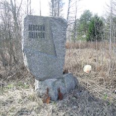
Монумент (Памятник «Невский порог») (Отрадное)
Russian Federation

Монумент (Памятник «Невский порог») (Отрадное)

10.7 mi
War cemetery, Kirovsk
Russian Federation

War cemetery, Kirovsk

8.7 mi
Show the full map
Reviews
Share your experience

No review yet

Discussions
Start a discussion...

No discussion yet

« Mga - Urban settlement in Kirovsky District, Russia » is provided by Around Us (aroundus.com). Images and texts are derived from Wikimedia project under a Creative Commons license. You are allowed to copy, distribute, and modify copies of this page, under the conditions set by the license, as long as this note is clearly visible.

Discover hidden gems everywhere you go!

From secret cafés to breathtaking viewpoints, skip the crowded tourist spots and find places that match your style. Our app makes it easy with voice search, smart filtering, route optimization, and insider tips from travelers worldwide. Download now for the complete mobile experience.

Around Us App Screenshot
❝

A unique approach to discovering new places❞

— Le Figaro

❝

All the places worth exploring❞

— France Info

❝

A tailor-made excursion in just a few clicks❞

— 20 Minutes

Around Us
Travel Guide & Maps
Download

Send to your phone

QR Code
1

Open the camera app on your mobile.

2

Point at the QR code with your camera. A notification will appear.

3

Tap the notification to open the link.
