Ruskeala

Log in to your account

AroundUs is a community-driven map of interesting places, built by curious explorers like you. It grows with every review, story, and photo you share.
Connect to save your favorite spots, contribute locations, and create personalized routes.
Continue with Google
Continue with Apple
Continue with X
Continue with Facebook
Continue with email
By continuing, you accept our Terms and Conditions and our Privacy Policy
Create an account
Add to collection
Map
Suggest a change
Share

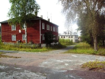
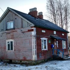
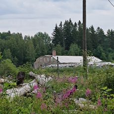
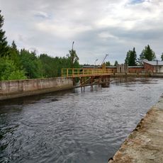
Ruskeala, Rural settlement in Sortavalsky District, Russia.

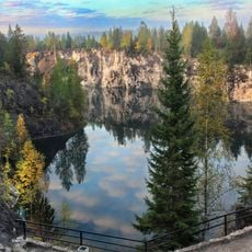
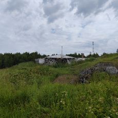
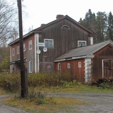
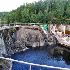
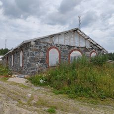
Ruskeala is a rural settlement in Karelia in northwestern Russia, located within the Kaalamskoye rural settlement. The place is known for its former marble quarries, which are now flooded and form an unusual landscape feature.

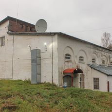
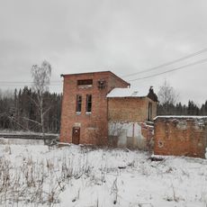
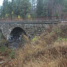
The region was part of Finland's Viipuri Province until the end of World War II. After 1945, it became part of Sortavalsky District in Russia and ceased to be an active quarrying center.

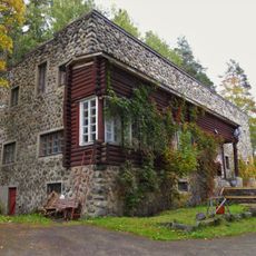
The marble quarries supplied stone for major buildings in St Petersburg, such as St Isaac's Cathedral and the Marble Palace. This heritage shaped how people in the region understood their connection to the city.

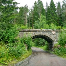
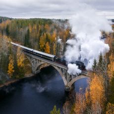
The settlement is accessible via the international Blue Highway, a route connecting Norway, Sweden, Finland, and Russia in the region. Reaching the place works best by car given the remote location and sparse settlement pattern.

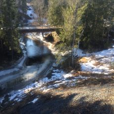
The former marble quarries are now filled with clear water and form one of the largest artificial water bodies in Karelia. The steep marble walls and depth of the flooded quarry create a surprising natural spectacle in this region.

Location: Kaalamskoye rural settlement

GPS coordinates: 61.93083,30.59194

Latest update: December 8, 2025 13:41

Photos
Around this place
Ruskeala Mountain Park
Russian Federation

Ruskeala Mountain Park

1.7 km
Ruskeala waterfalls
Russian Federation

Ruskeala waterfalls

2.4 km
Памятное место, где в июле 1941 г. размещался полевой штаб 168-й стрелковой дивизии (Рюттю)
Russian Federation

Памятное место, где в июле 1941 г. размещался полевой штаб 168-й стрелковой дивизии (Рюттю)

14.6 km
Хозяйственная постройка (Рюттю)
Russian Federation

Хозяйственная постройка (Рюттю)

12.4 km
Памятник советским воинам-освободителям (пушка), установленный в честь 25-летия освобождения Карелии от немецко-фашистских захватчиков (Хелюля)
Russian Federation

Памятник советским воинам-освободителям (пушка), установленный в честь 25-летия освобождения Карелии от немецко-фашистских захватчиков (Хелюля)

22.5 km
Hämekoski railway bridge
Russian Federation

Hämekoski railway bridge

19.8 km
Здание машинного зала с нижней плотиной (Хямекоски)
Russian Federation

Здание машинного зала с нижней плотиной (Хямекоски)

20.4 km
Harlu railway station building
Russian Federation

Harlu railway station building

21.9 km
Hämekoski hydroelectric power plant
Russian Federation

Hämekoski hydroelectric power plant

20.4 km
Братская могила советских воинов, погибших в боях с фашистскими захватчиками (Хелюля)
Russian Federation

Братская могила советских воинов, погибших в боях с фашистскими захватчиками (Хелюля)

20.8 km
Yanisyarvi railway station bridge
Russian Federation

Yanisyarvi railway station bridge

19.5 km
Glavnoye shosse, 20
Russian Federation

Glavnoye shosse, 20

22.7 km
Конюшня усадьбы Сомероя (Рюттю)
Russian Federation

Конюшня усадьбы Сомероя (Рюттю)

12.4 km
Деривационный канал (Хямекоски)
Russian Federation

Деривационный канал (Хямекоски)

20.4 km
Jaskelajnen Dacha
Russian Federation

Jaskelajnen Dacha

19.4 km
Sahankoski hydroelectric power plant
Russian Federation

Sahankoski hydroelectric power plant

4.4 km
Road bridge across Löytöoja
Russian Federation

Road bridge across Löytöoja

22.4 km
Комплекс построек скотного двора усадьбы Сомероя (Рюттю)
Russian Federation

Комплекс построек скотного двора усадьбы Сомероя (Рюттю)

12.4 km
Дом жилой пристанционный и отдельно стоящая хозяйственная постройка Саракапильканена (Кааламо)
Russian Federation

Дом жилой пристанционный и отдельно стоящая хозяйственная постройка Саракапильканена (Кааламо)

6.1 km
Railway bridge across Jänisjoki
Russian Federation

Railway bridge across Jänisjoki

20.7 km
Склад-пакгауз пристанционный (Кааламо)
Russian Federation

Склад-пакгауз пристанционный (Кааламо)

6.1 km
Hämekoski Dam
Russian Federation

Hämekoski Dam

20.5 km
Railway bridge across Löytöoja‎
Russian Federation

Railway bridge across Löytöoja‎

22.5 km
Коровник усадьбы Сомероя (Рюттю)
Russian Federation

Коровник усадьбы Сомероя (Рюттю)

12.5 km
Братская могила советских воинов, погибших в боях с фашистскими захватчиками (Рускеала)
Russian Federation

Братская могила советских воинов, погибших в боях с фашистскими захватчиками (Рускеала)

433 m
WWII memorial in Harlu
Russian Federation

WWII memorial in Harlu

22.6 km
Harlu new school
Russian Federation

Harlu new school

22.6 km
Karelian Zoo
Russian Federation

Karelian Zoo

12.3 km
Show the full map
Reviews

Visited this place? Tap the stars to rate it and share your experience / photos with the community! Try now! You can cancel it anytime.

« Ruskeala - Rural settlement in Sortavalsky District, Russia » is provided by Around Us (aroundus.com). Images and texts are derived from Wikimedia project under a Creative Commons license. You are allowed to copy, distribute, and modify copies of this page, under the conditions set by the license, as long as this note is clearly visible.

Discover hidden gems everywhere you go!

From secret cafés to breathtaking viewpoints, skip the crowded tourist spots and find places that match your style. Our app makes it easy with voice search, smart filtering, route optimization, and insider tips from travelers worldwide. Download now for the complete mobile experience.

Around Us App Screenshot

A unique approach to discovering new places

Le Figaro

All the places worth exploring

France Info

A tailor-made excursion in just a few clicks

20 Minutes