Enable Location

We need your location to show you interesting places around you

Discover nearby places

Find interesting locations and hidden gems around you

Precise directions

Get accurate directions and distances to places

Your location is never shared with other users. It's only used when you tap the location button.

Byrum's raukar

Log in to your account

Start exploring — it's free

Trusted by 64,919 travelers worldwide

Continue with Google
Continue with Apple
or

We will send you a code to connect

By continuing, you accept our Terms and Conditions and our Privacy Policy

Check your inbox

We've sent a pincode in your inbox. Please enter the code below.

Byrum's raukar
Discussion Reviews 1 Photos
3.1k Popularity

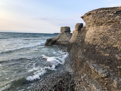
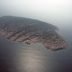
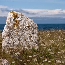
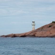
Byrum's raukar, Nature reserve on western shore of Öland, Sweden.

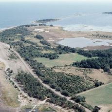
Byrum's raukar is a nature reserve on the western coast of Öland, a Swedish Baltic island, made up of a series of freestanding limestone columns along a stretch of shoreline. The columns stand directly on the beach, some rising from shallow water and others from the rocky shore, all shaped by centuries of wind and wave erosion.

Around 490 million years ago, this part of what is now Sweden lay beneath a shallow tropical sea where coral reefs grew during the Ordovician period. When the sea withdrew, the reef material was left behind and slowly carved by erosion into the columns visible on the shore today.

The word "raukar" comes from the local dialect and refers specifically to these tall, weathered limestone columns found along the Baltic coast. Visitors often notice how each column has a different shape, some wide and flat at the top, others thin and pointed, giving the beach a look unlike any other shoreline.

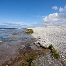
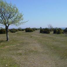
The reserve sits close to the village of Byrum and is easy to reach by car, with parking areas near the site. Arriving earlier in the day gives visitors more time to walk along the shore and see the columns without crowds.

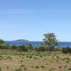
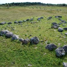
This type of limestone column is found only on the Swedish Baltic islands, and the Byrum shoreline is one of the densest concentrations on Öland. What many visitors do not realize is that some columns normally sit below the waterline and only become visible when the water level drops, hinting that the formation extends further into the sea.

The community of curious travelers

AroundUs brings together thousands of curated places, local tips, and hidden gems, enriched daily by 60,000 contributors worldwide.

Start exploring
Inception
June 11, 1935
GPS coordinates
57.22583,16.95528
Latest update
March 3, 2026 13:56
Reviews
Share your experience

No review yet

Discussions
Start a discussion...

No discussion yet

« Byrum's raukar - Nature reserve on western shore of Öland, Sweden » is provided by Around Us (aroundus.com). Images and texts are derived from Wikimedia project under a Creative Commons license. You are allowed to copy, distribute, and modify copies of this page, under the conditions set by the license, as long as this note is clearly visible.

Discover hidden gems everywhere you go!

From secret cafés to breathtaking viewpoints, skip the crowded tourist spots and find places that match your style. Our app makes it easy with voice search, smart filtering, route optimization, and insider tips from travelers worldwide. Download now for the complete mobile experience.

Around Us App Screenshot

A unique approach to discovering new places

Le Figaro

All the places worth exploring

France Info

A tailor-made excursion in just a few clicks

20 Minutes

Around Us
Travel Guide & Maps
Download

Send to your phone

QR Code
1

Open the camera app on your mobile.

2

Point at the QR code with your camera. A notification will appear.

3

Tap the notification to open the link.