Ban Dan Lan Hoi, district in Sukhothai province, Thailand
Location: Sukhothai
Elevation above the sea: 93 m
Shares border with: Thung Saliam
GPS coordinates: 17.00611,99.57472
Latest update: June 6, 2025 11:13

Sukhothai Historical Park
13.8 km
Wat Si Chum
12.8 km
Historic Town of Sukhothai and Associated Historic Towns
13.8 km
Wat Mahathat
13.8 km
Wat Sri Sawai
13.6 km
King Ram Khamhaeng Monument
13.9 km
Wat Phra Phai Luang
13.5 km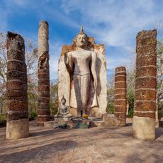
Wat Saphan Hin
10.9 km
Wat Sa Si
13.6 km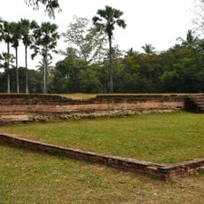
Noen Prasat
14 km
Wat Pa Mamuang
12 km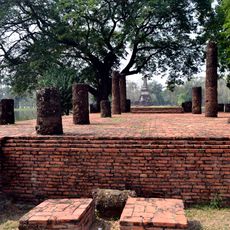
Wat Traphang Ngoen
13.4 km
Wat Tra Kuan
13.8 km
Wat Sorasak
14 km
Wat Chana Songkhram
13.8 km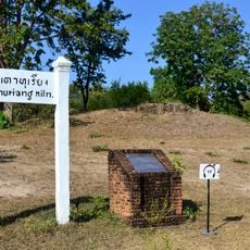
Thuriang Kilns
13.3 km
Wat Khao Phra Bat Noi
10.3 km
Wat Chang Rop
10.6 km
San Ta Pha Daeng
13.8 km
Wat Chedi Ngam
10.2 km
Wat Tuek
12 km
Wat Mangkorn
10.9 km
Wat Son Khao
14 km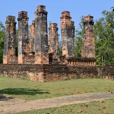
Ho Thewalai Mahakaset Phiman
11.9 km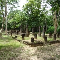
Wat Aranyik
10.6 km
Wat Mae Chon
13.8 km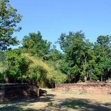
Wat Tao Thuriang
13.5 km
Reviews
Visited this place? Tap the stars to rate it and share your experience / photos with the community! Try now! You can cancel it anytime.
Discover hidden gems everywhere you go!
From secret cafés to breathtaking viewpoints, skip the crowded tourist spots and find places that match your style. Our app makes it easy with voice search, smart filtering, route optimization, and insider tips from travelers worldwide. Download now for the complete mobile experience.

A unique approach to discovering new places❞
— Le Figaro
All the places worth exploring❞
— France Info
A tailor-made excursion in just a few clicks❞
— 20 Minutes